


Community-led Landscape Rehydration: Building drought resilience on a community and catchment scale
Part of the Community of Practice Project landscape rehydration case study series with Mulloon Institute
Published March 27, 2025
Working Together for Landscape Rehydration in the Swan Brook Catchment and Beyond
Our property, being 2,300 ha, is about 5% of the catchment…We have a neighbour two properties downstream who has also done a lot of really good work in landscape rehydration, putting in contour banks and a chain of ponds. So between us about 10% of our catchment is now rehydrated, which is a great first step and we’ll build from there.’ – Johannes Meier
This case study shares the story of a group that came together to rehydrate the Swan Brook catchment, and how this project is inspiring and supporting other communities to start rehabilitating their catchments. The case study features farmers, extension staff and rehydration specialists discussing their motivations, the practical steps they took to begin catchment restoration, and their model for supporting, learning and sharing together. Four of the farmers from the Swan Brook catchment and the wider Northern Tablelands region share their rehydration projects, reflecting on how they match their current land management and visions for their properties.

Video 1. Rehydrating Landscapes Together. Source: Grow Love Project and project partners.
The Highlights
Community-led landscape rehydration
- Drought and landscape degradation motivated farmers and local organisations in the Northern Tablelands to restore their waterways and farmland
- A core group (GWYMAC Landcare, Mulloon Institute, Northern Tablelands LLS, local farmers) formed to identify issues, plan strategies and secure funding
- Mulloon Institute received funding from the Australian Government’s Future Drought Fund for a Community Practice Project (CoPP)
- The CoPP provided training through Bootcamps, Field Days, Boots on the Ground day, Mentoring Program, and Professionals’ Intensive
- Nine farmers participated in the Mentoring Program, designing and implementing rehydration techniques on their properties
Helpful strategies
- Forming a consortium of motivated partners (organisations and farmers)
- Creating a scope of work that matched funding and regulatory constraints
- Building individual and community capacity to design and undertake rehydration works through low-risk, low-cost, nature-based solutions
- Practical hands on days (e.g. Boots on the Ground, Bootcamp)
- Opportunities for farmers to connect with peers to share experiences and knowledge
- Supporting individual farmers to realise rehydration projects on their properties (e.g. Mentoring Program)
Insights and next steps
- Slowing the water flow and retaining water on one property supports others in the catchment
- Peer connection combined with specialist knowledge effectively supports farmers in practice adoption
- Professionals’ Intensive helps to scale up restoration
- Ongoing community engagement and funding are needed to sustain a CoPP, which largely falls on the core group of organisations and farmers
- Ongoing touchpoints (e.g. via field days) will help to sustain the CoPP
About the Swan Brook catchment
The Swan Brook catchment in the Northern Tablelands of NSW is a relatively long and narrow catchment of about 30,000 ha (40 km long, 7 km wide), ranging in elevation from 580–1,260 m above sea level. The vegetation is made up of about 60% non-native and 40% native species, while soils are primarily derived from different types of basalt rocks (Black earths – Vertosols, Chocolate soils – Dermosols, and Euchrozems – Ferrosols). Historical and present-day land uses have altered the land surface of the catchment so that there is less infiltration of water into soils and more runoff and erosion during rainfall events. The simplification of stream channels by erosion over nearly 200 years has also resulted in water draining from the system more quickly than before European arrival.1Landscape Rehydration in the Swan Brook catchment, Scoping Report, November 2021. Mulloon Consulting.

Figure 1. Swan Brook catchment showing the main catchment boundary. Source: Mulloon Consulting.


When the Swan Brook stopped running
Until the early 2000s, the Swan Brook in the Northern Tablelands of NSW had never stopped running, says GWYMAC Landcare coordinator Byron Norman, who grew up on a property on the Swan Brook:
I remember as a kid the creek never dried up. And then in the early 2000s, it just stopped flowing, and then it would flow intermittently, after really heavy rain, but then it would just dry up again.
Others noticed changes to the catchment as well. Farmer Johannes Meier, who lives on and manages the Danthonia Bruderhof community property near the Swan Brook, saw a significant decrease in water flow in a stream running through the property during the Millenium drought. The stream had ‘almost always run,’ he says, ‘and as the property degraded and the properties surrounding us degraded, the stream was actually decreasing and it was just becoming a series of pools and even “dry pools” over time.’
In 2019, for the first time in living memory, the Swan Brook stopped flowing for more than 12 months after a long dry period. Lee Thomspon, the local CEO and Landcare coordinator for the Gwydir and Macintyre Resources Management Committee (GWYMAC) recalls, ‘Landholders were suffering, our biodiversity was also suffering within our landscapes.’
Early innovators
Early innovators
Driven by the state of the landscape in the early to mid 2000s, a few farmers along the Swan Brook began making changes to restore the small water cycle and prepare their farms and the catchment for the weather conditions they were facing. Glenn Morris and Johannes Meier were two of them.
Glenn Morris manages the 1,000 ha property Billabong. When he first began managing it in the early 2000s, it was severely degraded: ‘the soil couldn’t hold much water when it rained, water would basically find the fastest way down the hill taking with it the silt and fertility on the top, and creating erosion as it went.2Climate-Smart Pilots, Farmer Stories – Glenn Morris Glenn built a series of swales3A swale is a shallow, elongated depression in the landscape designed to capture, slow, and filter water runoff. and modified contour banks4A modified contour bank is an earthen graded bank modified to decrease the gradient to slow and redirect flow across a wider landscape. that intercept heavy rainfall events, reducing erosion and allowing the water to slowly soak into the landscape. He also applied a Holistic Management approach to grazing his Brahman x Hereford cattle. With a focus on soil health, humus, grazing management, herd genetics and rehydration works, Glenn has seen healthier soils, the regeneration of native vegetation and a reduced need to bring in feed.
Johannes and the Bruderhof community have been on Danthonia since 1999 when they purchased the 2,300 ha property as a sheep, cattle and cropping enterprise. Originally they farmed it conventionally, says Johannes, ‘and then we realized that we were just losing money and that the property was degrading in front of our eyes’.
After the Millenium drought, ‘when the property was at its worst level of degradation’, Johannes began building contour banks and using wetland restoration methods. Inspired and informed by Natural Sequence Farming and Peter Andrews, Johannes and his team started off slowly:
We began by making one level contour bank and then observing what happened, observing when it rained, observing the pasture growth below and above it, and found that, yes, it was way more productive below the contour bank where the moisture was spread out and penetrating the soil. And then as time went on and as our budget allowed, we just slowly ticked over and did more and more.
Johannes started to see indications that the works were helping to build biodiversity and soil carbon, and says the profitability on the farm has increased by $75 per ha over the past five years.

Image 2. Johannes Meier at Danthonia. Source: Grow Love Project.

Image 3. Chain of ponds at Danthonia in the Northern Tablelands. Source: Grow Love Project.
Growing interest in the community
Growing interest in the community
Johannes started thinking about his neighbours and the vital role of the community in restoring the catchment. This really hit home for him in the 2019 drought. ‘Everybody in the district had stopped, there was a lot of despair, a lot of financial hard times, mental health challenges; none of us were untouched by it,’ says Johannes. ‘But to see that and to realise that there are ways to mitigate that, there are ways to make a landscape more sustainable and to hang onto water longer’ motivated Johannes and other local farmers, GWYMAC and Northern Tablelands Local Land Services (NTLL) to coordinate a catchment-scale response.
After the dry period, Lee Thompson recalls ‘there was a definite concern in the community that things are getting real. And a lot of people recognised the need to do something to hold more water in our landscape.’ Byron Norman adds, ‘There was a real concern that we were in a rain shadow. You’d see storms coming and then they would just split and move.’
Landcare meetings became a great way for farmers like Johannes and Glenn to share what was happening on their farms, which also helped to pique the interest of more farmers in the community. Lee recalls, ‘Johannes would say, “Look, this is what we’re doing and it’s making a difference.” So that’s when the conversation started to change. We were like, “Ok, well, if Johannes can do it and Glenn can do it, what can we do?”’
And this is how the idea of a catchment scale project came about, says Lee:
It’s great to have champions in your own backyard. Neighbours’ interests peaked a little and that’s where the idea originated, that this is something we could do together. People can’t do it on their own.
Taking the next steps: Identifying gaps and bringing in expertise
Hearing from the local farmers who had already implemented rehydration works offered an opportunity to dispel myths around the costs involved and to see examples of a variety of techniques and approaches. ‘There’s a perception that it’s going to cost a lot of money,’ says Byron, ‘whereas there can be just small changes in techniques or…different grazing management and things like that.’
With a growing group of interested farmers, Lee and Byron could see that people had differing levels of knowledge and there were a few knowledge gaps around landscape rehydration. ‘Rehydrating a landscape can mean many things. It can be how you’re managing your paddocks, how you’re managing your soil, how you’re managing your livestock? So there are many factors, not just doing in-stream work or doing work in our gullies,’ Lee says.
The group reached out to Mulloon Institute, and soon after, principal landscape planner Peter Hazell and his team traveled to the community. They listened to farmers and other locals describe challenges affecting individual properties and the broader landscape while also visiting existing restoration projects.
Identifying the best opportunities to rehydrate the Swan Brook
Mulloon was funded by GWYMAC, NTLLS and Levin Family Foundation to do a scoping report on the catchment.6To read the full report visit: https://www.catchmenttwin.org/s/Swan-Brook-Scoping-report.pdf After analysing the condition of the landscape and consulting with farmers, the report identified ‘dysfunctional aspects of the landscape’ and opportunities to ‘restore function and shift the landscape towards a more hydrated state’. According to the report:
The greatest gains across the catchment can be made by increasing the volume of water that infiltrates soils on slopes and flats following rainfall events. This will increase soil health and primary productivity and moderate flows in Swan Brook, increasing the permanency and quality of water in the stream.
Mulloon identified that the best opportunities for landscape rehydration in the Swan Brook catchment were:
- Gully stabilisation
- Contour bank modification
- Grazing management
- Cover crops
- Revegetation
- Natural infrastructure
Making it happen at a catchment-scale (and beyond)
Over several years, Mulloon and the community continued to work together to refine their approach and source funding for catchment restoration in the Swan Brook. The scoping report envisaged a series of works in the Swan Brook itself, however funding and regulatory constraints meant that the most viable approach was to start on smaller unregulated tributaries on multiple properties across the catchment.7The scoping report noted that in-stream structures in Swan Brook itself could restore the natural flow, acknowledging however that this would be in a regulated part of the catchment, requiring approval from relevant government agencies. ‘Properties with low groundcover and actively eroding drainage lines impact the volume, speed and quality of water that flows through neighbouring properties,’ says Mulloon learning programs manager, Tam Connor. Each property that undertakes rehydration works slows the water entering the next property lower down, and so on; the benefits add up across the catchment. In this way, a catchment-scale initiative can help to ‘retain more water in the landscape for longer, while also improving soil health, biological productivity and agricultural sustainability’.8Landscape Rehydration in the Swan Brook catchment, Scoping Report, November 2021. Mulloon Consulting.
‘We start with each individual property and help them to do the work on a small scale, so that collectively they can contribute to an improvement in their catchment.’ Tam Connor
Mulloon Institute and the Swan Brook community shifted attention to supporting individual farmers to realise rehydration projects on their own properties. Finally, after many meetings and much dedication on the part of the organisations and farmers, Mulloon received an Australian Government Future Drought Fund grant in 2023 to establish the Community of Practice Project (CoPP), a skills-focused program centred on strategies that improve water cycling and build drought resilience. The Swan Brook catchment was selected as one of five communities around Australia participating in this program.
The Communities of Practice Project
The CoPP includes a series of activities designed to build land managers’ capacity to plan, design and undertake landscape rehydration projects using low-risk, nature-based solutions (see Appendix 1 for more detail on the types of works involved). Activities included introductory Field Days, a hands-on Bootcamp, a Boots on the Ground day where the community participated in building one project, a Mentoring Program, and a Professionals’ Intensive for NRM professionals to advance their technical skills and community engagement strategies.
Lee reflects that the group really benefited from the structured program:
Having that expertise to get those one-on-ones, to work on the landholders’ plans together. I think that’s the exciting part. Seven out of our original ten landowners all now have property plans they can work on, know their next steps. Without having that Community of Practice or that funding, I think we’d still be chasing our tails.


Images 4 & 5. Bootcamp activity to encourage catchment-scale planning. Source: Mulloon Institute.

Image 6. Mulloon principal landscape planner Peter Hazell talking with participants at a Boots on the Ground event at Yarrawa Park. Source: Grow Love Project.
Peer support and sustaining the grassroots movement
Lee reflects that the peer-to-peer learning has been effective because of the safe environment that’s been fostered: ‘I think that’s why our project has been quite successful. Yes, we’ve got our champions like Glenn and Johannes, but they’re not in that group dictating to the others. They’re showcasing the benefits, they’re just telling their story of what they’re doing…every landholder will do it at their own pace.’
For Swan Brook farmer Codie Law, who had been wanting to make management changes for some time, this peer support was invaluable.
‘I really enjoyed sharing ideas and saying, “Well this is something I’ve tried, and even if it didn’t work, that’s fine, it’s a lesson learned.”’ Codie Law

Image 7. Codie Law (L) and Johannes Meier (R) after the Boots on the Ground day at Yarrawa Park. Source: Grow Love Project.
Engagement with other farmers also helped to bust a few myths about retaining water on any single property.
‘I originally assumed that if you held more water on your farm, then the next person wouldn’t get it. It’s actually the opposite. The more you hold it in, the more it hydrates here and the slower the water will flow down the Swan Brook and then everybody gets access to more water.’ Codie Law

Image 8. Peter Hazell supervising the construction of a log sill rock weir structure at Yarrawa Park. Source: Grow Love Project.

Image 9. A log sill rock weir structure after construction at Yarrawa Park. Source: Grow Love Project.
Building professional capacity and expanding the community
Along with 29 others from around the country, three professionals (from Landcare and LLS) attended the Professionals’ Intensive at Mulloon Creek. The program helped to build skills and confidence so that these professionals can enhance the work they are already doing to serve their own communities. Leaders in GWYMAC Landcare have demonstrated how effective this learning model can be. For example, Byron Norman has begun to support numerous projects beyond the scope of the CoPP. For example, he says:
As part of our Landcare events, we take the laser level out, we pick a little spot and we talk to them about the concept. We take it another step and do practical activities, showing that it’s nothing that’s going to hurt or cost a lot of money.
For farmers Emma Ratajczyk and Joe Latham, whose farm is in Warialda some 60 km away from Swan Brook, joining the CoPP offered them a chance to connect with other farmers and training. ‘We’re in the Mosquito Creek catchment but we don’t get anything like that [CoPP] here,‘ says Joe. The program was intentionally designed to bring in landowners from outside the Swan Brook catchment in order to broaden its impact.
Progressing landscape rehydration
What started as a small group of concerned and motivated farmers and professionals has now become a far reaching community dedicated to catchment resilience. Nine farmers from across five catchments in the Northern Tablelands have planned or started work on their own restoration projects as part of the CoPP, with an increasing number of properties in the Swan Brook catchment itself under restoration, and around 90 farmers and NRM professionals participating in local events. These projects will reduce water speed, improve water quality and increase water security not only on the properties where the works are completed, but across the catchments.
Beyond the Northern Tablelands, 35 properties across Australia have begun rehydration projects as part of the CoPP, and almost 400 have participated in events across the country. While many of the formal events have finished, 100 farmers and professionals have joined an online national support network where they are beginning to share property updates, successes and challenges and offer each other support.

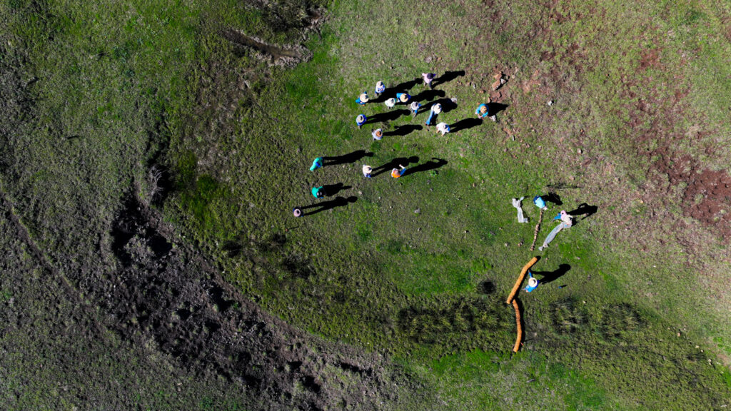
Image 10. CoPP participants gathering at Danthonia for the Bootcamp. Source: Mulloon Institute.
Next steps
Next steps: Towards catchment-wide restoration across the Northern Tablelands and ongoing community support
Lee is excited by the prospect of seeing all of the projects in 10 years’ time, and says, ‘We’re gonna take a snapshot and go ”holy moly look at this. This is amazing. Everyone’s looking good.”’ Ultimately, she would like to see everybody in the Swan Brook catchment take on landscape rehydration and be able to see the many benefits: ‘Slowing that water down in your landscape means you’ve got moisture in the soils for a longer period. So when you do hit those dry times, you’re gonna be able to hold on a lot longer.’
One of the challenges that Andrew Walsh (Northern Tablelands Local Land Services) highlights is that continued success of the project partly hinges on long-standing personal relationships and key people in the community, such as Lee and Byron. Andrew values the Community of Practice model and would like to see it supported more broadly by state governments, not just the current consortium partners.
Meanwhile, Byron and Lee would like to keep the Community of Practice running in Swan Brook, and expand the project to other areas within the community and include other activities alongside landscape rehydration. ‘It could be doing soil trials, micro applications, we just want to keep them going on the path of restoration,’ says Lee.
With the community continuing to share their knowledge and skills with other people, Mulloon’s Tam can already see the wider impact.
‘They’ve built this incredible momentum that has already exceeded the project. There is an activated community Landcare group, they are already out there sharing with the wider Landcare groups in their region and beyond.’ Tam Connor

Image 11. Boots on the Ground participants helping to make a pin weir at Yarrawa Park. Source: Grow Love Project.
Meet the Farmers
Out of the 90 farmers and professionals who joined project activities, nine of those farmers have participated in the Mentoring Program in the Northern Tablelands. These farmers, four of whom are featured below, were supported to develop and implement a landscape rehydration project using small-scale, low-risk nature-based interventions complemented by farm system solutions such as grazing management. Professionals from Mulloon, GWYMAC Landcare and other farmers supported the process.

Figure 2. Properties of farmers in this case study who participated in the CoPP. Inset map: approximate property locations of all nine CoPP Mentoring Program participants. Source: Mulloon Institute.
The Laws at Yarrawa Park: Protecting and restoring riparian areas
Codie Law grew up on Yarrawa Park in the Swan Brook catchment and now manages the 722 ha property with his wife, Natalie, and their two children, Riley and Hannah. They run a cattle grazing operation and have turned their passion for stock horse breeding into a business. The Laws joined the CoPP to help them work towards their goal of managing water more effectively. In May 2024 they opened Yarrawa Park to 38 people at the Boots on the Ground event, during which they built the first few structures in a gully that leads to a dam.


Farm Facts
Property
Yarrawa Park
Owners/Managers
Codie Law and the Law family
Location
Jukumbal, Ngoorabul and Gamilaraay Country, Swan Vale, NSW
Regional Climate
Warm summer, cold winter
Average Annual Rainfall
711 mm
About Yarrawa Park
The Laws would like to try new ways of managing Yarrawa Park because ‘the country is just not responding to the fertilisers like it used to,’ says Codie, and even though they have had some pretty good seasons, they were often making rash decisions and ‘it just wasn’t really working’.
Codie began thinking about other ways to manage the farm and learning about regenerative agriculture through podcasts, YouTube videos and books. Over the past four years, the Laws have started to take a few small steps. ‘I’ve started to graze a little differently, and we’re definitely planning to put in some multispecies pastures. We’re already cutting back on our annual load plan11The annual load plan is used to manage the amount of livestock on a specific area of land over the course of the year. It is a method that allows land managers to match livestock grazing intensity with the land’s carrying capacity, so that over-grazing or under-grazing doesn’t occur. this year,’ explains Codie.
Motivated by proof of the benefits of landscape rehydration
Ready to make more changes on the farm, and ‘draw a line in the sand, start somewhere and do things a little different’, Codie connected with neighbours and GWYMAC Landcare where he learnt about Mulloon’s work in landscape rehydration and the Swan Brook catchment scoping report.
Codie had previously been reluctant to put money into trying new practices, especially if he couldn’t see proof of it working on a commercial farm, but he was impressed with the rehydration works that Johannes Meier had been doing at Danthonia. ‘What sold me was that Johannes had data from the last 15-20 years showing positive trends in carrying capacity and weight gains, even in dry periods,’ says Codie.
‘Even through periods of really dry times, he showed where they were still running more stock, but had more groundcover and more water in the landscape.’ Codie Law
The balance was not quite right
Following the 2017–19 drought, the Laws had two very good years. But even then, Codie reflects, ‘The balance was not quite right.’ In their lower cultivated country, dams were full and water was just rushing off the landscape, while in high country the dams were empty for six months of the year.
Codie was ‘taken by the idea of slowing the water down and retaining more water in our landscape’. He originally assumed that ‘if you held more water on your farm, then the next person wouldn’t get it. It’s actually the opposite. The more you hold it in, the more it hydrates here and the slower the water will flow down the Swan Brook and then everybody gets access to more water.’
Neighbours Johannes and Glenn visited Yarrawa Park and talked through some of the ways they had managed to slow the flow of water on their properties, ‘averting water from areas where it’s rushing off and sending it around into areas that might traditionally be a little drier,’ says Codie. This appealed to him and helped him form initial ideas about landscape rehydration at Yarrawa Park.
A vision for rehydrating Yarrawa Park
Now the Laws aim to manage water more effectively across Yarrawa Park to ‘improve water quality, increase reliable water supply for livestock and reduce surface run-off from cultivated paddocks, which are causing the active erosion of waterways and threaten dam structures’. Their project vision is:
To protect, enhance and restore the riparian area along the front paddock gully with a series of in-stream structures, exclusion fencing and revegetation. The goal is to provide a buffer reserve between cultivated paddocks and the waterway, as well as slowing and retaining more water within the waterway during flood events and to help prevent erosion.
Working closely with Mulloon Institute, the Laws have identified project areas and interventions ranging from farm systems solutions (such as transitioning crops to multispecies and adding exclusion fencing) to natural infrastructure (such as in-stream structures and farm dam enhancement; see Figure 4 for a list of structures).

Figure 3. Property boundary (orange) and project site (blue). Source: Landscape Rehydration Project Plan at Yarrawa Park, Mulloon Institute.

Figure 4. Project plan (zoomed area) for Yarrawa Park showing in-stream (wet gully) structures. Source: Landscape Rehydration Project Plan at Yarrawa Park, Mulloon Institute.
Building a series of in-stream structures with the community
First on the list was constructing a series of structures in a gully that leads to a dam. This became the focus of the Boots on the Ground day. Thirty-eight people joined the activities, led by Mulloon and GWYMAC Landcare with support from neighbouring farmers. The group worked together to construct a pin weir12A pin weir consists of brush woven around wood stakes and placed in minor incised gullies, scalded or eroded sites, to trap debris and sediment at the source. The pin weir was not part of the original plan (Figure 4), it was added to suit the conditions at the time of the Boots on the Ground day. and a log sill rock weir structure (see Images 13 and 14). They also transplanted reeds from further up the gully to encourage wetland species and to create more vegetation throughout the gully, helping to protect the soil and filter and slow the flow of water.
Water from the gully flows into a dam downstream of the interventions. The aim is to slow the flow, reducing the amount of nutrients and sediments entering the dam. Codie also plans to fence off a lot of the gully to help protect it from cattle.


Images 13 & 14. Building the pin weir at the Boots on the Ground day at Yarrawa Park, May 2024. Source: Grow Love Project.
The value of getting together and sharing knowledge and experiences
Codie and his family all participated in the CoPP events and have valued the opportunity to get together with others and share knowledge and experiences.
‘I guess it gives you a bit of confidence too, because, you know, there’s always somebody to talk to instead of thinking I’m all crazy.’ Codie Law
Codie sees a lot of value in the rehydration works. In the short to medium term, he sees value in improving productivity, which may also turn into ‘financial gain or improved carrying capacity or weight gain or all of the above’. But the other part, says Codie, ‘is that we want to improve what we’ve got for whoever has it next’.
For other farmers who are considering making changes, Codie shares the advice that was given to him:
You just need to start by drawing a line in the sand and saying, “well, from today, we’ll do something different, even if it’s one practice, one area, or one gully.” That’s all we’ve tried to do. Codie Law
Ross Thompson at Inverness: Stabilising gullies and catching sediment
Ross Thompson has been farming all his life. He grew up on the family farm in the Swan Brook catchment and then bought the neighbouring property, Inverness, when he was 20 years old. He now manages both properties. He has observed that the valley has ‘always been very susceptible to soil erosion, even when we first came here, it was timbered but had erosion throughout’.
Having already implemented some earthworks on Inverness and understanding the theory behind landscape rehydration, Ross was keen to participate in the CoPP and work on gully stabilisation at Inverness.


Farm Facts
Property
Inverness
Owner/Manager
Ross Thompson
Location
Jukumbal, Ngoorabul and Gamilaraay Country, Swan Vale, NSW
Regional Climate
Warm summer, cold winter
Average Annual Rainfall
711 mm
Property Size
785 ha
Elevation
700–800 m
Enterprise Type
Sheep, cattle, cropping (for seed and on-farm feed)
Landscape
Undulating
Catchment
Swan Brook catchment
Soils
Brown Vertosols. Dark brown medium clay13Source: Landscape Rehydration Project Plan, Inverness. Mulloon Institute.
About Inverness
Inverness runs as a mixed farm with mostly sheep and cattle and some cropping for seed and on-farm feed. While Ross’s father cleared a lot of the land to develop it as a farm, it was still fairly well timbered, and since then Ross has also been planting trees back into the landscape where he sees a need. Ross explains, ‘Back then, it didn’t need any fertiliser or anything like that,’ and while over time he has used inputs, in the past ten years has used less and less:
Rather than trying to pour fertilisers into it…and trying to bang in a double crop, we might let it sit fallow for 18 months, we might hit it with a broadleaf or something like that, take thistles out and just chew off the grasses over the summer rather than killing everything.
Implementing rotational grazing was one of the biggest changes he has made to stock management. He finds that rotational grazing takes pressure off vegetation and helps him to manage worm problems in sheep because the animals are never grazing in areas they have recently left droppings in, which breaks the worms’ reproduction cycle. In the cultivated areas, Ross uses a minimum till approach, bringing in a scariseeder14 A scariseeder is a piece of agricultural equipment that combines scarification (soil disturbance) with seeding in a single pass. at planting time for minimal disturbance seeding.
Over the years, Ross and his family have done a fair amount of rehydration earthworks on the two properties, putting in contour banks and creating flumes to channel water and help conserve soil and reduce erosion. Ross explains, ‘Some of them worked well and some of them didn’t, but we’ve learnt a bit about dealing with the volume of water.’
Now Ross’s vision for Inverness is to have stable soils across paddocks and to slow and steady the flow of water in the main gullies to catch sediment, eliminate erosion and retain water for longer. He would also like to promote more perennial pasture and shift away from cropping.
Stabilising gullies and hydrating the local area
Through the CoPP, Ross was keen to work on stabilisation in a gully that runs for 2 km through the western part of the property. Together with Mulloon Institute, he identified several priority issues and areas:
- Poor soil stability – lack of surface roughness and consistent groundcover in cultivated paddocks
- Active erosion along the banks of the main gullies and gully floors in several areas
- Recent high flow events within the two main gully channels have burst through two gully dams, reducing the water security of the property and creating headcuts that are actively eroding otherwise intact reaches of the upstream gully
- Maintaining existing earthworks (e.g. contours) and infrastructure (e.g. fences) to prevent erosion, allow vehicle access, manage vegetation and promote groundcover near waterways
Trialling small-scale weirs to catch sediment
Ross is aiming to address these issues, with a goal to:
Trial small-scale rock weir structures in order to catch lost sediment in the property before the downstream boundary. Build up confidence before working on more incised reaches of the gullies upstream. A secondary project may be managing concentrated flows with graded banks or or trialling coil logs across banks to slow water and prevent bank outlet erosion.
Ross has chosen a part of the gully which isn’t too steep so he can see how it works, gain experience with building a few different types of weir structures, including a rock weir, a log sill rock weir, and a rock ramp, and see how they perform. The weirs are built onto a rock base using materials sourced on site. Ross is using large rocks to create a ‘rock armour’ to stabilise the structures.
Ross expects that the structures will rehydrate the local area, help stabilise the gully and promote vegetation growth:
So the water ponds up and goes out into the surrounding soil, and encourages stabilisation of the gully…Some places I expect to silt up and retain some soil, causing grass to grow, which will catch sediment, and that will improve the quality of water right down the whole catchment.

Figure 5. Whole property map including boundaries (orange) and project site (blue). Source: Mulloon Institute.

Figure 6. Site plan (zoomed area) for gully stabilisation at Inverness. Source: Mulloon Institute.
A bigger impact when working together
Ross has most enjoyed learning about cost-effective techniques, optimal placement of erosion control structures and the value of working together at a catchment scale:
The water quality is a big factor. Watching tonnes and tonnes of topsoil go down the creek is a pretty sad thing. Water doesn’t just stay on your property as a rule, if it falls, it might run through your place and it might run through someone else’s place.
Simple approaches like starting at the top of a gully can make a huge difference, explains Ross. After a neighbour in the higher country undertook gully work, the water quality coming into Inverness is improving. The water ‘comes down through his country, and then it goes into two dams of ours. The quality of that water is a lot better.’
Ross plans to stay connected with the CoPP farmers and would like to see the entire catchment area have stabilised soils and improved subsoil moisture and water tables.

Image 16. Close up of the rock weir on Inverness. Source: Ross Thompson.

Image 17. Rock weir (centre) at the project site on Inverness. Source: Ross Thompson.
Michael Mather at Belmore: Softening the land, starting with tributaries high up
Michael Mather is a third generation farmer at Belmore, which he owns with his wife, Kim. The property is part of the Frazers Creek catchment known for its historic sapphire mining, which led to a lot of degradation. Michael has introduced cattle over the past 18 years to Belmore, which was originally a sheep farm, and now plans to solely run cattle, focusing on breeding and backgrounding.15Backgrounding is the grouping and acclimatisation of cattle for feedlots (Meat and Livestock Australia). Michael joined the CoPP to continue to address erosion and soften the landscape at Belmore and to carry on with his role in the community.


Farm Facts
Property
Belmore
Owners/Managers
Michael and Kim Mather
Location
Jukumbal Country, Nullamanna, NSW
Regional Climate
Warm summer, cold winter
Average Annual Rainfall
750 mm
About Belmore
While Michael’s father and grandfather taught him soil conservation methods, such as introducing graded banks to stop erosion and encouraging vegetation, the farm was run using standard methods of the time. But ‘conventional farming just wasn’t working for us,’ says Michael, and he thought, ‘there’s got to be a better way than just adding fertiliser and spraying chemicals on weeds. The weeds were still coming up and fertiliser costs were going up.’
For the last 30 years, Michael has been trying different farming methods, many of which he learnt about through Nullamanna Landcare and GWYMAC Landcare, which he has been a part of since their inception, serving as a committee member for GWYMAC Landcare for the past 10 years and chair for five.
Wanting to reduce high levels of drenching, he began rotational grazing of his sheep, subdividing bigger paddocks and moving the sheep around. Michael continues to rotational graze his cattle today. He has over 31 paddocks and continues to divide the paddocks further. His aim is to have 90% of the property resting at any one time.
Michael focuses on building soil health, ‘trying to soften the soil and turn it into a sponge’. He grows fodder crops and directly drills multispecies into the previous season’s grazed stubble. He is in the third year of using a range of non-chemical inputs, preferring microbes and compounds, such as calcium nitrate, to control weeds when needed.
After three years, Michael is noticing improvements. The soil structure was previously hard and clodded topsoil and now the paddocks are softer and spongier and water is penetrating. There is now also less runoff and the native grasses are returning, and even in below average rainfall they have good groundcover.
‘All of a sudden it just happens, when you walk into your paddock, you can feel that the paddock has softened.’ Michael Mather
Softening soils and rehydrating the landscape
The journey into landscape rehydration was a ‘natural progression’ for Michael. His grandfather had been making contour banks trying to address erosion since the 1940s. Mick reflects that he ‘looks at a landscape and thinks, ok, how can I soften this landscape so that it’ll look after me and look after future generations?’
Understanding the importance of landscape rehydration and wanting to continue to address erosion and soften the landscape, Michael was keen to get involved with the CoPP. He joined the Professionals’ Intensive training at Mulloon Creek, developed his own project, and has been a core part of the growing community.
Starting at the top of the catchment and working on tributaries
About 10 km of Frazers Creek was completely dried out after the 2017–19 drought, and there’s a section of the creek on Belmore where erosion has led to the creek bed dropping about 1.5 m over the last 30 years. Michael has fenced off the area and has noticed a lot more properties are fencing stock off, but he would like to do more to help restore Frazers Creek. He is encouraged by signs of biodiversity: fish have survived and there are crustaceans and bugs. He would like to build up the bottom of the creek and put the big water holes back, however, ‘the regulations we need to deal with are impossible’. Instead, inspired in part by working with Mulloon Institute, Michael is concentrating on the tributaries.
‘It really hit me that there are things you can do on those tributaries and start there, start at the top of your hills…’ Michael Mather
Michael goes on:
…and we’re at the top of the catchment. So if I stop those big runoff events going down and tearing fences out, gouging the beds out, if I can spread the water more and slow it down, it’s going to be of benefit to me. Once the water is in a creek and it’s running off your property, you’ve lost it, you don’t get that back.
Slowing the flow in Mussel Creek
Michael’s vision for the rehydration project is to:
Manage, infiltrate and retain as much water as possible in the upper slopes of Mussel Creek to reduce the force of water along the creek downstream of Pineliegh Lane. Stabilise downstream erosion and incision of Mussel Creek from headcut creep17Headcut creep refers to the upstream migration of an erosional feature (headcut) within a gully or stream. This occurs when fast-moving water erodes the base of a channel, causing the exposed edge (or ‘headcut’) to progressively move upstream over time. and channel incision.
He is installing swales, earth banks18An earthen structure designed to lift water from an incised channel to spread and dissipate across a landscape. and other structures to slow water flow into Mussel Creek, to spread water across pastures and to prevent erosion in tributaries and drainage lines on their property (see Figure 8).

Figure 7. Whole property map including boundaries (orange) and project site (blue). Source: Mulloon Institute

Figure 8. Site plan (zoomed area) showing location of swales. Source: Mulloon Institute.
Michael put the first swale in himself using an excavator. The swale is about 750 m and it runs across the landscape and into an existing dam (see Image 19). Soon after the swale went in there was about 38 mm of rain. There wasn’t even any grass growing yet, but Michael could see signs that water was infiltrating the landscape:
I went up there on the bike when it was flowing like crazy. Everywhere I went across that bank, it was seeping through the bank onto the pasture below.
Once all swales have been completed and are working, Michael would like to start working directly in Mussel Creek, which is a second order stream. He plans to ‘place earth, rock and brush structures to help with generating it back to a chain of ponds’. Michael is making use of what’s on the property, pulling out invasive tea trees and pines to reduce growth and scattering the debris over rocks to build soils and grow more groundcover. He has also been laying the trees across the contour to create brush weirs.
Michael plans to monitor the effectiveness of these strategies by comparing the water flow and erosion between treated and untreated areas of their property.

Image 19. Completed swale at project site on Belmore in the upper reaches of the Mussel Creek catchment in February 2025. Source: Michael Mather.
Looking at the landscape, asking questions and starting small
For a long time Michael has been ‘looking at the landscape, not just across it’, and asking lots of questions as part of routine management, such as, ‘Where’s it green now? Where’s it not green? Why did that get more rain than over there? Is there something different there?’
Through participation in the CoPP, Michael has expanded his ways of reading the landscape and the tools he has up his sleeve. He sees the value of using vegetation as a rehydration tool rather than going in with a bulldozer and doing earthworks as a default approach. ‘There are frogs and all sorts of things that live in waterways. So, you know, frogs and crayfish don’t really like bulldozers.’
For those wanting to start a project in their own catchment, Michael is keen to convey that any property can benefit from these techniques: ‘We’ve proved that through the involvement with Mulloon, we’ve got people from right out the other side of Inverell to over near Guyra, it’s not just on the Swan Brook catchment…It’s the same principles and they’ll work anywhere. It’s just reading your landscape and then working out what your capacity is to actually achieve what you want to get done.’
He also suggests starting small and simple, reducing runoff from the top down and not focusing overly on creeks.
‘You start at the top of the hill, every property’s got a hill, start at the top of that, walk up there and have a look and from there work out where you’re going to go.’ Michael Mather
Emma and Joe at Waterfall: Strategically choosing where to start
When Emma Ratajczyk and Joe Latham purchased their 300 ha Northern Tablelands property, Waterfall, in 2007, they soon recognised its potential for water security. Joe reflects that, while dry periods are always extremely challenging, it was so good ‘to come out of a dry period and see running water’.
Emma and Joe know how fortunate they are, but they also understand their responsibility to care for these waterways. Waterfall is nestled in the middle of cropping country. As Emma says, ‘It is different from a lot of that country. It’s undulating with a lot more riparian zones, and there’s a lot more natural water than surrounding properties.’ However, this also means there’s ‘a lot more to protect’, which has motivated Emma and Joe to join the CoPP to expand their knowledge of landscape rehydration and connect with other farmers.


Farm Facts
Property
Waterfall
Owners/Managers
Joe Latham and Emma Ratajczyk
Location
Weraerai Country, Warialda, NSW
Regional Climate
Warm summer, cold winter
Average Annual Rainfall
711 mm
Property Size
316 ha
Elevation
550 m
Enterprise Type
Cattle
Landscape
Gentle undulating slopes
Catchment
Gwydir River catchment
Soils
Black Vertosols19 Sourced from NSW government Espade web application.with some exposed red sandy soil in the gully20Source: Landscape Rehydration Project Plan, Inverness. Mulloon Institute.
About Waterfall
Joe Latham came from a traditional cattle farming family, and to begin with, Emma and Joe managed their cattle using ‘fairly traditional methods’. They had been interested in different approaches: reading about Peter Andrews’ ideas on Natural Sequence Farming, following Tony Coote’s and Mulloon Institute’s work repairing waterways, and learning about Allan Savory’s approach to grazing management. They had also tried out some gully restoration using hay bales and rocks to help slow the flow of rainwater running off the neighbouring properties. Emma reflects, ‘Some of the structures worked magnificently and contributed to building soil, some were not robust enough to withstand the force of the water flow and were gradually washed downstream.’
It was after the 2017–2019 drought and seeing the state of the property that Emma and Joe really started to shift their farming methods and focus more on their waterways.
‘To see our country in such a state was pretty devastating…there wasn’t a blade of grass. It was just dirt. Bare soil stimulates erosion when the rain finally arrives, and this is what happened. The rain and water flow cut channels in the soil and the creek banks. The water came from the entire catchment above us.’ Joe Latham
Emma and Joe enrolled in a Holistic Management course which helped provide direction and an opportunity to learn more about rotational grazing. Soon after they implemented rotational grazing across the property, allowing areas to rest for long periods. They also started pasture cropping21For more on pasture cropping, see Colin Seis’s case study on his property Winona., planting crops directly into existing pastures.
In a short time they began to see increased groundcover and organic matter, reduced runoff and improved moisture retention in the soil. They can now carry more cattle comfortably and consistently. Joe recalls:
We are trying to return all the cultivation country back to natural pasture, and interestingly, by reducing cultivation, our internal dams get no runoff because the organic matter that’s built up helps to hold water back and allows it to go into the soil. Even our red country, which once had so much runoff that it could fill a dam overnight, now has capacity to hold moisture.
Emma and Joe’s vision for Waterfall is to ‘create resilient pastures, where groundcover, soil and water management work to hold more moisture in the landscape and to create a flourishing riparian zone which will allow for permanent water to flow in Mosquito Creek’.
Building on their knowledge to care for the waterways
With care for their waterways front of mind and having tried landscape rehydration in the past, Emma and Joe were keen to build on their knowledge base and connect with other farmers. They were impressed by the reputation of Mulloon Institute and inspired by the rehydration of Mulloon Creek.22See Mulloon Rehydration Initiative. They could see the potential to do something similar on Mosquito Creek, the main creek running through Waterfall. While Waterfall is situated outside of the Swan Brook catchment, they had heard about the successful rehydration works happening at Danthonia and, lacking opportunities to work with other farmers and specialist organisations in their own catchment, they joined the Swan Brook initiative.


Images 21 & 22. Pin weir that Emma and Joe constructed at Waterfall after learning the technique at the Bootcamp. Source: Emma Ratajczyk.
Learning to map the catchment, starting on small tributaries
One of the most valuable opportunities that came out of the two-day Bootcamp for Emma and Joe was learning how to create a catchment map and position their property and its waterways within the wider catchment. Emma explains:
We got the opportunity to determine the catchment of Mosquito Creek and that was quite mind blowing. We knew we were at the headwaters of Mosquito Creek and that when it rained we had a torrent of flow coming out of that gully from our neighbours. But looking at the size of the catchment above us was quite mind-blowing.
They soon realised that Mosquito Creek was too big a tributary to work on because it would require extensive planning and approvals, so they ended up choosing to work on two smaller tributaries of Mosquito Creek.
Restoring an erosion gully to slow the flow of water and hydrate the landscape
With support from Mulloon Institute environmental engineer and landscape planner, Erin Healy, Joe and Emma chose to work on a gully impacted by erosion (see Image 23). ‘It’s a dry gully that rips through a black soil cultivation paddock. The gully’s been there for 100 years, and it’s up to 7 m deep,’ says Joe.
The project design adds to two existing structures that Emma and Joe built using hay and rock plugs in the upper part of the gully. While these structures have been effective at holding soil and moisture at the top of the gully, the channel remains incised downstream of the interventions.

Image 23. Gully impacted by erosion at Waterfall. Source: Emma Ratajczyk.
Their project vision is to:
Construct barriers intermittently down the gully to catch and slow the flow of surface water before it drains into Mosquito Creek. The slowing of water will halt active erosion, allow the gully to regenerate and promote vegetation establishment. Where necessary we would like to reshape the banks of the gully to decrease the gradient and encourage better groundcover and stabilise vulnerable soils.
‘It’s a big project,’ Joe says, ‘and there’s a decent fall in elevation and a huge variation in width and depth of the erosion’, but he ‘thought we’d get more learning opportunities out of it with that particular gully’. ‘They are putting in a lot of small interventions using different materials, so there are opportunities to try out different techniques and apply their learnings across the property,’ says Erin (see Figure 10).
Now that they have finished the planning phase, Emma and Joe will collect materials and build the structures with support from Landcare to do some of the excavation work.

Figure 9. Whole property map of Waterfall including boundaries (orange) and project site (blue). Source: Mulloon Institute.

Figure 10. Site plan (zoomed area) for gully restoration at Waterfall. Source: Mulloon Institute.
Making progress through peer support, building community interest
Emma and Joe have gotten a lot out of the connection with like-minded people who are also trying to make a change. Joe reflects:
The hardest part is change for a lot of people. I know it was for myself. But to go to a day like that [Boots on the Ground day at Yarrawa Park], it’s encouraging, it’s just lovely, because you realise what you’ve learned and the progress that you’ve made already, when you can see other people learning that for the first time. Then of course, getting more from the more experienced or the different experiences and sort of expanding a bit laterally.
While it’s still early days for their project, Emma and Joe have confidence in the project, having seen results from rotational grazing and landscape rehydration interventions in other parts of the property, including more groundcover, moisture retention in the soils, stable productivity and wildlife.
‘Seeing the insects and animals, the wildlife, it’s very clear when you’re amongst that noise down at the creek, how successful it is.’ Emma Ratajczyk
They are hopeful that as they do more of this kind of work, neighbours might begin to notice and it might spark curiosity, and maybe one day a catchment scale project could happen on Mosquito Creek.
Further Resources
Explore related resources for landscape rehydration

For more than three decades, Charlie Maslin has been carefully integrating livestock management with natural infrastructure to rehydrate the landscape on the family farm, Gunningrah. He has come to think about water in new ways and seen huge improvements to the health of the landscape and animals. The property now holds onto water for longer and supports a thriving and productive agro-ecosystem.
This episode is a collaborative effort with our friends at Mulloon Institute as part of their Communities of Practice Project. In it, we chat with Charlie Maslin, an amazing land steward raising cattle and sheep on the Monaro in New South Wales.
Water is the source of all life. But when landscapes aren’t functioning properly, water becomes a destructive force. Degraded soils are unable to absorb rainfall, resulting in water running off the land too fast to sustain plant growth and causing erosion and damage. Because water knows no boundaries, the impact of degraded land can reach well beyond a single property to an entire catchment and beyond. As climatic extremes increase, building soil and landscape function and rehydrating degraded catchments can deliver a myriad of benefits for farmers and communities.

The project is designed as a collaboration between the Institute and regional partners to foster the growth of local ‘communities of practice’ in five regions around Australia that will continue beyond the project period.
Acknowledgements
This case study was produced by Soils for Life as part of the Community of Practice Project (CoPP), led by Mulloon Institute in collaboration with regional partners. Mulloon Institute is a leader in landscape rehydration and restoration, working with farmers across Australia to create resilient, productive and profitable farms where agriculture and the environment are working in unison. The Project received funding from the Australian Government’s Future Drought Fund. Soils for Life acknowledges the generous contributions of the farmers and organisations that have contributed to the case study.

This project has received funding from the Australian Government’s Future Drought Fund.
For more information
Follow us for the latest
If you have any questions, get in touch at [email protected].
