

'Water ponding for rangelands repair and rehydration'
Low-cost, scalable practices that offer possible solutions
As part of the Rangelands Living Skin project, four producers are running trials of low-cost, scalable practices that offer possible solutions to increase farm income and landscape function.
Gus and Kelly Whyte, based in Wentworth NSW, are one of the four producers. In addition to replicated plot trials of various treatments such as liquid vermicast foliar spray, solid vermicast and biochar, they are also trialling water ponding.
Water ponding is a mechanical intervention, appropriate on fairly gentle slopes, to slow the flow of water across the landscape and encourage water infiltration into the soil. This approach is used to reclaim scalded country and rehydrate rangeland landscapes.
The Whytes were keen to rehydrate a large clay plan area on their property. They accessed a Local Land Services grant for $10,000 to undertake the water ponding project. The Whytes contributed $5,000 and LLS provided the surveyor as well as directed and oversaw the contractor for constructing the banks. Gus reiterated that producers should do water ponding projects ‘in conjunction with and under the instruction of someone who knows what they are doing, like LLS. Water ponding needs a fair bit of planning to make sure the banks are going in the right spot. Good advice is certainly readily available.’
In February of this year, the Whytes and LLS selected two areas within the water ponding project area to monitor. The whole project area is over 300 hectares in size (Photo 1).
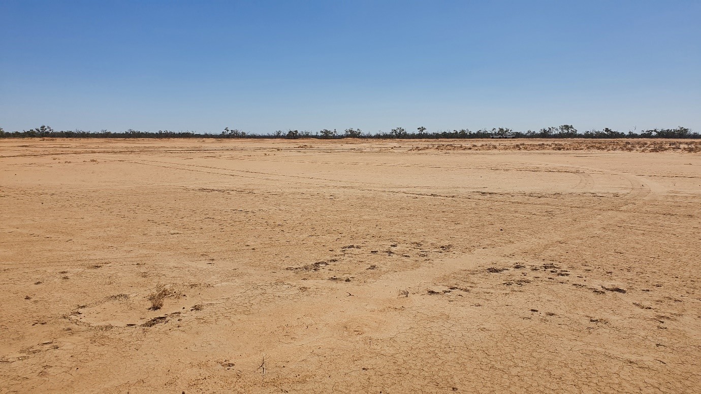
Photo 1. Claypan area to be tested for improvements with water ponding.
Between February and June, a grader was used to construct over 60 u-shaped earth banks. The construction paused in April and May during large rain events because as Gus explained, ‘there is a lot of soil you must move to make these contour banks.
They are 500mm high at their peak and 2m across at the bottom.’
Constructing water ponds is much easier and long-lasting when done with dry soil.
Over the next three years, the Whytes and collaborating scientists will look at how the water ponding works have changed soil, pasture, production and biodiversity, as compared with a control site and reference site (Figure 1).
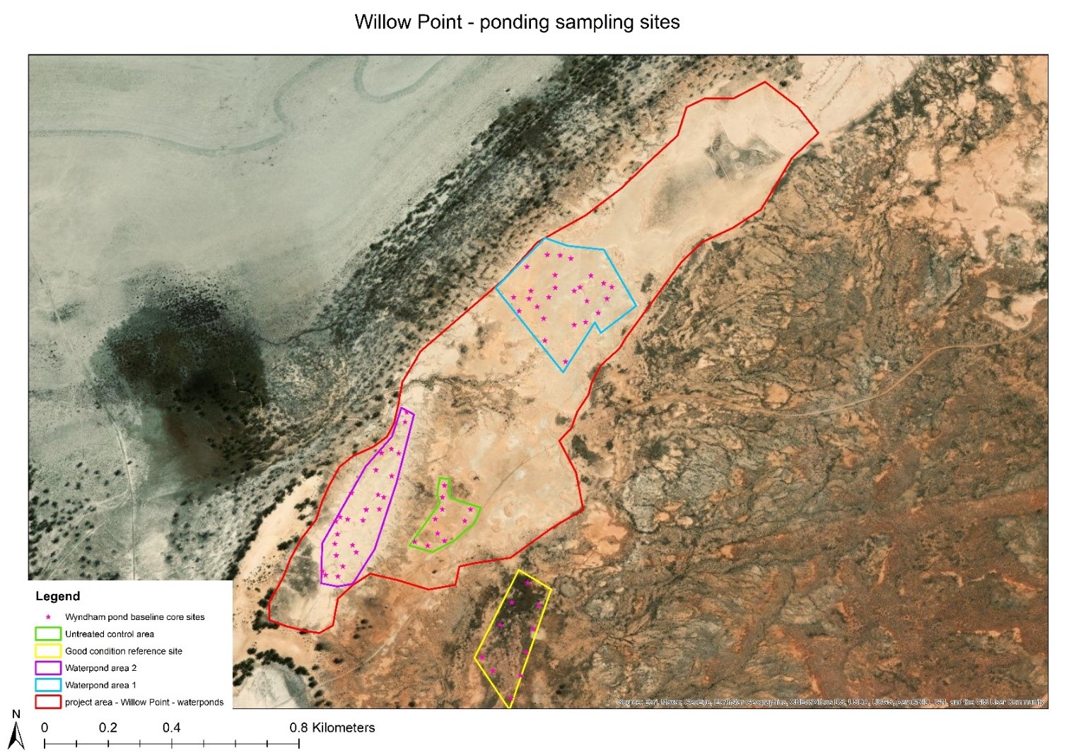
Figure 1. Area in red within where ponding works occurred on Willow Point. Purple and blue areas were selected for monitoring impacts of the ponding, across two different soil types. Area in yellow was selected as a reference area in good condition due to better water flow. Area in green was selected as a control (untreated) area. Soil cores and pasture assessment occurred at random points within these areas (pink stars).
The control site is a claypan area which will not be ponded. The reference site is a paddock in good condition as it receives good water flow already (Photo 2). The expectation is for the ponding trial areas to regenerate, and in time, look more like the reference site.
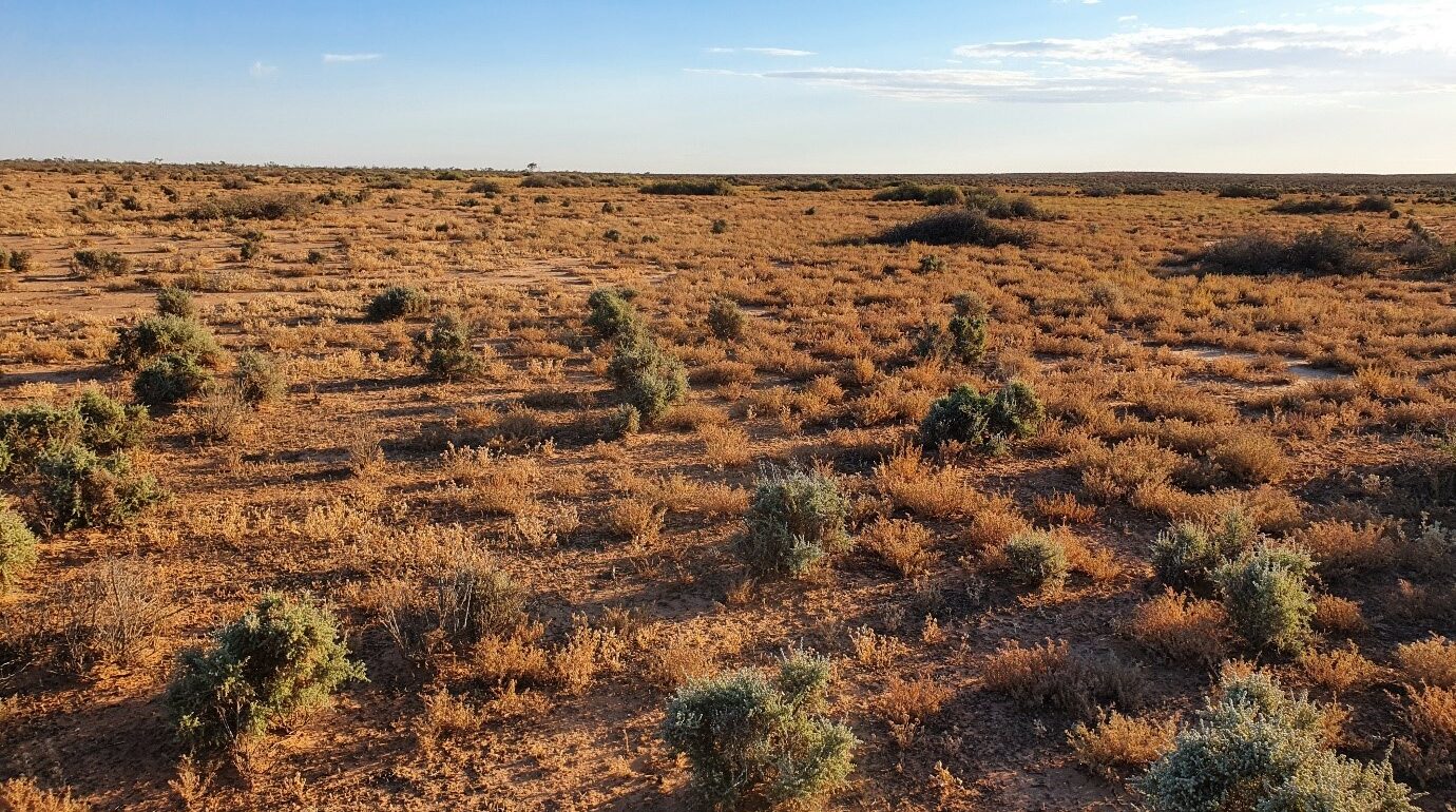
Photo 2. Reference (good condition) area, Willow Point.
So far, Gus has observed that the ponds have retained a lot of water (Photo 3), and seven months after construction, the ponds are already influencing the landscape. According to Gus, ‘there is certainly an increased growth of salt bushes and other annuals in places where there were previously no plants’ (Photo 4).
While it is easy to see that the landscape is changing with more plant growth and pasture, the Whytes are also looking forward to the scientific studies with project partners to understand other types of soil and landscape change – such as soil carbon, water infiltration, and microbiology – to better understand and explain the value of landscape and soil stewardship practices.
The Western LLS Rangeland Rehabilitation program is also keen to see how this water ponding will reinstate natural surface water flows. As Senior Land Services Officer Paul Theakston says, “Gus and Kelly’s project area originally would have acted like a “sponge” with shallow ponds (called gilgais) absorbing water into the soil and excess water being slowly released as low energy flows.” Paul has seen many such projects – including water ponding, water-spreading banks and diversion banks – reinstate these natural water flows and landscape function. He hopes to see erosion and claypan rehabilitation projects on many properties in the rangelands.
To hear more about the Whytes’ journey, check out these videos on their soil management and an introduction to their station. Stay tuned for the initial results of the trials, to be published in 2023.
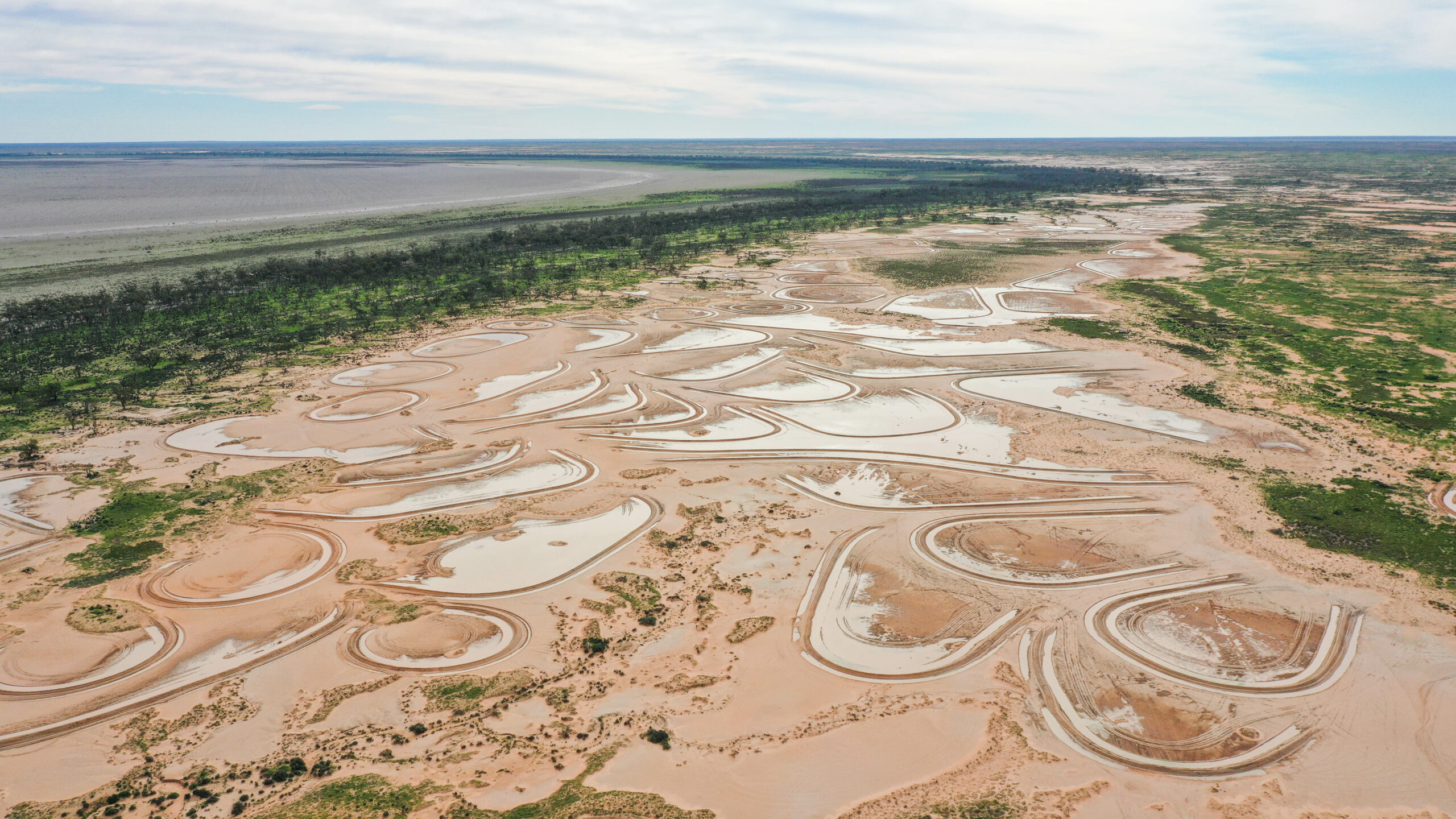
Photo 3. Water ponding in action at the Whyte’s property (Photo: Brett Naseby).
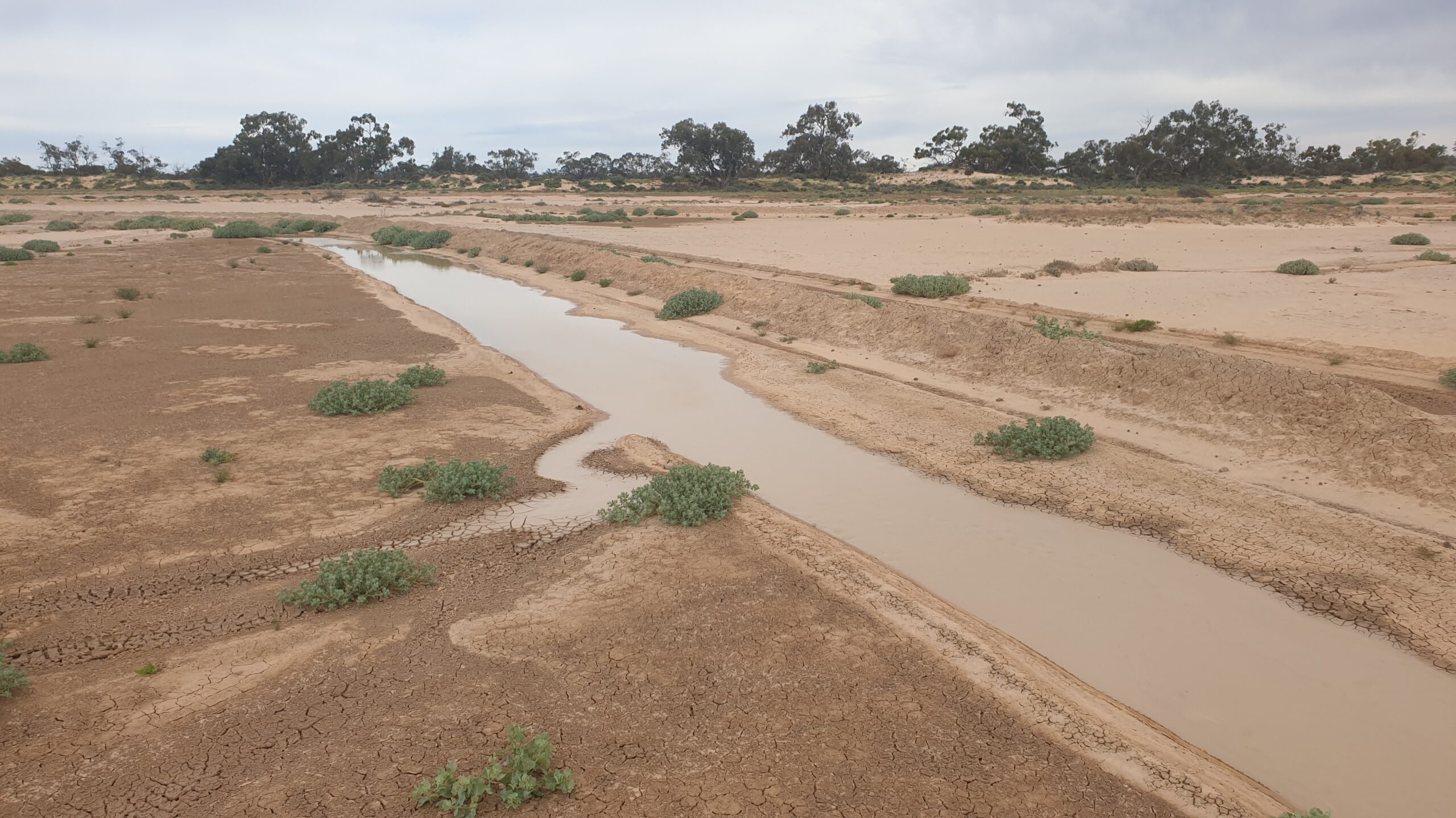
Photo 4. Some of the main early colonising species are the pop saltbush (Atriplex holocarpa) and fan saltbush (Atriplex angulata).
About the Rangelands Living Skin
project
The rangelands represent a large amount of Australia’s (80%) and NSW’s (40%) land mass. With much of the rangelands dedicated to agriculture, they are an important production area.
Led by NSW Department of Primary Industries and funded by Meat & Livestock Australia, the Rangeland Living Skin project is a significant investment in the southern rangelands.
This four-year project links farming families, scientists and collaborators to evaluate cost-effective practices – chosen by producers – that can regenerate the NSW rangelands and support dependable production.
Visit the Rangelands Living Skin project website to read more, sign up for the project newsletter, or contact the team.
