

The Scotts at Glen Elgin
Using evidence to grow a sustainable business in the Lower Slopes region | Published January 2024
‘I had this discussion with a friend of mine where we decided to name our most memorable four or five farming years … the years we came up with were ones when extreme hardship was experienced. We agreed that it’s such times when you are shaken out of your comfort zone and forced to make big changes to your operation. You put down a reticulated water system, you buy a feed cart, you do something … they’re the ones that really stick in your psyche.’ – Steven Scott
Steven and Cindy Scott have a clear mission: ‘to gather and collect evidence from trusted sources to grow a sustainable business’. They manage a number of properties in the Lower Slopes region of the Riverina, and the majority of their income is from cattle, particularly the sale of seedstock breeding cattle. Their home property is Glen Elgin with other properties close by at Henty and Munyabla.
Steven’s family has been farming in the region since the 1870s and Steven has observed how things run on the farm since primary school. Growing up on the Henty property, he began working with his parents in 1987 after completing a degree from Charles Sturt University and took on management of the property and business in 2000. Cindy has a background in marketing and joined Steven to live on the farm, providing business support. They have raised three children together.
Cindy and Steven are committed to making well-informed changes and to assessing their impact across their farm. In recent years they have been able to put money they’ve made out of seedstock back into the landscape in the form of soil improvements and regenerative projects. They are keen Landcare participants and have been working toward 10% revegetation of the landscape for several years.
There have been some big shifts in attitudes at Glen Elgin over the decades. Steven’s grandfather would often tell him about the trees he’d cleared ‘in a rather bragging manner’, as he believed the number of trees removed was directly proportional to the amount of extra grass he could grow. If he was alive today, Steven is sure his grandfather would struggle to relate to how this generation of Scotts are revegetating by planting thousands of trees, habitat corridors and shelterbelts.
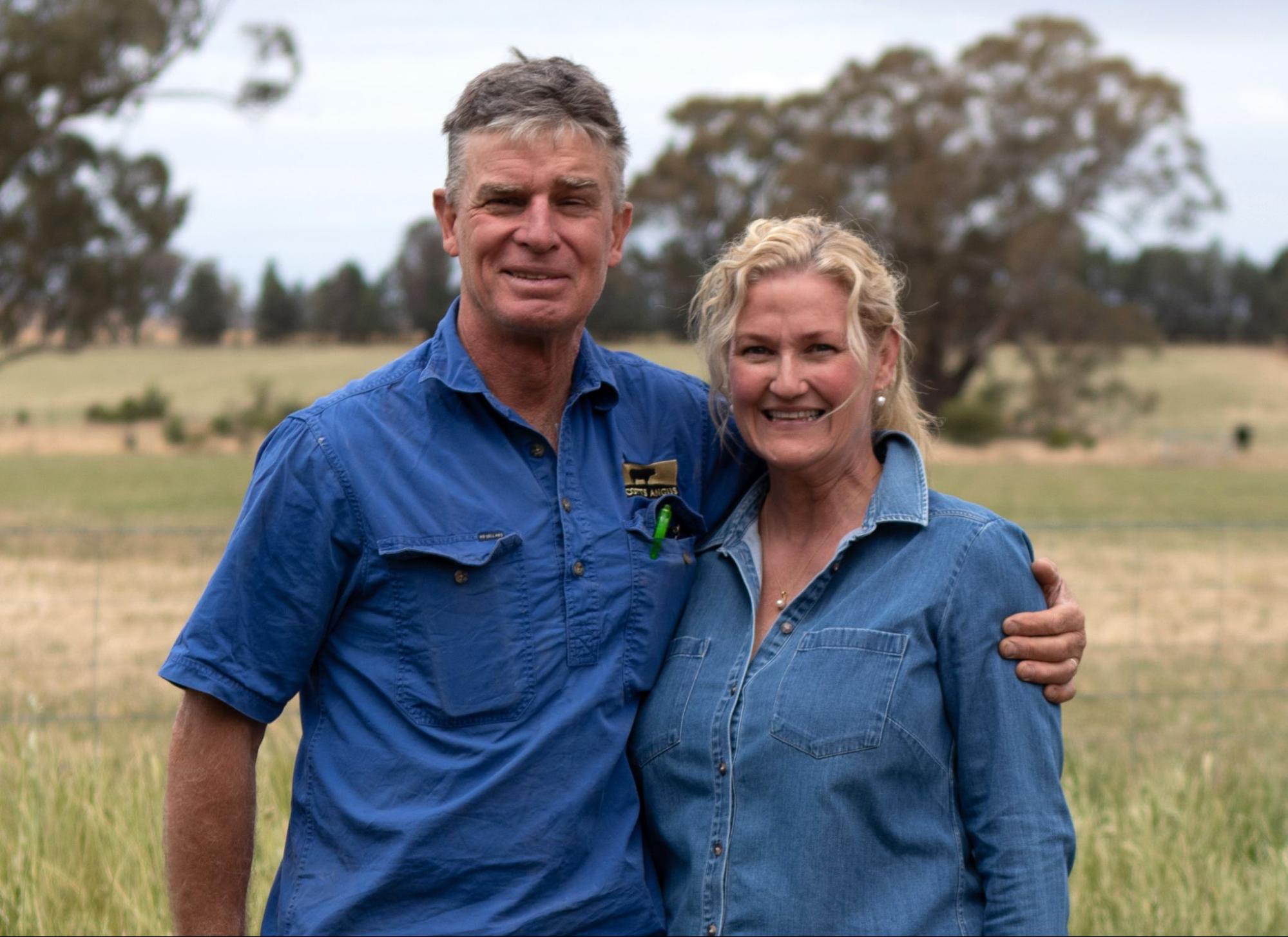
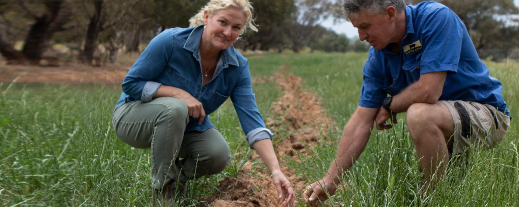
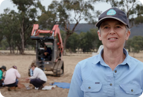
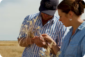
Image 1. Cindy and Steven Scott together at Glen Elgin. Source: Grow Love Project.
Video 1. Planting native shelterbelts in the Riverina. Produced by the Grow Love Project
Farm Facts
Location
Wiradjuri Country | Henty, Glen Elgin and Munyabla, Riverina, NSW
Climate
Warm summer, cold winter
Average Annual Rainfall
550 mm (recent, 1993–2022)
Agro-ecological Region
Temperate cool-season wet
Property Size
2,400 ha
Elevation
259 m
Social Structure
Family owned and operated
Enterprise Type
Seedstock, cattle breeding, commercial Angus beef production and wheat and canola cropping.
Landscape
Undulating rises and colluvium (moved under gravity and deposited at the base of hillslopes). Lower slopes have formed on granite-derived colluvium and alluvium (stream deposits). The landscape has been extensively cleared.
Soils*
Texture-contrast soils, including those with sodic (Sodosols), neutral (Chromosols) and acidic (Kurosols) subsoils. Non-texture contrast soils with little or no subsoil structure (Kandosols). Minor occurrences of deep, earthy sands (likely Rudosols or Tenosols) associated with streams and creeks.
*Learn more about soil classifications at www.soilscienceaustralia.org.au
The Highlights
Drought Resilience Strategies
Soil and Landscape Monitoring
Future Plans
- Responding to changing conditions by ‘staying on their toes’ and reviewing feed costs, labour units and stocking rates
- Maintaining flexibility with their cropping program, e.g. sacrificing crops early when conditions are poor
- Continuing to revegetate the landscape
- Introducing soil and landscape monitoring through in-field assessments and continuing and expanding soil sampling lab tests
- Increasing understanding of some of the local soil conditions, including limiting factors (weak soil structure, low organic matter and cation exchange capacity below 5 cm depth, and the low count and activity of soil organisms)
- Implementing regular sampling and testing, including of the subsoils
- Prioritising continuous observation and periodic in-field assessment to inform grazing and cropping decisions
- Recognising that building soil organic matter and carbon is a ‘slow game’
- Understanding factors that contribute to a low soil organism count and exploring options for building soil biology
- Maintaining water sources and conserving fodder
- Increasing the diversity and quantity of wildlife, financial returns from improved productivity and personal satisfaction from improving the landscape and reducing erosion
Landscape and Soils
Cindy and Steven Scott’s property, Glen Elgin, lies approximately 15 km west of Henty in the Lower Slopes region of the Riverina, south-west NSW. The local landscape is mostly undulating rises with the occasional broad ridge and steeper hill. The often long, lower slopes are associated with drainage lines and alluvial fans.
The local soils reflect periods of erosion (soil loss) and deposition (eroded soil that is transported and deposited elsewhere), with soil depth varying from shallow on the ridges and crests to deep on the lower slopes. The upper slopes are mostly texture-contrast soils (sandy or loamy topsoils overlying clay subsoils), which are commonly sodic (dispersive), but may also be non-sodic, with a soil pH that is either neutral or acidic. Alluvial and colluvial soils may feature lower in the landscape, where the Scotts have also identified black clay soils.
Erosion is a major soil limitation in the region, with topsoil losses due to sheet erosion on the upper and midslopes, especially in intensively cultivated areas. Lower in the landscape, moderate to severe gully erosion of the sodic soils may be a feature in the major drainage lines. The historic clearing of vegetation has contributed to localised acidity and salinity. Vegetation in the region was once grassy woodland or tall woodland and is described as having been extensively or totally cleared. Areas of native grassland remain, with remnant pockets of shrubby woodland including white box (Eucalyptus albens), white cypress pine (Callitris columellaris) and grey box (Eucalyptus microcarpa).
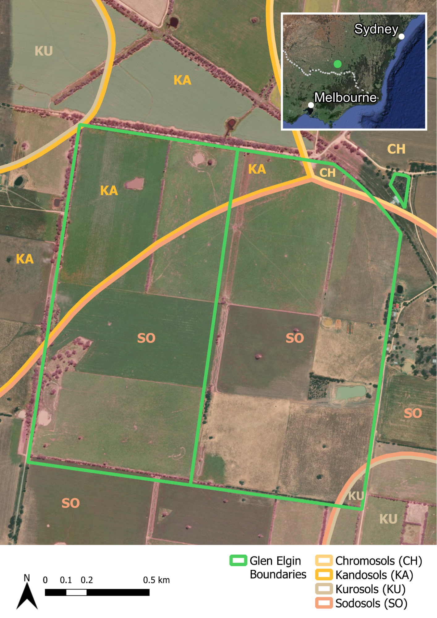
Figure 1. The broad soil orders at Glen Elgin. Source: Soils for Life and DPIE (2021).1
1These soil orders represent a regional overview and are not derived from detailed soil information. The soil boundaries are based on the Department of Planning, Industry and Environment (DPIE) (2021) Australian Soil Classification (ASC) Soil Type map of NSW, Version 4.5, Department of Planning, Industry and Environment, Parramatta.
More about the Scotts
A snapshot of production and finance at Glen Elgin
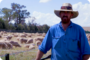
The Scotts’ farming business, Scotts Angus, specialises in seedstock and commercial Angus beef production with 200 bulls and 150 breeding heifers offered for sale annually, as well as a cropping program consisting of 800 ha of wheat and canola. They sometimes feel ‘like the odd ones out in the region’ because their business focus is cattle, while most of their neighbours are dryland cropping or producing fat lambs.
Steven and Cindy take an evidence-based approach to growing their business and exploring and testing new ideas all the time. They have benchmarked with a farming consultant for the last 20 years, who has helped them to track and improve financial and production outcomes. Cindy comes from a corporate background and her knowledge has been useful in growing the seedstock business and bringing a business-minded, analytical approach to their operations. They regularly put themselves in the position of an investor and ask, ‘would we invest in this company?’
The Scotts are ‘fairly happy’ with where they are financially and while they carry some debt, they have increased their asset base and have a comfortable work-life balance, which means debt is not a major stressor in their lives.
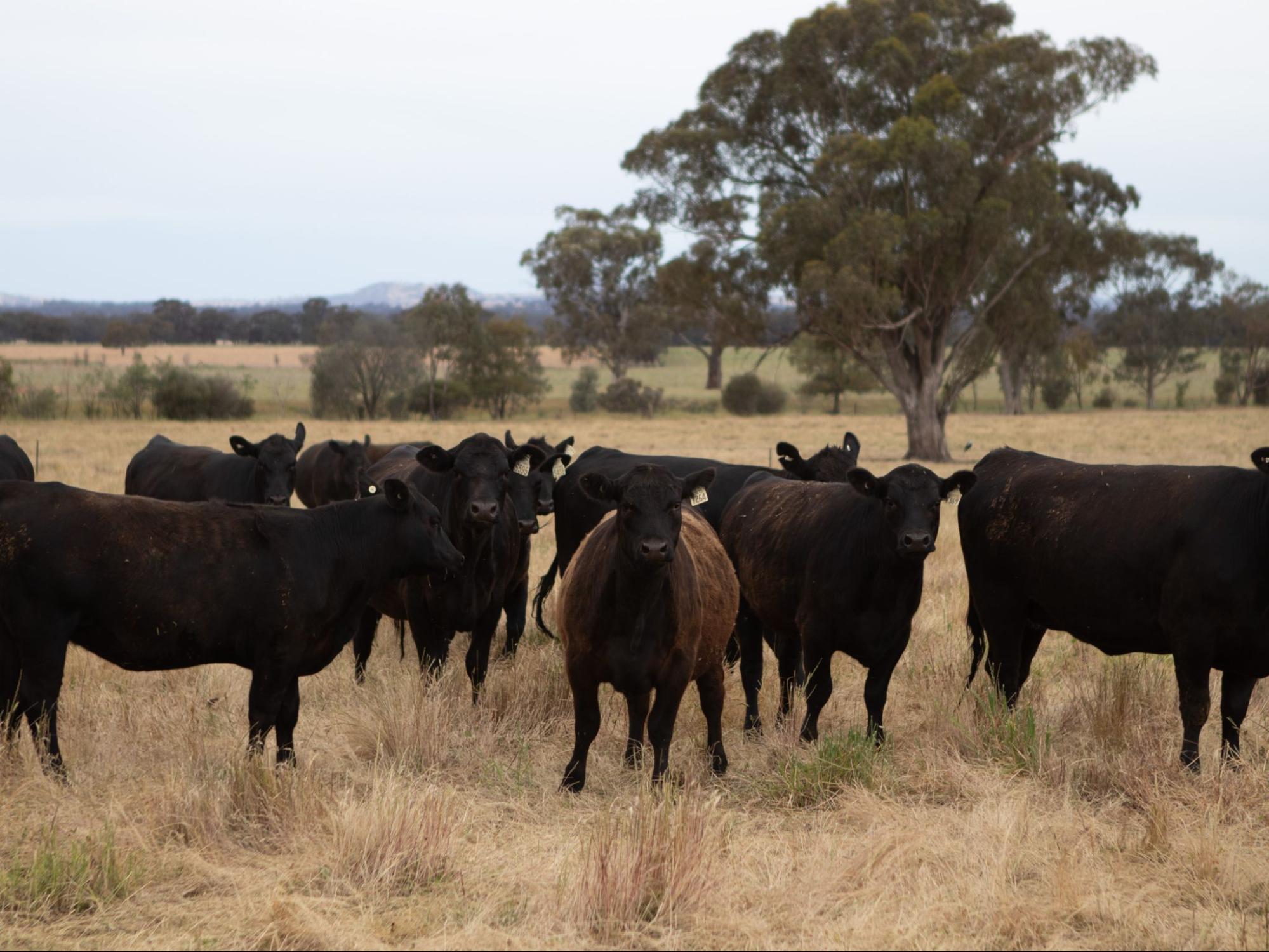
Image 2. Livestock at Glen Elgin. Source: Grow Love Project.
Improving soil and landscape health at Glen Elgin
Over the decades, the landscape has been heavily cleared (98%), to the extent that Cindy described the farm as a ‘moonscape’ when she first came to the property. Many of the paddocks only have one or two old paddock trees and several of these have been lost in recent years. Steven describes their landscape and soils as, ‘gently undulating, ranging from a little bit of gravelly, friable red soil on ridges through to some, puggy, sodic, grey clays on the lower part, and incorporating some, fertile black clays in middle parts.’
The majority of the farm is ‘sown down to deep rooted perennial temperate and sub-tropical pastures’ and Steven believes that the ‘structure and stability of most of the soils is fairly sound’. The Scotts have been involved in various initiatives to test, monitor and ‘bring life back into the soil’, including collaborating with the Department of Primary Industries to regularly measure soil fertility and acidity, and more recently with the Riverina Local Land Service (LLS) on the Farming Smarter soil project. This involved ‘precision agriculture technologies’ including electromagnetic surveying (EM38 is an induction method based on sensing soil electrical conductivity).
Efforts they’ve made to improve the fertility of the soil have involved ‘putting out a lot of lime and phosphorus’. They have experimented with different applications of lime, shifting from the standard rate of 2.5 t/ha to 4–6 t/ha incorporated to 10 cm. The Scotts have also added numerous species of dung beetles with the aim to get an ‘annual blanket’ of different species that are active throughout the year to help stimulate microbiology and circulate nutrients. They say that previous soil tests indicate an increase in soil fertility in areas where they have applied phosphorus and lime. They have also tested carbon levels in the soil and, based on their recent results, Steven sees this as a ‘slow game’ but something they will enthusiastically continue to work on.
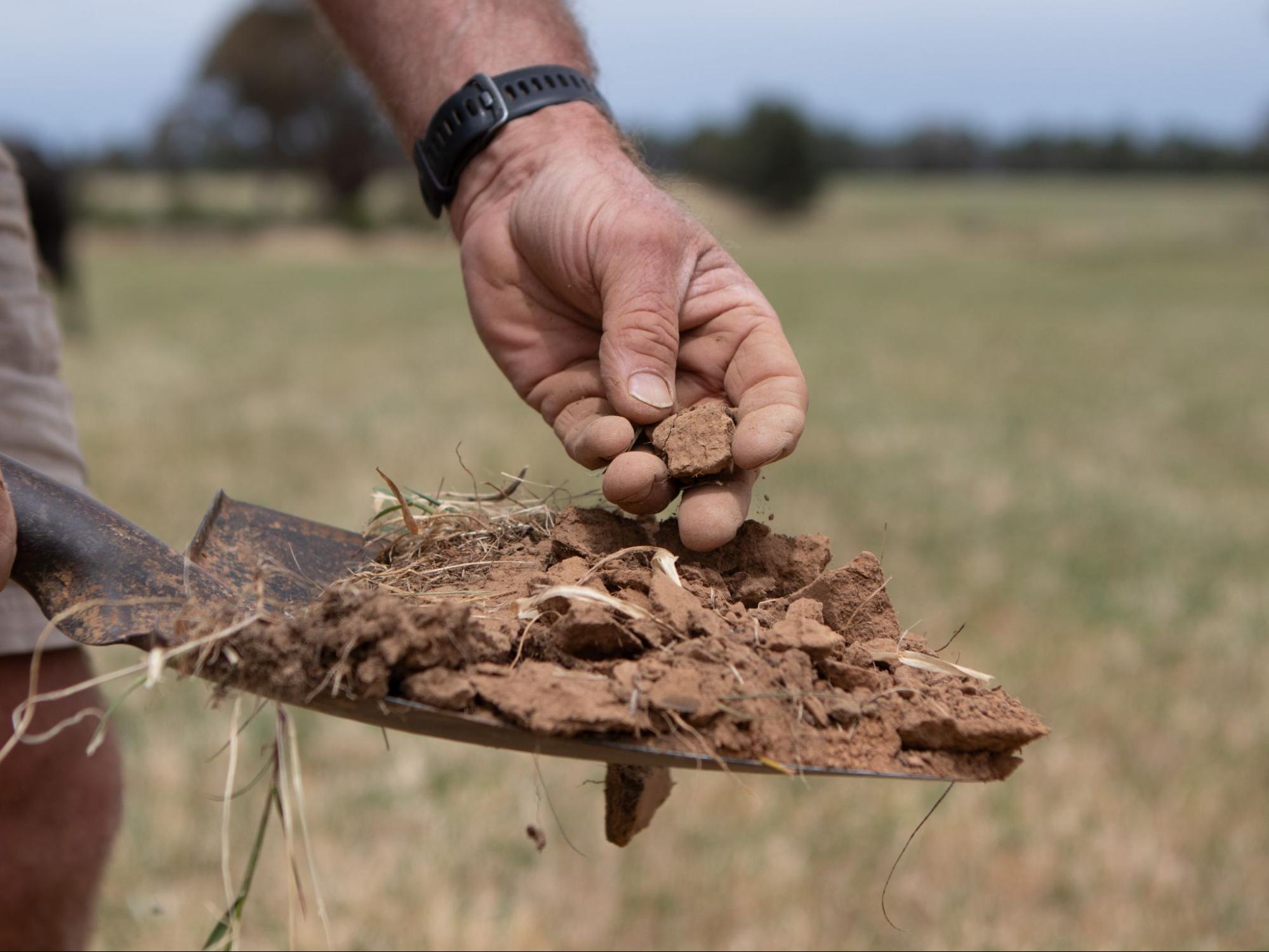
Image 4: Soil at Glen Elgin. Source: Grow Love.

Image 5. Steven monitors the soils at Glen Elgin. Source: Grow Love Project.
Like other farmers in the Riverina, droughts have been tough for the Scotts. For them, resilience in dry times is about ‘staying on their toes’. They constantly assess feed costs, labour units and available options as conditions change. One of their main strategies with their cattle operations is to manage stocking rates. During the Millennium drought they ‘moved a lot of cattle fairly quickly’. They are always flexible with their cropping program, and have often sacrificed crops in response to conditions. For example, they recently baled canola crops several times during drought because there was no money to be made taking it through to grain.
While the experiences during droughts are tough, Steven also sees them as transformative. He believes they lead to better operations in the longer term because farmers are forced to act and adopt new approaches in order to survive:
‘I had this discussion with a friend of mine where we decided to name the most memorable four or five farming years that we were aware of. The years we came up with were ones when extreme hardship was experienced. We agreed that it’s the times when you are shaken out of your comfort zone and forced to make big changes to your operation. You put down a reticulated water system, you buy a feed cart, you do something … they’re the ones that really stick in your psyche.’ – Steven Scott
Dealing with drought while raising small children has been one of the most challenging experiences for the Scotts. The combination of ‘working much longer hours to survive’ with the demands of caring for very young children made them focus on maintaining outside interests to balance the financial and mental strain.
Observing the benefits of shelterbelts at Glen Elgin
The Scotts are one of 15 producers in the Riverina who are being supported to implement one of three practices (enhanced farm dams, native shelterbelts or stock management areas) to improve drought resilience as part of the Riverina Drought Resilient Soils and Landscapes project. The project also involves the farmers participating in soil monitoring activities, field days, an online farmer discussion group and a WhatsApp group. The Scotts have chosen to plant more native shelterbelts – woody vegetation with a mix of trees and shrubs – across the farm.2
In addition to the support provided by the project, another reason the Scotts decided to join the Riverina project is the opportunity it provides to meet people who are innovative and open-minded. As Steven says, ‘I enjoy sitting in meetings with those people and picking up ideas and feeling motivated listening to others who share our objectives and passions.’ They were also recently involved in a Meat and Livestock Australia (MLA) peer-to-peer program, and Cindy is currently collaborating on a study with Melbourne University exploring the co-benefits of trees and shelterbelts on farms. Steven and Cindy are always looking for ways to improve the farm and are thoroughly enjoying both the journey and the results.
2To read more about shelterbelts explore our project partner’s resources Riverina LLS free training and Sustainable Farms, ANU.
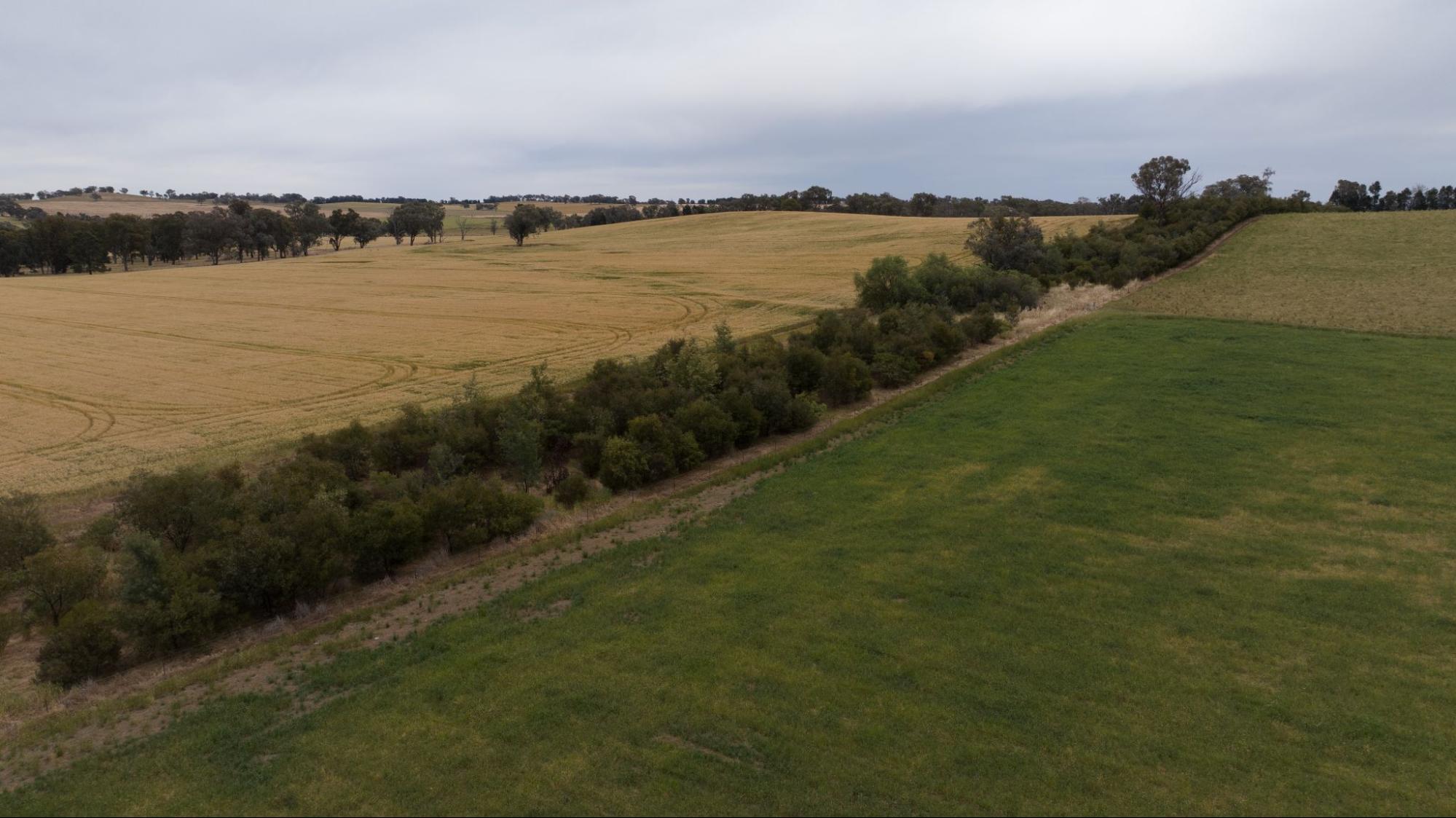
Image 6. Existing shelterbelts on the Scotts’ property. Source: Grow Love Project.
Practice Implementation
Revegetating the landscape with extensive shelterbelts at Glen Elgin
Historically, the property was extensively cleared of vegetation, which contributed to localised soil salinity and acidity in the region. In the 1980s and 1990s, shelterbelts were introduced back into farming land primarily to control problems with secondary salinity. These days, the integration of shelter and shade into farming systems is often a strong motivation, as well as improving the aesthetics of a farm and providing habitat for native wildlife. There is growing evidence of productivity gains because the reduction in wind speed can lead to higher survival rates for livestock and lambs, which has a flow on to improved weight gains.
Participating in the Riverina project is a natural extension of revegetation work the Scotts have already undertaken with the aim to diversify species and revegetate 10% of the farm. They have planted shelterbelts over the past 20 years, evolving from narrow single rows to wider corridors of native vegetation. Now the Scotts are carefully integrating the shelterbelts between paddocks (see seedlings from recent plantings in Images 7 and 8).

Image 7. Seedling from recent planting at Glen Elgin. Source: The Scotts.
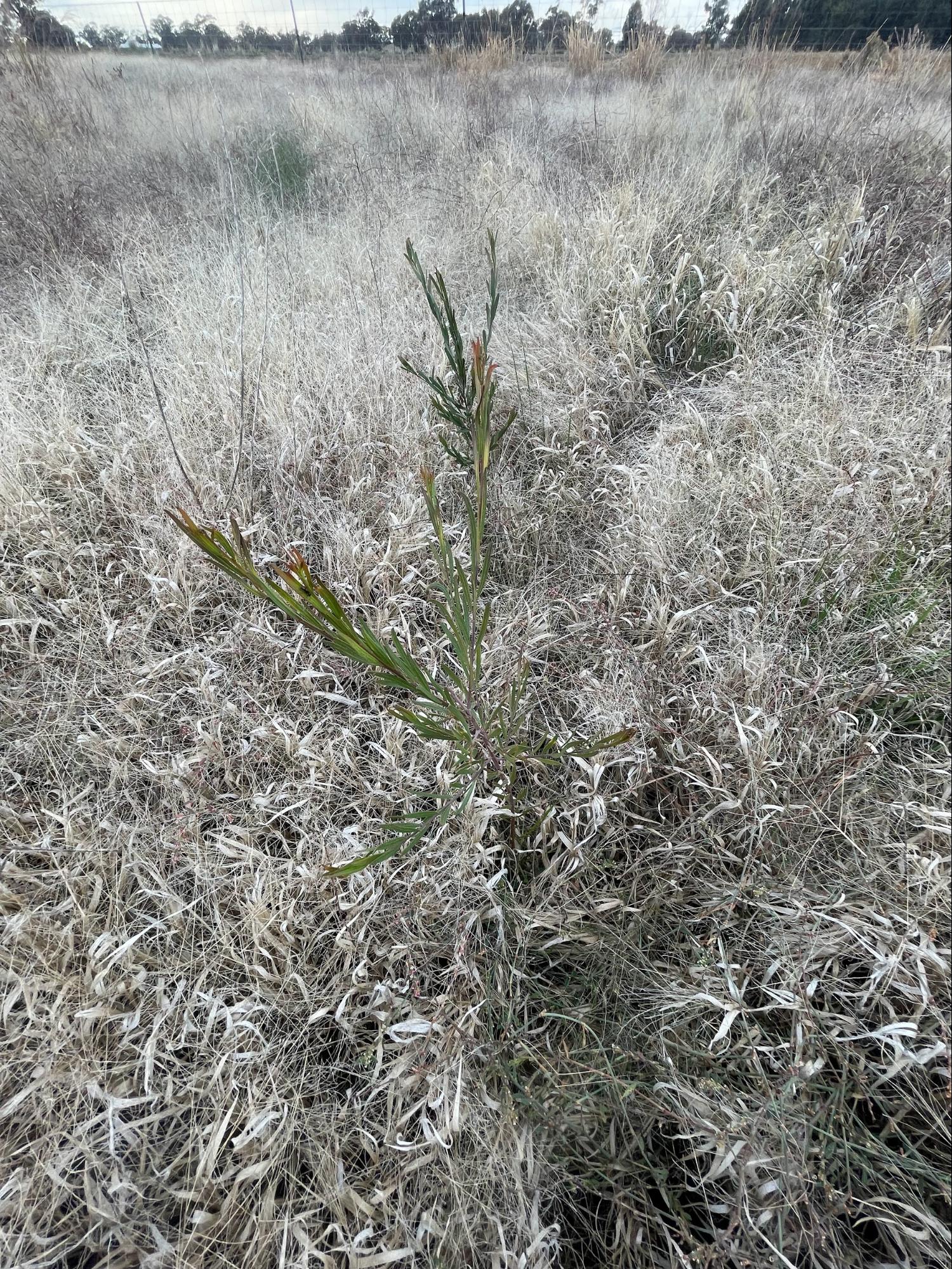
Image 8. Seedling from recent planting at Glen Elgin. Source: The Scotts.
Planting a new shelterbelt
The Scotts use direct seeding (see Image 9) because it is cheaper and faster than planting tube stock by hand. They accessed direct seeders through LLS and Greening Australia, and with two drivers, the Scotts can plant 90 km of seed in just one day. Steven says that the most important consideration is weed control prior to sowing. The Scotts will hard graze the area and then burn or spray with herbicide.
The results from direct seeding have been mixed, ranging from 80% of the seeds failing to germinate in some instances to areas too thick to walk through in others. Steven says it’s normal to have failures due to a range of unpredictable conditions. Where there are high rates of germination failure, the Scotts come back in with a ute and do more direct seeding. If there are only low rates of failure, then they tend to replant with tube stock.

Image 9: Direct seeding of shelterbelts at Glen Elgin. Source: The Scotts.
The Scotts hope these new plantings offer a range of benefits that contribute to farm productivity and the conservation of natural assets. In recent years, the Scotts have been celebrating the return of native birds and animals, which they view as central to the farm ecosystem. The sounds and regular sightings of small woodland birds such as superb fairy-wrens (Malurus cyaneus), songlarks (Cincloramphus sp.) and grey-crowned babblers (Pomatostomus temporalis) are a welcome indication for the Scotts of an improving ecosystem. And Steven recently saw his first bare-nosed wombat (Vombatus ursinus) on Glen Elgin:
‘A wombat on the farm?! Yeah. Got a hell of a kick out of it.’
Cindy Scott will continue to be closely involved in a study with University of Melbourne to quantify benefits of tree corridors like increased lambing rates or weight gains.
‘We get a great sense of satisfaction when we drive around the farm. We used to be able to see five kilometers and now we can’t see any further than 500 m, and beyond that there’s another tree corridor.’ – Steven Scott

Image 10. Mature shelterbelts at Glen Elgin that show the ongoing planting across the properties for several years. Source: Grow Love
Soil Monitoring
The Scotts have been developing their understanding of soils for many years and growing their confidence in monitoring their own soils. Participating in the Riverina project has supported them to make monitoring a routine practice that they plan to continue. With support from Riverina LLS and Soils for Life, they are monitoring the health of their soils through their own observations and field assessments, complemented by soil sampling and lab testing.
Each farmer participating in the project received a report offering a general interpretation of their soil test results and had the opportunity to discuss their results with a Soils for Life soil scientist. They were also encouraged to share their photos and insights of their in-field observations and assessments with each other via the online farmer discussion group, Whatsapp group and field days.
Setting up monitoring at Glen Elgin
Choosing a monitoring site
Soils for Life worked with the Scotts to identify a location on their farm where they could do their in-field soil assessments, and that was also suitable for any future monitoring of their soils, vegetation and biodiversity. The Scotts chose a site in ‘Munyabla Melon P’ paddock on a lower slope, north of one of Glen Elgin’s many established shelterbelts.
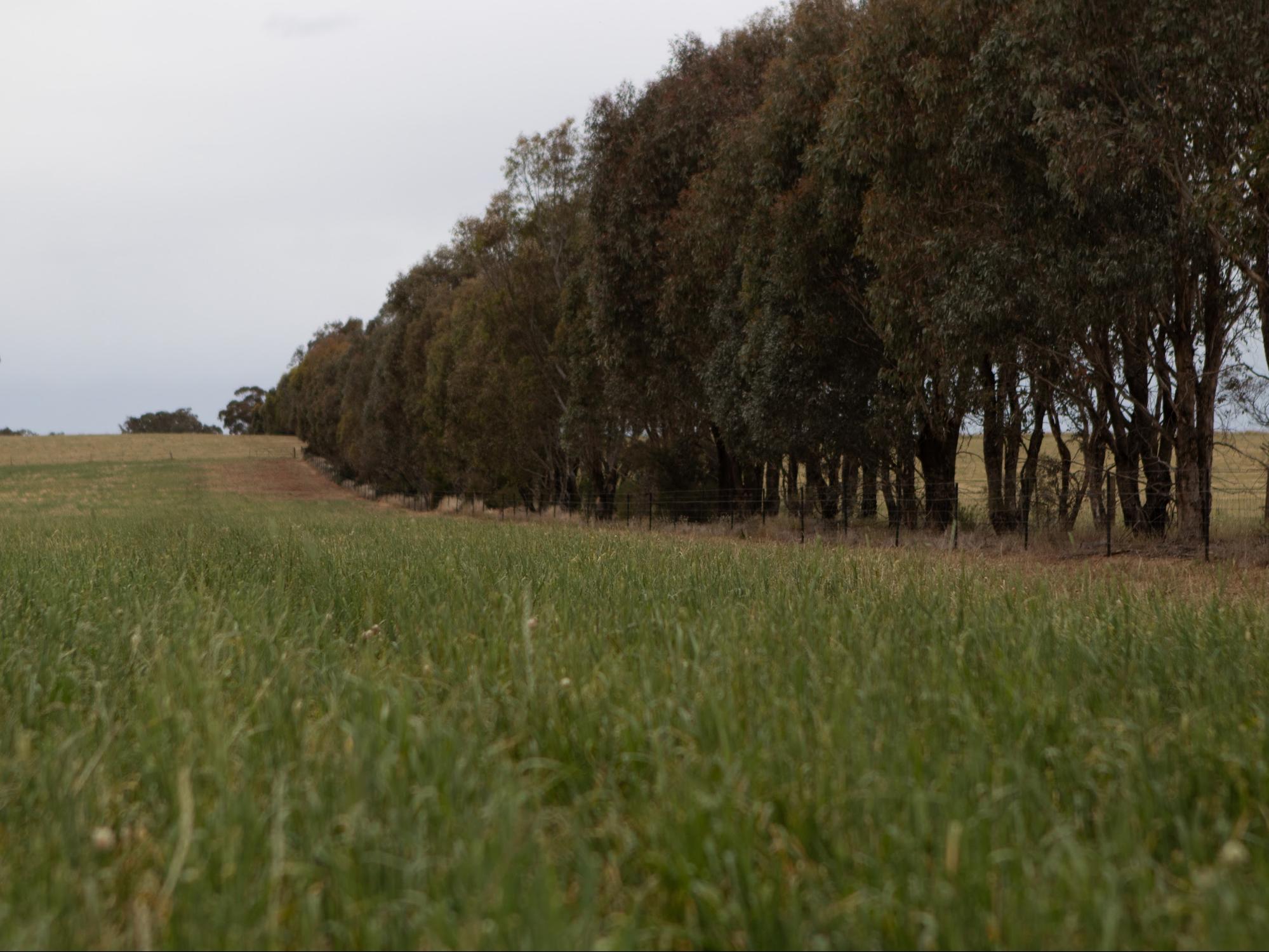
Image 11: An established shelterbelt at Glen Elgin close to the ‘Munyabla Melon P’. site. Source: Grow Love Project.
Setting up monitoring routines
Finding the time to regularly monitor can be challenging, so Steven and Cindy needed to make it manageable amidst their many priorities. To begin with, they are focusing on one location and have chosen a convenient site beside a laneway that Steven drives down daily and where he already has a habit of taking photos of groundcover. ‘We use that area as our basis for the [recent] soil testing, so that everything is basically done within that one little area’, says Steven.
‘I’ve got my groundcover hoop hanging on the fence to remind me. The first Monday of every month I pull up there, I take my photo into the distance and then I’ll walk out 20 paces and drop the groundcover hoop and take photos of the ground.’ – Steven Scott
In-field assessments
The Scotts did three independent rounds of in-field assessments at the ‘Munyabla Melon P’ site in August 2023, February 2024 and May 2024. Each time, they applied the following monitoring techniques using guides provided by Soils for Life: photopoints, groundcover, soil infiltration, aggregate stability, soil organisms and soil pH assessment.
The in-field assessments are described below and have been developed into a ‘Soil Health Challenge’, see the Soil Health Assessment Guide at the bottom of the page (with the exception of the pH assessment). Insights from the monitoring are summarised in the next section.
Photopoints: This assessment involves setting up permanent locations where photos are taken repeatedly to capture changes over time.
Groundcover: A simple way to measure groundcover is by visually estimating the percent of the soil surface within a confined area that is covered and not bare.
Steven has a well-rehearsed routine for assessing groundcover once a month, allowing the Scotts to see changes over time and under different conditions (see Images 12 and 13).
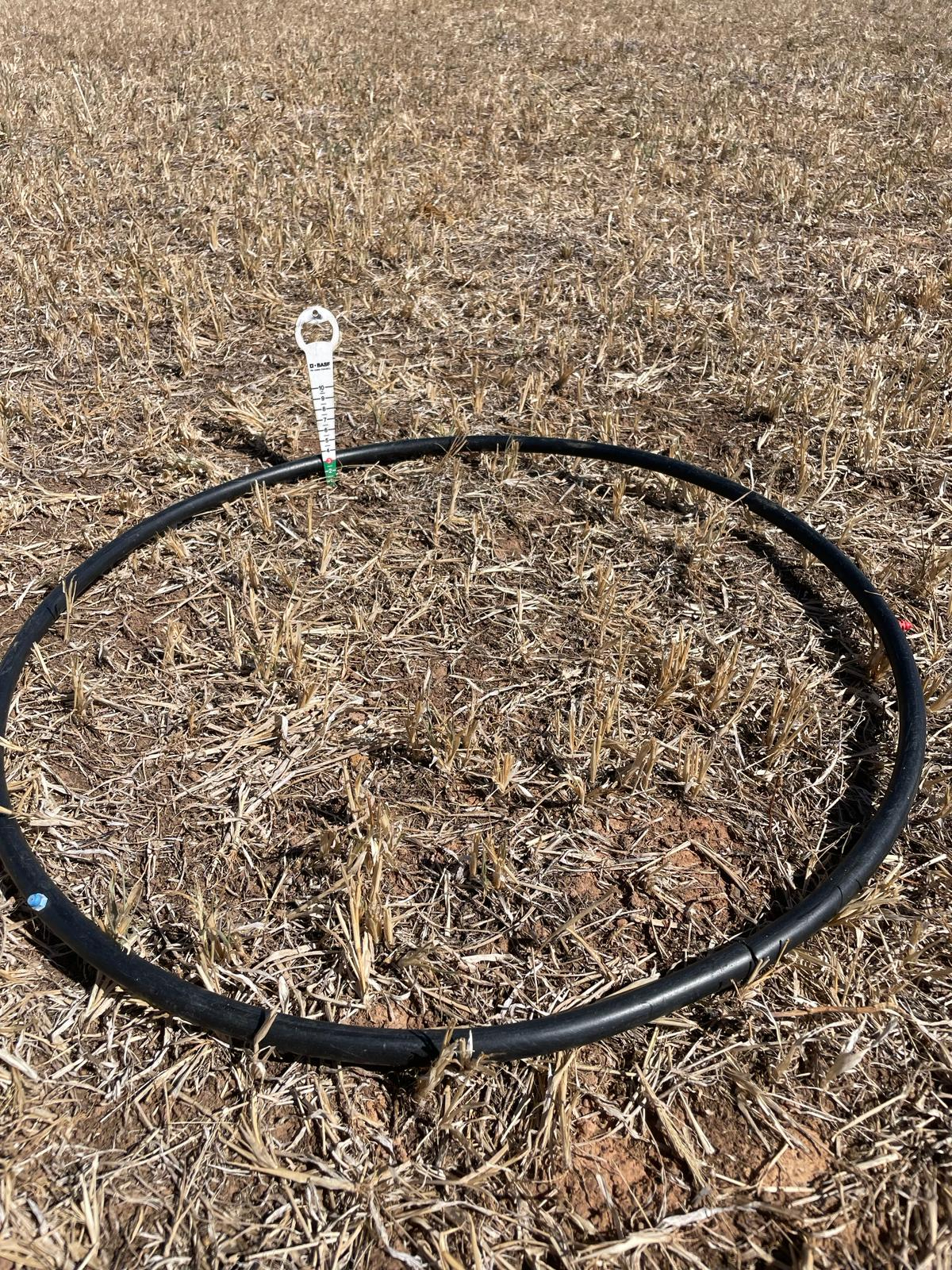
Image 12: Assessing groundcover at ‘Munyabla Melon P’ in February 2024. Steven notes, the ‘groundcover is thinning out. No green shoots, only residual phalaris and hairy panic plus some clover burr.’ Source: The Scotts.

Image 13. Assessing groundcover at ‘Munyabla Melon P’ in June 2024, four days after 40 mm rain. Source: The Scotts.
Soil infiltration: Soil infiltration is the downward entry of water into the soil. The rate at which water can infiltrate can be estimated in the field by recording the time it takes for a volume of water to enter and move through the soil.
Steven had not done water infiltration assessments prior to the project and now plans to add this assessment to his monitoring routine, along with periodic aggregate stability assessments (see below) to inform grazing and cropping decisions.
Aggregate stability: Soil structure regulates the movement and storage of air, water and organisms, and therefore nutrients, in the soil. Soils with stable aggregates are more likely to retain their structure and are better able to withstand the forces imposed by wetting and drying, raindrop impact, stock trampling, cultivation and other disturbance.
Soil organisms: Soil organisms are responsible for many soil processes, including contributing to the development of soil structure, the breakdown of organic matter and the cycling of nutrients. One of the simplest methods for assessing the soil organisms that are visible with the naked eye (e.g. worms, beetles, spiders, ants, etc.), is to record the number that can be seen in a sample of soil within a defined period of time.
Soil pH assessment: Soil pH is the acidity or alkalinity of the soil. Soils may be naturally acidic or alkaline, depending on the parent material on which they formed. Agricultural practices also influence soil pH, often removing alkalinity from the farming system, which results in an increase in soil acidity over time. A number of methods for estimating soil pH in the field are available. The Scotts used the soil pH kit provided as part of the project, which is readily available from hardware stores.3
3The kit is called a Manutec Soil pH Test Kit and comes with easy to follow instructions. The kit is based on Raupach and Tucker’s field method for assessing soil pH. See Raupach, M and Tucker, B (1959) The field determination of soil reaction. Journal of the Australian Institute of Agriculture Science 25:129−133. To see a soil pH demonstration, visit: https://www.youtube.com/watch?v=HZz3-cv_GGc&t=123s
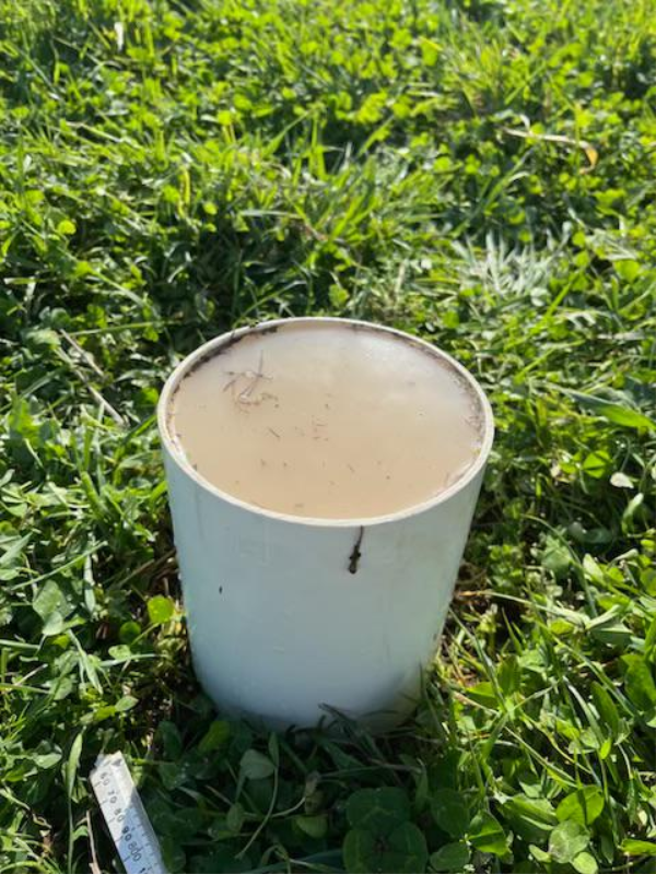
Image 14. Assessing water infiltration at ‘Munyabla Melon P’ in August 2023. Source: The Scotts.
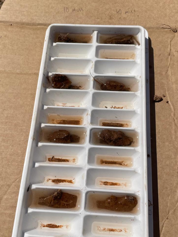
Image 15. Assessing aggregate stability at ‘Munyabla Melon P’ in February 2024. Source: The Scotts.

Image 16. Assessing pH at ‘Munyabla Melon P’ in August 2023. Source: The Scotts.
Sampling for lab tests
To supplement in-field monitoring, the Scotts collected soil samples from one location at the ‘Munyabla Melon P’ site for laboratory analysis. The samples were collected from four different depths in the soil (see Image 17) and submitted to the laboratory for a range of soil physical, chemical and biological tests. The purpose of sampling at a single location was to provide the Scotts with a more in-depth account of the soil at their monitoring site so they can track changes in these soil properties over time. With additional investment, soil monitoring and sampling at multiple locations across Glen Elgin would provide the Scotts with a broader understanding of their soils.
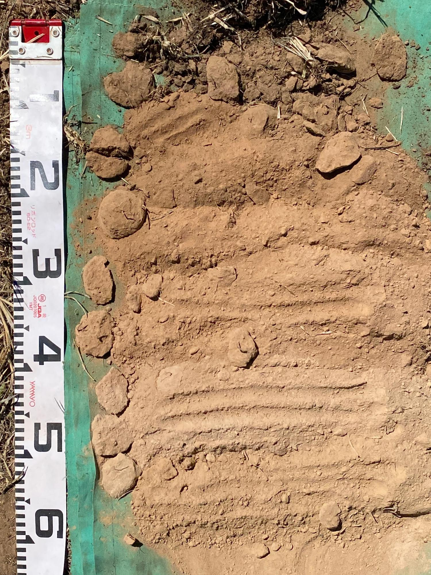
Image 17. Soil at different depths at ‘Munyabla Melon P’. Source: Soils for Life.
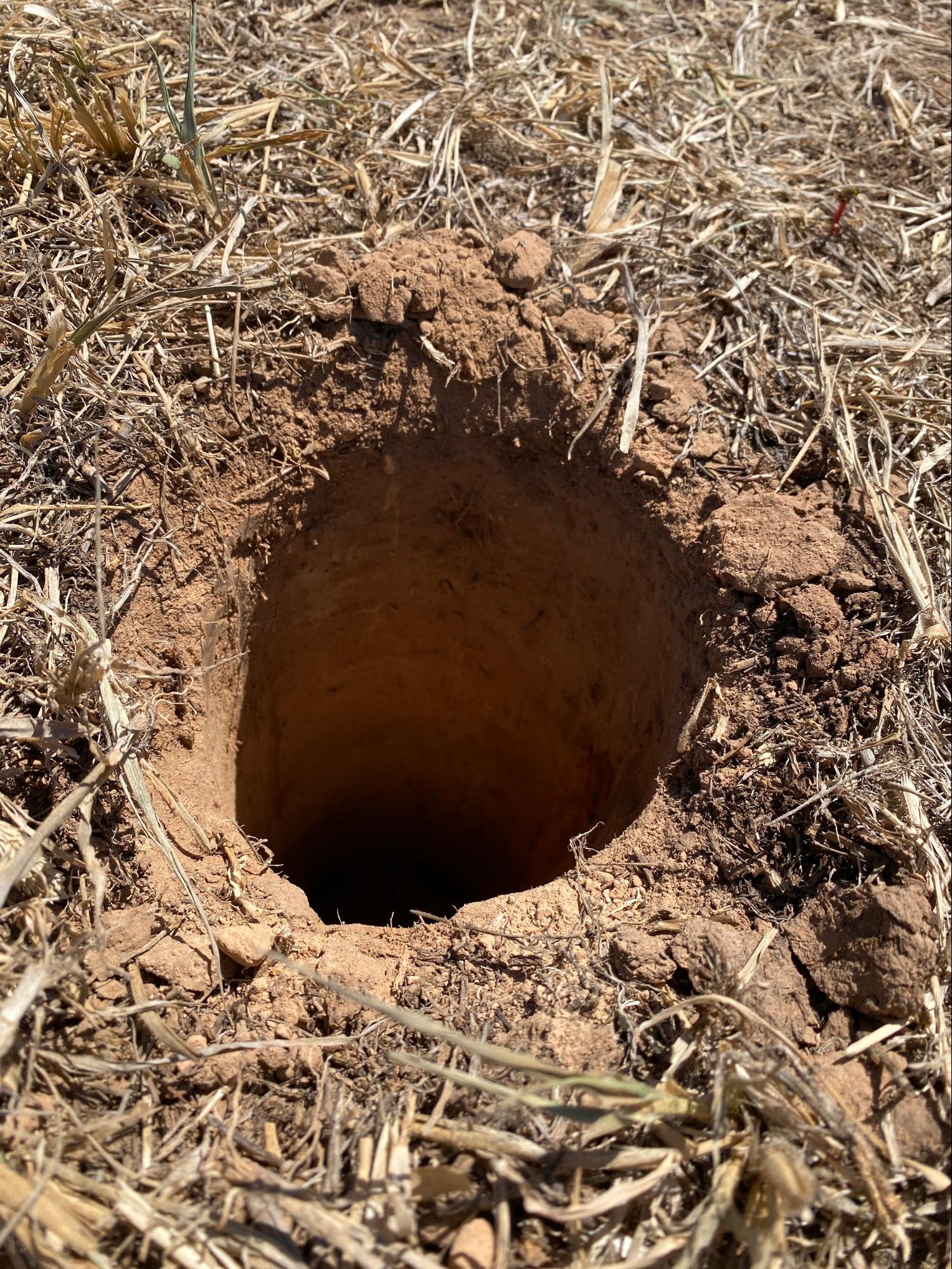
Image 18. Samples were collected from depth using a hand auger, minimising disturbance at the sample site. Source: Soils for Life.
Soil and landscape insights
The soil at the ‘Munyabla Melon P’ site is well-drained, with a gradual increase in soil texture from loam to clay loam and a neutral pH trend. Based on the in-field assessments, observations at the time of sampling and the results of the soil testing, the most notable potentially limiting properties are the weak soil structure, low organic matter and low cation exchange capacity (CEC) below 5 cm depth in the soil and the low quantity and activity of soil organisms.
Organic matter and fertility
Soil organic matter is complex, comprising many components, including (but not limited to) soil organisms, plant residues, active soil organic matter and stable organic matter (humus). Because of its complexity, soil organic matter is estimated from soil carbon measurements, and the Scotts previous soil testing has included soil carbon.
The lab results from the ‘Munyabla Melon P’ site show that total carbon is moderate to high (3.3%) in the 0– 3 cm sample, which equates to an estimated soil organic matter of 5.8%. While this result is 1–2% higher than the Scotts have seen in previous soil testing at different locations on Glen Elgin, soil organic matter (and therefore soil carbon) can be highly variable over time and within, and between, soil types.
Soil organic matter can range from recent (e.g. fresh plant residues and animal manures) to ancient (e.g. charcoal) and its cycling is largely dependent on water availability, soil structure and soil pH. The building and cycling of soil organic matter, or ‘turnover’, is largely dependent on climate and soil type. Achieving sustained increases in soil organic matter is typically a long term process that occurs over decades. Steven recognises this and sees the building of soil organic matter and carbon as a ‘slow game’ but something he and Cindy will enthusiastically continue to work on.
Soil cation exchange capacity is a measure of the soil’s capacity to exchange and retain basic cations (and therefore nutrient availability for plants). It is also an indicator of soil fertility and is influenced by the soil clay content, organic matter levels and soil pH.
The CEC of the monitoring site soil at Glen Elgin was low to moderate from 0–3 cm and low from 5–50 cm in the soil. The higher CEC in the 0–3 cm sample reflects the high soil organic matter, and the decrease in CEC from 5 cm depth in the soil reflects the decrease in soil organic matter and the amount and type of clay in the clay loam subsoils.
In an effort to increase soil fertility in certain paddocks, the Scotts have added phosphorus and lime, experimenting with different rates of application (from 2.5 t/ha to 4–6 t/ha) incorporating to about 10 cm depth in the soil. Results from previous soil testing indicate that the soil fertility has increased in areas where phosphorus and lime have been applied.
A question that remains for the Scotts is whether soil acidity exists to the extent that incorporating lime deeper than 10 cm and maintaining a higher rate of application are viable management options. This is a common query raised by farmers who struggle to find efficient and affordable solutions to subsoil acidity.
Because soil organic matter, particularly humus, has a CEC many times greater than any clay type, increasing its levels in the topsoils will not only stabilise the topsoils, but will also increase soil water retention and act as a substantial source of nutrients for the soil organisms and the plants.
The Scotts participation in the project has also led to an increased understanding of nutrient balances in the soil, in particular the relationships between CEC, clay content, organic matter and soil pH.
Soil organisms
Soil organisms contribute to soil health in a number of ways. Many are important in helping break down organic matter, cycling nutrients and the mineralisation of nutrients into plant-available forms. Others contribute to soil aggregation via their secretions, which bind soil particles together to form aggregates. In addition to being critical to soil fertility, the absence of abundant, diverse and active soil biology may contribute to soil instability and soil structural decline.
Soil organism counts conducted at the Elgin monitoring were low. Considering their focus on plant diversity, commitment to reinstating trees across the landscape and the steady increase in land area that is under pastures rather than cropping, the Scotts expected to see more ‘life in the soil’ at Glen Elgin. While soil organism counts are a reasonable indicator of the presence of soil organisms that we can see, there can be any number of explanations for low counts, including: monitoring when the soil is too wet or dry (which was common for many of the project participants, including the Scotts); low soil organic matter levels representing a lack of food sources; and compacted, structureless soils resulting in a loss of habitat and limiting the movement of soil organisms.
Many Australian agricultural soils are bacteria-dominant due to the loss of fungal communities following the clearing of trees and shrubs, soil disturbance (tillage destroys fungal hyphae and mycelium) and the use of fungicides. The low count and activity of the soil fungi in the 0–3 cm sample from the ‘Munyabla Melon P’ site suggests that the mycorrhizal (fungus to roots) relationships responsible for microbe-root-plant interactions, such as water and nutrient uptake and exchange are low, limiting nutrient cycling and availability.
In such a scenario, the soil’s capacity to store and transmit oxygen, water and nutrients can be improved by increasing soil organic matter, beneficial fungi and the diversity and abundance of food sources for organisms living in the soil. One way that the Scotts are working on increasing soil organic matter and nutrient cycling is by introducing different species of dung beetles. The Scotts have learned that certain species of dung beetles are active at different times of the year, and they are aiming for an ‘annual blanket’ of activity to help stimulate microbiology and circulate nutrients.
Soil infiltration, sodicity and stability
Over time, the natural weathering of soil parent materials can result in nutrients, clays and salts accumulating in the soil. If one of these salts is sodium, and the sodium is associated with the clays as an exchangeable cation, the soils are described as sodic and potentially unstable.
The soil test results showed that the soil at the ‘Munyabla Melon P’ site is non-sodic from 0 to 40 cm, with exchangeable sodium percentages (ESP) ranging from about 3 to 4%, and sodic at 40 cm, with an ESP of 8.7%. While the common threshold for sodicity is 6%, soils with ESPs as low as 3% can be unstable.
Steven has observed that the ‘stability of most of the soils is fairly sound’. Given the soil test results for aggregate stability show the soil to be moderately stable from 0–40 cm, and the in-field aggregate stability assessments yielded a similar outcome, his observations seem well-supported. These outcomes, however, are based on a small number of in-field observations and lab tests and may not be representative of the property as a whole.
One of the many benefits of observing, sampling and testing deeper in the soil is being able to identify potential limitations to soil workability and productivity such as sodicity across the farm. Subsoil properties not only influence soil water movement and storage, and the depth at which plant roots can grow to access water and nutrients (effective rooting depth), but they might also reveal other limitations to productivity.
At Glen Elgin, if it is present deeper in the profile, soil sodicity may only be an issue if the soils are exposed or disturbed and subsequently wetted (e.g. during the process of building a dam, or brought to the surface through cultivation, when dispersion can occur).
Soils with low stability, including sodic soils, are more susceptible to soil structure decline than stable soils. This loss of soil structure limits key soil processes such as soil water infiltration and aeration, resulting in a less than ideal habitat for soil organisms and plant roots. In heavy clay soils this would prove a limitation to soil water infiltration, but in the ‘Munyabla Melon P’ soil, the lighter loam to clay loam textures will assist the movement of water into the soil.
Steven observed soil water infiltration rates ranging from slow (15 mm/hr in August 2023) to rapid (260 mm/hour in February 2024), noting that the infiltration rate slowed after 60 minutes for the February monitoring event. This is not unexpected, as infiltration rates tend to vary depending on a range of conditions at the time of monitoring, including the moisture content of the soil.
Future monitoring
Prior to their involvement in the Riverina project, the Scotts had not undertaken any in-field assessments of their soils. The farmer-led soil assessments that were introduced as part of the project encouraged the Scotts to observe their soils more regularly and to consider how their paddock observations might relate to soil function.
Steven now sees value in continuous observation and the periodic paddock assessment of soil properties to inform their grazing and cropping decisions. He believes that the in-field assessments of soil water infiltration have contributed to their overall understanding of how much water might be available for plant growth, and this has informed them when it comes to livestock rotations to avoid overgrazing certain paddocks.
Participating in the Riverina project has led Steven to reflect on ‘how little value he had been getting out of lab results in the past’, and ‘how little he really understood about what the soil test results mean’. Although he is a firm believer that monitoring is essential to good management, in his experience not all of the data he has collected over the years has been useful. He found it ‘incredibly valuable to have expert consultation’ in interpreting the soil test results and relating the results to practical implications in the context of his farming enterprises.
The Scotts are interested in discovering how variable their soils are and intend to progress their monitoring routine. They recognise the value of more regular sampling and testing, including of the subsoils, but they would also like to maintain the higher level of interpretation that the Riverina project offered so they can use the information more effectively.
Reflecting on their participation in the Riverina project activities, and the results of the farmer-led assessments and soil monitoring site test results and interpretation, Steven recognises that certain soil and landscape characteristics are beyond his control. However, he also acknowledges that while they have adopted many worthwhile practices at Glen Elgin, there is more they can do to improve their overall soil functionality, especially through managing their grazing regimes.
Looking to the Future
Now that their children are mostly grown up, Steven and Cindy have more time on their hands to explore and implement new practices. Their aim with any new management decision is to ensure they are adopting best-practice strategies based on available science. Their plan is to continue using objective metrics to evaluate the success of operations, including return on assets, stocking rates, water use efficiency and improvements to the soil.
Future indicators of success for the Scotts will be increases in the diversity and quantity of wildlife, as well as financial returns from improved productivity, a reduction in erosion and personal satisfaction at improving the landscape. Steven recognises that there is some resistance in the community to revegetation over concerns like increased wildlife road hazards, but Steven continues to focus on the environmental and social benefits and hopes for change in community attitudes over the long term.
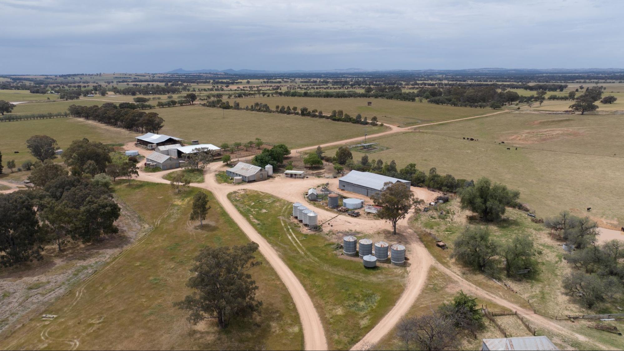
Image 19. Glen Elgin, in the Lower Slopes region of the Riverina. Source: Grow Love Project.
Videos about this project
Watch the Scotts and other Riverina farmers talk about the Riverina project, soil monitoring and three drought resilient practices.
Soil Monitoring in the Riverina
Coming Together for Resilient Soils and Landscapes
Stock Management Areas in the Riverina

Dam Enhancements in the Riverina
Downloads and links
See the links below to download documents relevant to this page.
Acknowledgements
This case study is part of the Riverina Drought Resilient Soils and Landscapes project, which aims to support producers in adopting drought resilient practices and enhance their landscape and soil monitoring capabilities. The Riverina Project is led by Riverina Local Land Services (LLS). It is supporting 15 producers to adopt one of three well-established management practices that enhance agricultural productivity and profitability during or after droughts while safeguarding natural resources. As part of the project, Soils for Life has prepared five case studies that follow producers as they implement their chosen practice/s, and their experiences with soil lab-testing and in-field observations. The producers are guided in their practice implementation with support from Riverina LLS, and have opportunities to learn through field days and webinars provided by the project partners, and an online discussion group. This project is led by Riverina Local Land Services, in conjunction with Sustainable Farms ANU, and Soils for Life. This project has received funding from the Future Drought Fund. We acknowledge that the contents of this page do not necessarily reflect the views of these contributors.

This project has received funding from the Australian Government’s Future Drought Fund.
For more information
Follow us for the latest
If you have any questions, get in touch at [email protected].

