

The Wilkes-Bowes at Anderloose
Building soil health and profitable farming in the Lachlan Region | Published January 2024
‘We always knew we wanted low inputs, partly because we needed to and partly because – coming from where I came from – I saw the value of native grasses.’ – Dee Wilkes-Bowes
Craig and Dee Wilkes-Bowes have always wanted their own property and moved to Anderloose with their two young daughters, Imogen and Grace, in 2009 after the Millennium drought. They have made many changes to management over 14 years, and the family are ‘still building the property and business.’ They describe their approach as ‘striving for a sustainable balance with profitable outcomes,’ and see soil monitoring as key to understanding their landscape.
Financing the purchase themselves, Craig and Dee have been focused on making cost effective decisions and integrating practices that support the regeneration of their soils and landscapes. The couple combine off-farm work while managing their property. Dee grew up in Ivanhoe and Balranald, further west of Anderloose and has a degree in agricultural economics. Craig is originally from England, with a background in computer programming. Their two daughters ‘loved growing up on the farm’ and are now young adults at university with an intention to remain involved in the family business.
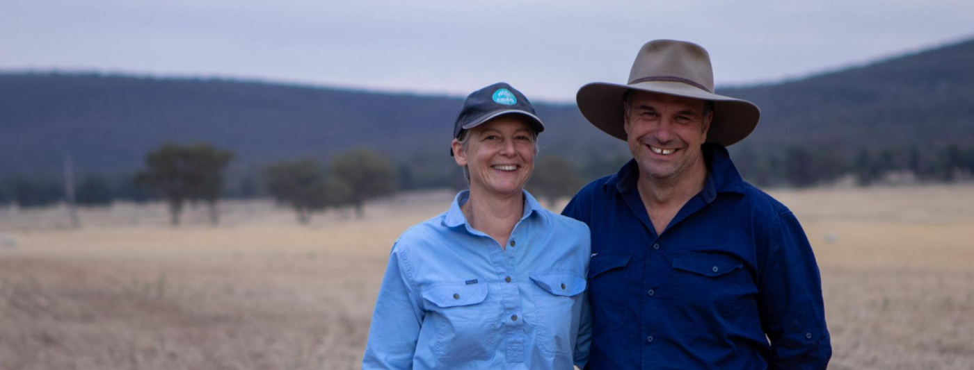
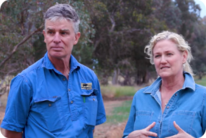
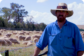
Image 1. Craig and Dee Wilkes-Bowes. Source: Grow Love Project.

Video 1. Soil monitoring in the Riverina. Produced by the Grow Love Project
Farm Facts
Location
Wiradjuri Country |Naradhan, Riverina, NSW
Climate
Hot dry summer, cold winter
Average Annual Rainfall
433 mm (recent, 1993-2022)
Agro-ecological Region
Mediterranean
Property Size
2,400 ha
Elevation
200 – 400 m
Social Structure
Family owned and operated
Enterprise Type
Grazing sheep (Australian whites and dorpers) and cattle. Fodder crops and occasional commercial cropping.
Landscape
Lower order stream valleys and relatively flat plains (cleared) surrounded by the foot slopes, steep hills, and ridges of the Naradhan Range (forested) to the north and west.
Soils*
Brown, shallow sandy soils (Rudosols or Tenosols) associated with extensive rock outcrop on the ranges; texture-contrast (Chromosols) and non-texture contrast (Kandosols) soils on the foot slopes and flats; deep, sandy soils (Rudosols or Tenosols) on the flats and along the creek lines.
*Learn more about soil classifications at www.soilscienceaustralia.org.au
The Highlights
Drought Resilience Strategies
Soil and Landscape Monitoring
Future Plans
- Maintaining a nimble approach, ‘destocking when needed, but ensuring that we’re not under-stocking when we have got the feed’
- Developing a range of management options to allow early response and multiple options when moving into dry periods
- Maintaining groundcover including deep rooted perennial grasses and a diversity of species
- Building a stock management area (SMA) to help reduce the pressure on pastures and support swift recovery after dry conditions
- Enhancing dams and adding trough water points to improve water quality and livestock health
- Continuing riparian restoration to build landscape resilience
- Long-term approach to soil monitoring with ongoing monitoring at several sites across Anderloose using Craig’s own soil monitoring app
- Improved understanding of the limiting properties at one soil monitoring site, namely low cation exchange capacity and an increase in exchangeable sodium (sodicity) at depth
- Improved understanding of which soils are more fragile and what can be done to improve the drought resilience of these soils
- Greater awareness that subsoils are just as important as topsoils
- Greater awareness of the link between sodic soils and erosion
- Expanding the monitoring program at Anderloose
- Tracking species diversity, groundcover and livestock carrying capacity as indicators of productivity and drought resilience
- Optimising fertiliser application rates for pasture and crop sowing based on knowledge of their soils
Landscape and Soils
Craig and Dee Wilkes-Bowes’ farm, Anderloose, lies to the west of Naradhan, in the Lachlan region of the Riverina. The property is about 30 km south of the Lachlan Valley, which represents the northern border of the Riverina region.
Anderloose is surrounded by the bedded sandstones of the Naradhan Range to the north and west. Off this steeper country, the farmed foot slopes and flats are a mix of colluvial (moved under gravity and deposited at the base of hillslopes), residual (formed in place) and alluvial (associated with the creeks and streams) soils. Boulders and rock fragments are a common feature across the landscape.
Naradhan has a rich agricultural history of sheep grazing and winter cropping. The flat country has been extensively cleared of what was likely a diverse vegetation, including box and mallee (Eucalyptus spp.), currawang (Acacia doratoxylon) and other wattles (Acacia spp.), white cypress pine (Callitris columellaris) and a range of native perennial grasses, annual grasses and forbs.

Figure 1. The broad soil orders at Anderloose. Source: Soils for Life and DPIE (2021)1.
1These soil orders represent a regional overview and are not derived from detailed soil information. The soil boundaries are based on the Department of Planning, Industry and Environment (DPIE) (2021). Australian Soil Classification (ASC) Soil Type map of NSW, Version 4.5, Department of Planning, Industry and Environment, Parramatta.
More about the Wilkes-Bowes
Managing for landscape health and profitability
Since taking over Anderloose, the family have mainly run livestock. They grow some mixed crops to produce fodder and occasionally a commercial crop with a share farmer. They have been working to improve the landscape and began by applying the principles they learnt from Holistic Management training. They regularly rest paddocks through rotational grazing, and ‘try to run big mobs, although that’s not always feasible’ for them, for example when joining ewes.
Their long term aim is to make the farm profitable enough to sustain a comfortable lifestyle and hand Anderloose on to their daughters in good condition. They focus on maintaining groundcover, increasing native species and incorporating multispecies pastures with the overall aim to continuously ‘build soils, restore native grasses alongside introduced species and build groundcover.’ The Wilkes-Bowes have promoted native grasses and forbs across some paddocks, leaving others for cultivation, and have used minimal inputs apart from superphosphate on a ‘couple of paddocks’ in recent years.
‘We always knew we wanted lower inputs, partly because we needed to and partly because – coming from where I came from – I saw the value of native grasses.’ – Dee Wilkes-Bowes
The Wilkes-Bowes have been testing their soils since 2014. Monitoring the soil health is helping them develop a deeper understanding of their soil types and function, so they have a good handle on how their soils behave and what the ‘country does.’ The soils at Anderloose vary considerably across the landscape. Dee describes how they are very red in the higher areas and in the ‘natural valley they’re heavier, loamier. As soon as you get up towards the hill they turn into lighter soils, less fertile and rocky, there’s rock everywhere.’
Craig and Dee are developing skills using soil data to inform their decision making and would like to become more empowered in ‘managing to type.’
‘Understanding if there is something we can do, whether it’s fertilising or lime or even just planting appropriately to soil types, that is good to know.’ – Craig Bowes
Applying his programming skills, Craig is also in the process of designing a smartphone app that will allow them to systematise their monitoring program, and they plan to make the app commercially available in the future.
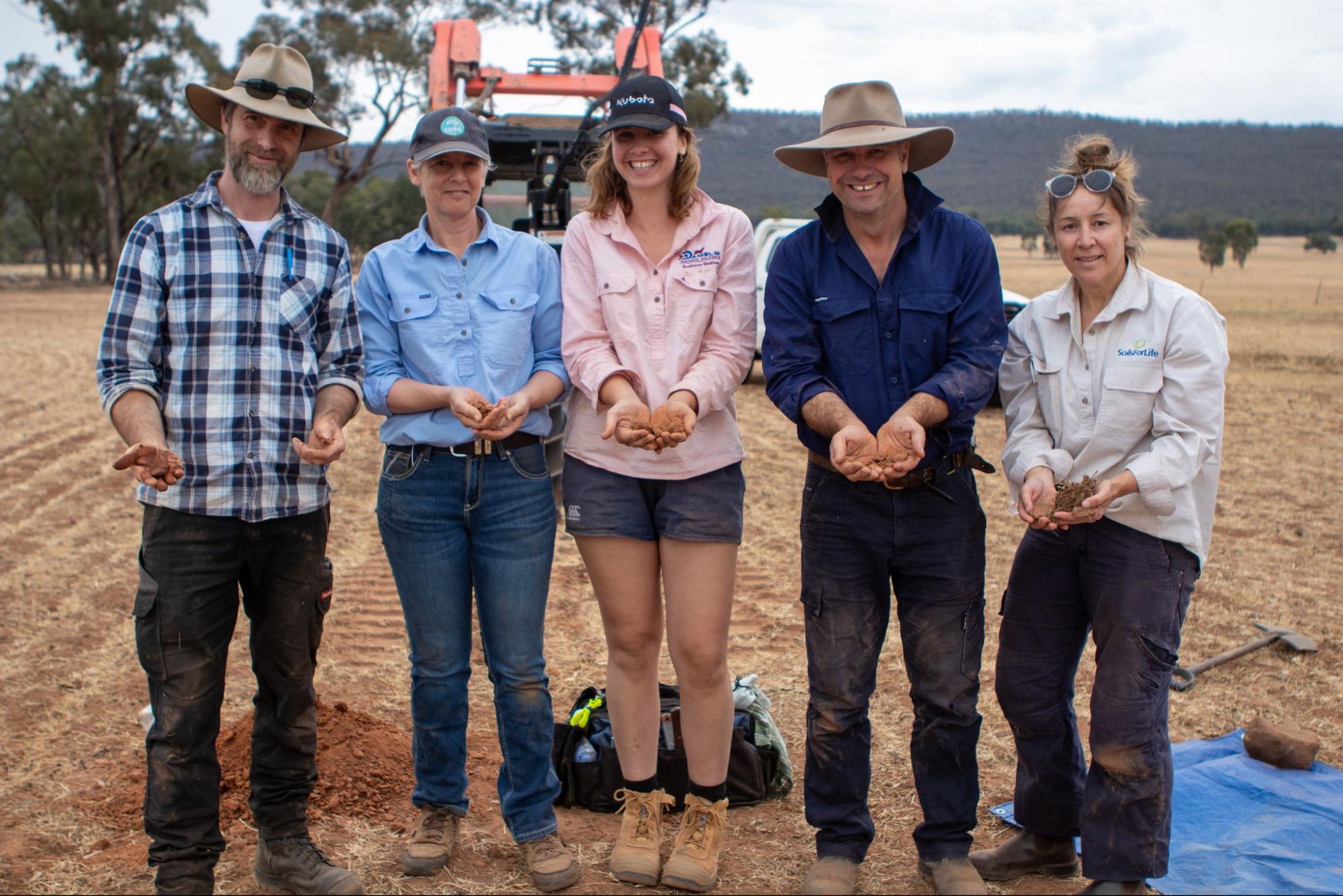
Images 2. Craig, Dee and Grace Wilkes-Bowes, with James Diack and Katharine Brown from Soils for Life during a soil monitoring activity. Source: Grow Love Project.
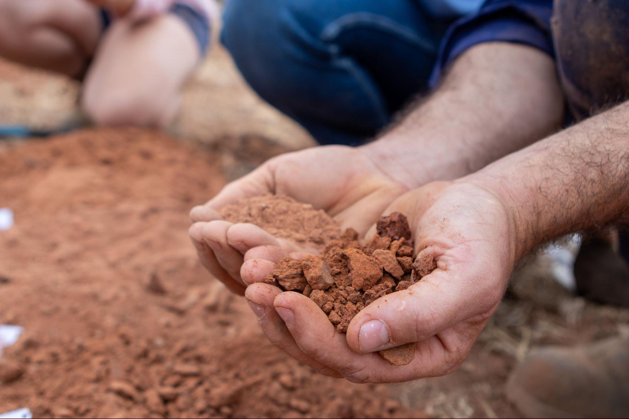
Images 3. A close up of soil at Anderloose. Source: Grow Love Project.
Living through drought
When the Wilkes-Bowes bought Anderloose from an absentee landholder, the land was ‘pretty bare’ from nine years of very dry conditions and low-level management. There has been a lot of work done on the property since to repair and rebuild it.
Growing up in rangeland environments, Dee is familiar with the physical impact and psychological stressors of drought, and she recognises the ‘emotion of it.’ She also notes that while best practice advice is focused on ‘decision points, where you destock progressively,’ she believes that things are ‘often messier in reality,’ because of the pressure and balancing act required when making high-stakes decisions.
‘It’s a balance between losing that groundcover and therefore the soil, and not having enough feed for our stock. We also need to make the property sustainable in the long term. So we try to be nimble around destocking when needed, but ensure that we’re not under-stocking when we have got the feed.’ – Dee Wilkes-Bowes
Dee and Craig watched the land at Anderloose become more and more depleted during the dry period of 2018 and 2019, and they experienced again the stress of losing groundcover, soil and not having enough feed for stock. Over these years they largely destocked and only kept a residual mob of sheep in one sacrifice paddock, which was relatively small but not designed to be a stock containment area and therefore did not offer the most efficient way of feeding and caring for stock. The land also suffered and took some time to recover. The experience motivated them to adopt new practices they hope will minimise the negative impacts of future droughts.
Building drought resilience
The Wilkes-Bowes decided to get involved with the Riverina Drought Resilient Soils and Landscapes project to increase their suite of management options so they can act early and have multiple options when moving into dry periods. They are one of 15 producers in the Riverina who are being supported to implement one of three practices (enhanced farm dams, native shelterbelts or stock management areas) to improve drought resilience. The project also involves the farmers participating in soil monitoring activities, field days, an online farmer discussion group and a WhatsApp group.
Craig and Dee have decided to build a new stock management area (SMA)2, including an adjacent saltbush (Atriplex spp.) and native shelterbelt, and are working to integrate this effectively into existing grazing practices. Their intention is to slowly reduce the pressure on their pasture by destocking where possible and gradually introducing containment feeding for select stock to ensure a swift pasture recovery after dry conditions pass.
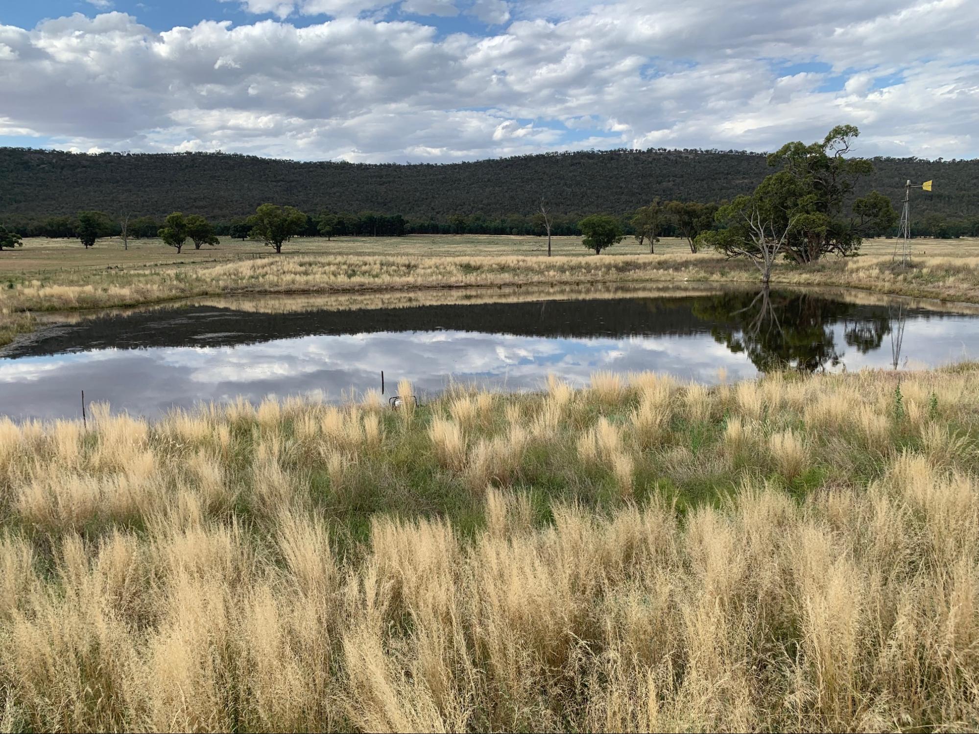
Working with the Riverina Local Land Services (LLS) to improve drought resilience is not a new experience for the family. They implemented dam enhancements a few years ago with the guidance and financial support of LLS.
‘We did a farm dam biodiversity project a couple of years ago … and prior to that we had fenced off two riparian areas. We’ve seen these areas regenerate and provide short-term grazing, whereas in the past stock had tended to hang on in the creek lines and over-graze the area.’ – Craig Bowes
Images 4. Before dam enhancements at Anderloose. Source: Craig and Dee Wilkes-Bowes.
Images 5. After dam enhancements at Anderloose. Source: Craig and Dee Wilkes-Bowes.
The dam enhancement has improved water management for livestock with better overall water quality. Water is transferred automatically using a solar pump to several water points in nearby paddocks, which supports stock health and is time efficient for Craig and Dee. Fencing off the dam completely has enabled superior water quality and has had the added benefit of supporting a more diverse range of wildlife, including a range of bird species. Craig also notes that the increase in biodiversity around the dam ‘lifts his spirits’ and has been good for his mental health, especially when the rest of the property really dries out.
2To read more about SMAs explore our project partner resources Riverina LLS free training and a recent publication produced by MLA.
Practice Implementation
Building a Stock Management Area (SMA) at Anderloose
Riverina LLS has been a ‘sounding board’ for the Wilkes-Bowes, helping them refine and improve their plans, maintaining informal communication throughout the program. For example, based on advice they received they decided to shift the original location of the SMA. In the end, the family positioned their SMA close to a lightly timbered area to provide livestock with shade and access to troughs of clean water pumped from the dam. The area allows for growth, should they decide to add to the SMA down the track. There is space to double the size of the SMA by adding pens to the south of the existing yards and to extend a stock corridor along them.
For Dee and Craig, the advice around the placement of the water tank and flow rates required for the number of stock was important. Craig also picked up various tips from listening to the experiences of other project participants, as well as the LLS staff on feed troughs, shade placement and animal behaviours. And the financial assistance from Riverina LLS through the Australian Government’s Future Drought Fund, enabled Craig and Dee to build this key piece of drought resilience infrastructure, which might otherwise have stayed on the ‘to do’ list.
Over the last six months, Craig and Dee have completed the fencing and built the water troughs. The SMA is almost complete, except for a few gates that they still need to attach and the 1 km of pipeline and tank that needs to be installed. They have faced some delays putting in the pipeline because of the ‘rock hard’ ground during a drier season, but the plan is to complete the SMA by July 2024. While building the SMA has been hard work, overall it has been a positive experience and the couple are looking forward to having the new piece of infrastructure fully finished and functioning.
Saltbush: a mixed diet for livestock and biodiversity zone
In July 2023 the family planted a belt of Anameka™ saltbush, a variety of old man saltbush (Atriplex nummularia) bred by CSIRO, from seed. While the seeds have not yet germinated, likely because of the prolonged dry spell immediately after sowing, the area is now fully fenced and they plan to replant in July 2024 using seedlings. Once the saltbush belt is established, the stock can go from the SMA yard directly into the saltbush for a period of grazing. Access to the highly palatable Anameka™ variety will add dietary diversity to the containment fed stock. Not only will the saltbush belt provide a source of fodder, it will also create a biodiversity zone. The plants will be sown wide enough apart to allow for grasses and forbs to flourish. It will also provide a windbreak for the adjoining paddock and slow water flow across the landscape.
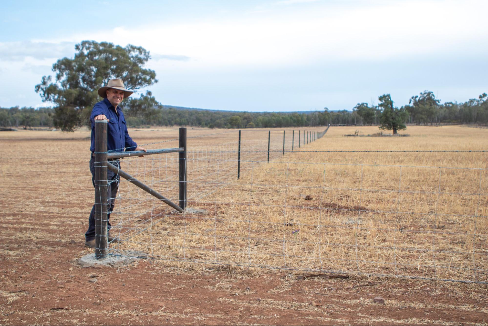
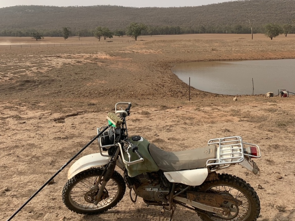
Image 6. Craig surveying new fencing for the SMA at Anderloose. The Wilkes-Bowes are looking forward to new saltbush (Atriplex nummularia ‘Anameka™’) plantings germinating when the rain comes. Source: Grow Love Project.
Soil Monitoring
Craig and Dee have been monitoring the soils at Anderloose for several years. With support from Riverina LLS and Soils for Life, they undertook additional monitoring to track the health of their soils through their own observations and field assessments, complemented by soil sampling and lab testing.
Each farmer participating in the project received a report offering a general interpretation of their soil test results, and had the opportunity to discuss their results with a Soils for Life soil scientist. They were also encouraged to share their photos and insights of their in-field observations and assessments with each other via the online farmer discussion group, Whatsapp group and field days.
Their recent monitoring experience has helped the couple to refine and focus their approach to soil monitoring as a drought resilience strategy. The experience has also given Craig the opportunity to develop his monitoring app through real-world testing and feedback within the farmer group.
Setting up monitoring at Anderloose
Choosing a site
Craig and Dee have been monitoring several paddocks across Anderloose using the soil monitoring app that Craig developed. For the project, Soils for Life worked with them to identify a new location on their farm where they could do their in-field soil assessments, and that was also suitable for any future monitoring of their soils, vegetation and biodiversity.
Situated adjacent to the SMA that is under construction, ‘Pig’s Paddock’ seemed a good fit for their monitoring site. Historically, ‘Pig’s Paddock’ was cleared of vegetation and has been frequently cultivated and/or heavily grazed.
In-field assessments and observations
The Wilkes-Bowes did the field assessments four times across the project, in September and November 2023, and February and June 2024. Each time, they applied the following monitoring techniques using guides provided by Soils for Life: photopoints, groundcover, soil infiltration, aggregate stability, soil organisms and soil pH assessment.
The in-field assessments are described below and have been developed into a ‘Soil Health Challenge’, see the Soil Health Assessment Guide at the bottom of the page (with the exception of the pH assessment). Insights from the monitoring are summarised in the next section.
Like many farmers, finding a routine for monitoring that worked,and fitting it into their busy lives on the farm was sometimes a challenge for Craig and Dee. Their daughter, Grace, who is studying agricultural science at Sydney University, was sometimes given the job of monitoring when she was home on the farm. They generally tried to make a habit of doing the observations around the time of the upcoming Riverina group Zoom sessions, but this wasn’t always possible, and sometimes their timing with monitoring was ‘quite random.’ They consistently assessed pH levels, but found counting organisms something that fell off the list when time was tight. Craig and Dee generally enjoy the monitoring process, and they found that putting the monitoring kit into a bucket along with monitoring method guides, which Craig had laminated, was a very useful way to streamline the process.
The photopoint assessment: This assessment involves setting up permanent locations where photos are taken repeatedly to capture changes over time.
Groundcover: A simple way to measure groundcover is by visually estimating the percent of the soil surface within a confined area that is covered and not bare.
Craig and Dee found the groundcover assessment extremely useful for not only assessing the percentage of groundcover but also the mix of plant species and ant activity. For Dee, ‘groundcover is an extremely simple but effective yardstick by which to measure soil health and how you are tracking in terms of pasture objectives.’
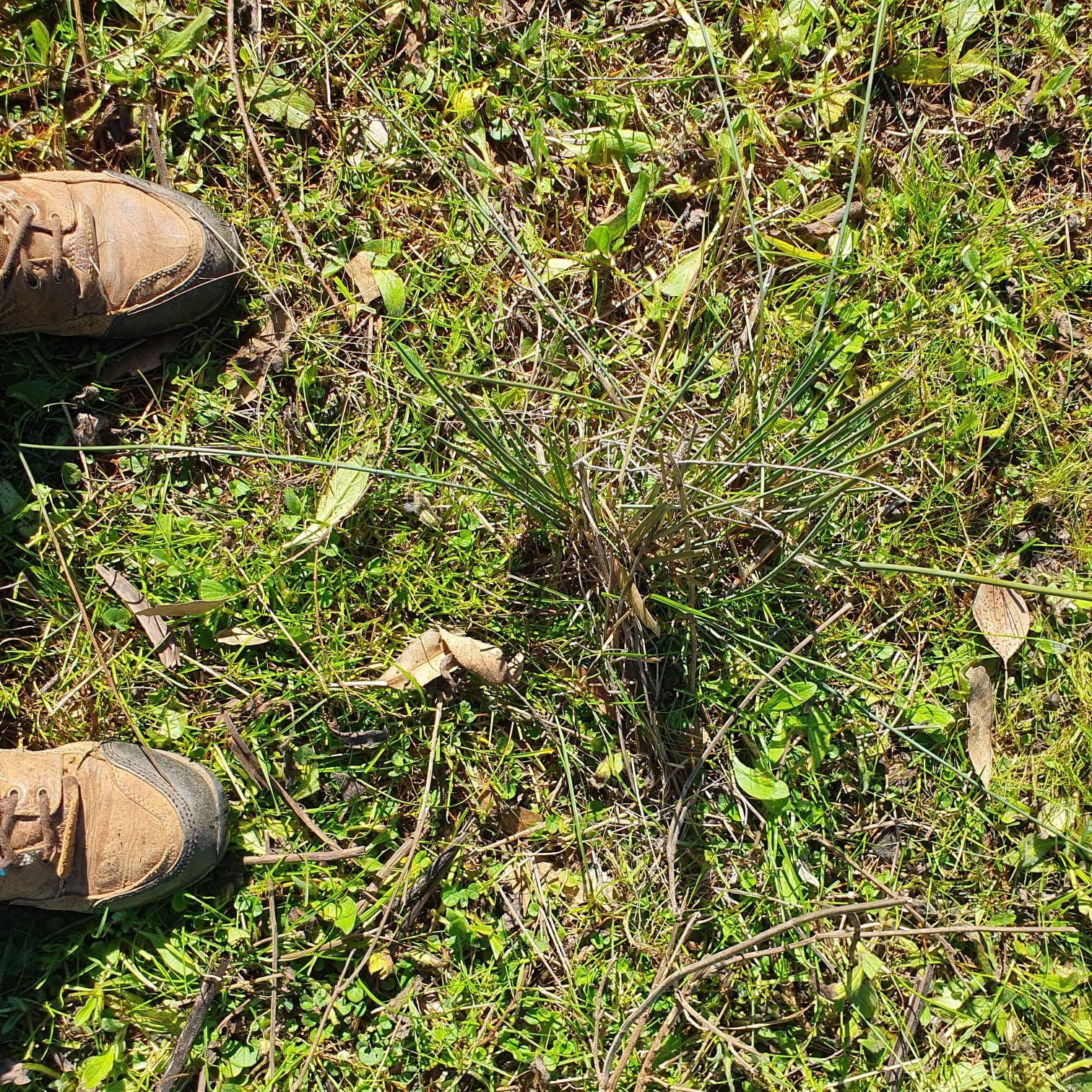
Image 7. Assessing ground cover in ‘Pif Paddock’ at Anderloose. Source: The Wilkes-Bowes.

Image 8. Assessing ground cover in ‘Pig Paddock’ at Anderloose. Source: The Wilkes-Bowes.
Soil infiltration: Soil infiltration is the downward entry of water into the soil. The rate at which water can infiltrate can be estimated in the field by recording the time it takes for a volume of water to enter and move through the soil.
One of the challenges that the Wilkes-Bowes had to overcome while assessing infiltration was the very hard ground at their monitoring site and many other parts of the property when things really dried out. As Craig said, ‘I destroyed one ring trying to get into the ground because the ground was just so hard.’3
3To avoid this scenario, consider a DIY infiltration ring made of steel or brass.

Image 9. Assessing soil infiltration at Anderloose in September 2023. Source: the Wilkes-Bowes.
Aggregate stability: Soil structure regulates the movement and storage of air, water and organisms, and therefore nutrients, in the soil. Soils with stable aggregates are more likely to retain their structure and are better able to withstand the forces imposed by wetting and drying, raindrop impact, stock trampling, cultivation and other disturbance.
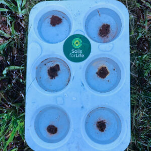
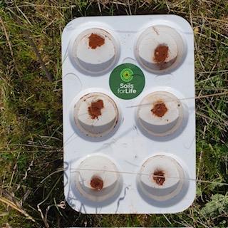
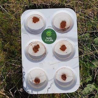

Images 10, 11, 12 & 13. Assessing aggregate stability at Anderloose in September 2023. From left to right: at the start, at 15 minutes, at 30 minutes and at 1 hour. Source: The Wilkes-Bowes.
Soil organisms: Soil organisms are responsible for many soil processes, including contributing to the development of soil structure, the breakdown of organic matter and the cycling of nutrients. One of the simplest methods for assessing the soil organisms that are visible with the naked eye (e.g., worms, beetles, spiders, ants, etc.), is to record the number that can be seen in a sample of soil within a defined period of time.
Assessing soil organisms became a regular part of the monitoring routine for the Wilkes-Bowes over 2023 and 2024. They found that one of the hardest things about doing this assessment was that they could find very few organisms because of the dry conditions, although this changed as the season improved.
Soil pH assessment: Soil pH is the acidity or alkalinity of the soil. Soils may be naturally acidic or alkaline, depending on the parent material on which they formed. Agricultural practices also influence soil pH, often removing alkalinity from the farming system which results in an increase in soil acidity over time. A number of methods for estimating soil pH in the field are available. The Wilkes-Bowes used a soil pH kit provided as part of the project, which is readily available from hardware stores4.
4The kit is called a Manutec Soil pH Test Kit and comes with easy to follow instructions. The kit is based on Raupach and Tucker’s field method for assessing soil pH. See Raupach, M and Tucker, B (1959) The field determination of soil reaction. Journal of the Australian Institute of Agriculture Science 25:129−133. To see a soil pH demonstration, visit: https://www.youtube.com/watch?v=HZz3-cv_GGc&t=123s
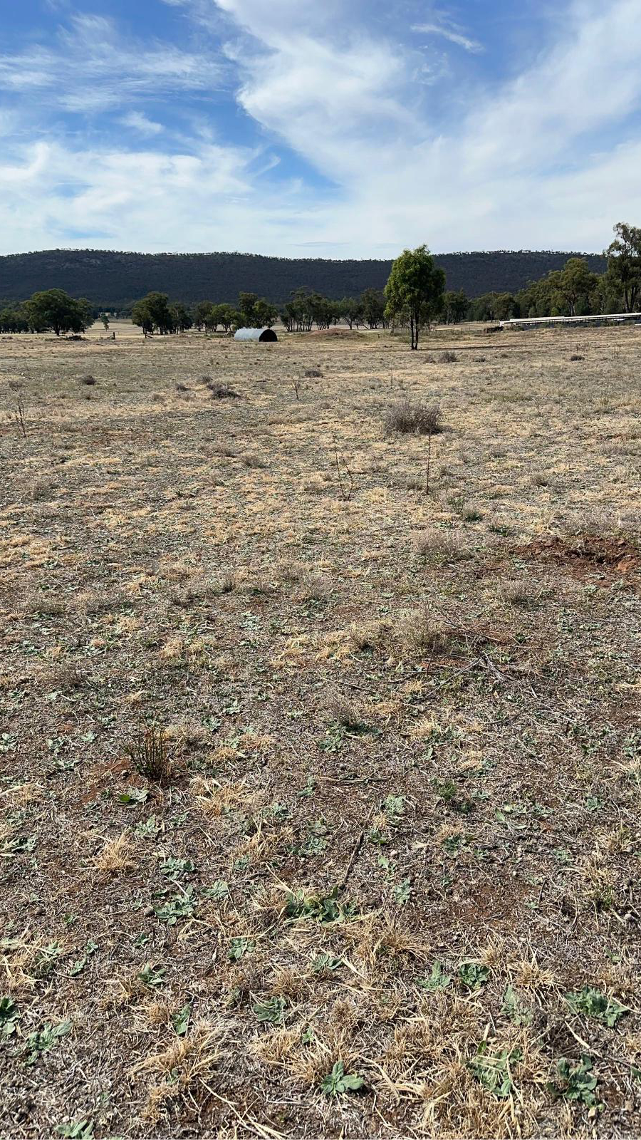
Image 14. Assessing groundcover at Anderloose in February 2024. Source: The Wilkes-Bowes.

Image 15. Assessing pH levels at Anderloose in February 2024. Source: The Wilkes-Bowes.
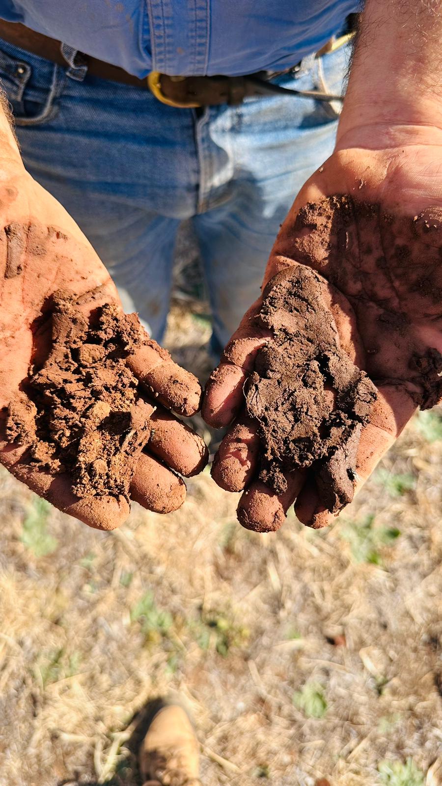
Image 16. Craig getting a literal feel for his soil after an infiltration assessment. Source: The Wilkes-Bowes.
The Wilkes-Bowes shared their results with the WhatsApp group. For example, they shared their images (see Images 14, 15 and16) with the message, ‘Very dry out at Naradhan – dams going dry but at least we get to clean them out. Been doing observations in paddocks sprayed pre-cropping. Infiltration: 300mm/hr; Acidity: 6; Aggregation: very stable – at 1 hour still stable. Some subsoil moisture but no organisms at all. Plant roots seen. Very sandy soil at 10cm Rain for Feb: 52mm but all on 6th and no runoff to dams.’
Sampling for lab tests
To supplement in-field monitoring, the Wilkes-Bowes collected soil samples from one location at the ‘Pig’s Paddock’ site for laboratory analysis. The samples were collected from four different depths in the soil (see Image 17) and submitted to the laboratory for a range of soil physical, chemical and biological tests. The purpose of sampling at a single location was to provide the Wilkes-Bowes with a more in-depth account of the soil at their monitoring site so they can track changes in these soil properties over time. With additional investment, soil monitoring and sampling at multiple locations across Anderloose would provide the Wilkes-Bowes with a broader understanding of their soils.

Image 17. The main soil monitoring site at Anderloose, called ‘Pig’s Paddock’. Source: Soils for Life.

Image 18. Grace, Craig and Dee enjoying a laugh while collecting soil for lab testing. Source: Soils for Life.
Soil and landscape insights
The soil at the ‘Pig’s Paddock’ site is well-drained, with an abrupt increase in texture from a loamy sand to a light clay and a neutral to alkaline pH trend. The most notable limiting properties are the low cation exchange capacity (CEC), and the increase in exchangeable sodium (sodicity) from about 40 cm depth in the soil.
Organic matter and fertility
The Wilkes-Bowes now have a deeper appreciation of the multiple benefits of building groundcover, including greater drought resilience. They are now more aware of the value of groundcover in relation to building above and below-ground biomass and increasing soil organic matter. The lab tests from the ‘Pig’s Paddock’ site showed that soil organic matter was 3.6% in the top 0 – 4 cm of the soil profile and decreases with depth.
Craig and Dee note that organic matter levels in the soils under mostly native pastures at Anderloose are higher than the level recorded at the ‘Pig’s Paddock’ site. Keeping in mind that not all soil tests are comparable, soils under pasture systems (particularly perennial pastures) tend to have higher levels of soil organic matter than those under cropping systems. Pastures offer more plant biomass (both above and below ground), and the soil has groundcover for a longer period.
Soil CEC is another indicator of soil fertility and for Craig, learning about CEC has been significant. The CEC is a measure of the soil’s capacity to exchange and retain cations (and therefore nutrient availability for plants) and is influenced by the soil clay content, organic matter levels and soil pH. At the ‘Pig’s Paddock’ site, the CEC is low to moderate due to the sandy topsoils (CEC is negligible in sands and silts) and the amount and type of clay deeper in the soil.
In ‘Pig’s Paddock’, maintaining groundcover, and introducing diversity in the plant species (whether crop or pasture), will help build organic matter in what could be described as fragile topsoils. Because organic matter, particularly humus, has a CEC many times greater than any clay type, increasing its concentration in the topsoils will not only stabilise the topsoils, but increase soil water retention and act as a substantial source of nutrients for the soil organisms and the plants.
In addition to clays and organic matter, soil pH can reduce (in the case of acidic soils) or increase (in the case of alkaline soils) soil CEC. The soil pH at the ‘Pig’s Paddock’ site is at the lower end of the neutral range and increases (becomes more alkaline) deeper in the soil.
Considering the high levels of sodium in the soil and the presence of the acidic cation aluminium, there may be value for Craig and Dee to continue to monitor soil pH to prevent an increase in the proportion of these cations (which are not needed by the plant) in relation to the exchangeable cations that are essential to plants (e.g. calcium, magnesium, potassium).
Soil microorganisms
Soil microorganisms contribute to soil health in a number of ways. Many are important in helping break down organic matter, cycling nutrients and mineralising nutrients into plant-available forms. Others contribute to soil aggregation via their secretions, which bind soil particles together to form aggregates.
As is the case in many Australian agricultural landscapes, the soil at the ‘Pig’s Paddock’ site is more dominant in bacteria than fungi. This loss of fungi in farming soils has come about due to several factors, including the clearing of trees and shrubs, soil disturbance (tillage destroys fungal hyphae and mycelium) and the use of fungicides. The lack of fungi means that the mycorrhizal (fungus to roots) relationships responsible for microbe-root-plant interactions, such as water and nutrient uptake and exchange, are limited, indicating that the nutrient cycling at the site is also limited.
One explanation for the low activity of the bacteria and fungi that are present is the dry conditions at the time of sampling. The low abundance and diversity of the soil microorganisms and the low levels of organic matter, suggest a lack of nutrition available to the soil microorganisms.
Ongoing management and monitoring of their groundcover is one way the Wilkes-Bowes can increase the abundance and activity of the organisms in their soils. The living plants will photosynthesise, extending their root systems and releasing exudates5, which support a diversity of soil microorganisms that help to both protect and feed the plants.
5Root exudates are organic carbon compounds (e.g. simple sugars, organic acids and amino acids) secreted from living plant roots into the soil.
Soil sodicity and stability
Over time, the natural weathering of soil parent materials can result in nutrients, clays and salts accumulating in the soil. If one of these salts is sodium, and the sodium is attached to the clays as an exchangeable cation (see cation exchange capacity), the soils are described as sodic and are highly susceptible to instability.
The soil at the ‘Pig’s Paddock’ site is sodic deeper in the profile, and this could be an issue if the sodicity is present at shallower depths elsewhere in the paddock or if the soil is exposed or disturbed and subsequently wetted (e.g. during the process of building a dam, or brought to the surface through cultivation, when dispersion can occur).
The Wilkes-Bowes have learned a lot about the relationship between sodic soils and erosion through the recent Riverina project soil monitoring process. They are looking at additional ways to protect against subsoil erosion in the creek areas and gullies at Anderloose, ‘We are trying to control the sodic soils by making sure they are not disturbed in the creek lines.’ They currently use various methods to slow the water down, such as dead trees or rolls of old ringlock fence pegged in the creek, as well as maintaining rollovers and contour banks with the aim of protecting the subsoils from being exposed.
Soil structure and infiltration
Soils with low stability, including sodic soils, are susceptible to soil structure decline. This loss of soil structure limits key soil processes such as soil water infiltration and aeration, resulting in a less than ideal habitat for soil organisms and plant roots.
The Wilkes-Bowes now understand that one of their ongoing challenges is to maintain productivity while minimising disturbance to the soil. They feel better equipped to rise to this challenge and are exploring different management options, from fencing-out stock to planting vegetation.
According to Craig and Dee, ‘groundcover is king’ and they are thinking about ways to introduce diversity in their plantings, including species with different rooting depths. A variety of plants with different growing habits will intercept and distribute rainfall across the soil surface, and when the plant roots die, will provide a food source for the soil organisms and leave cavities in the soil which become pathways for water to flow through the soil. The Wilkes-Bowes have observed the benefits of plant diversity in relation to soil water infiltration rate and water movement through the soil, noting that they had much higher infiltration rates in their native pasture soils than they recorded at the ‘Pig’s Paddock’ site.
Future monitoring at Anderloose
Craig and Dee now have a fuller appreciation of how soil physical, chemical and biological properties relate and contribute to soil function and are paying closer attention to all three influences. The soil monitoring at ‘Pig’s Paddock’ has value-added to their existing soil monitoring practices, and they now have a better idea of which soils are more fragile and what they can do to improve the drought resilience of these soils and their property in general.
The Wilkes-Bowes plan to integrate monitoring into their farming routine in the most time efficient and cost-effective way they can and are still working out the strategy for this. They are considering doing monitoring twice a year in contrasting seasons or seasonally and/or when making significant management decisions. They plan to use the monitoring methods they have been using as part of the Riverina project, as well as continuing their periodic soil sampling for lab testing. They are now especially interested in the sodicity in their soils at depth.
‘What we would like to do is have a few monitoring points that we go to every three to six months to see what’s happening with the species, the groundcover and the soil.’ – Dee Wilkes-Bowes
Participating in the project has revealed to Craig and Dee that their subsoils are just as important as their topsoils (they have previously sampled and tested their soils to 10 cm), particularly in relation to drought resilience. Subsoil properties not only influence soil water movement and storage and the depth at which plant roots can grow to access water and nutrients (effective rooting depth), but they might also reveal other limitations to productivity.
Craig and Dee know that the root systems of the vegetation have the potential to grow well beyond 10 cm depth in the soil, so they intend to expand their in-field observations and assessments to include their subsoils. In relation to subsoil limitations, they are keen to identify the extent of sodicity across the property and the depth at which it occurs, so they can determine whether it is limiting the ‘effective rooting depth’ of their soils.
While soil testing is often perceived as an additional expense, Dee and Craig are planning a strategic approach to future soil testing, starting with identifying the major soil types at Anderloose. This might involve them looking at existing mapping, designing a sampling plan and undertaking their in-field assessments followed by topsoil and subsoil sampling for lab testing.
Craig and Dee recognise the benefits of having a record of the baseline condition of their soils. Once they achieve this, they plan to monitor their soils more regularly to support their future management decisions. They could also consider establishing a few permanent monitoring sites that are representative of their major soil types, which would allow them to increase the efficiency of their soil testing and monitoring.
Looking to the Future
By expanding their monitoring program at Anderloose, Craig and Dee plan to use real-time observations with baseline data to confidently recognise links between soil and management decisions (e.g. linking grazing patterns to monitoring data over time to track productivity). They also plan to focus on tracking species diversity, groundcover and livestock carrying capacity as indicators of productivity and drought resilience, along with optimising fertiliser application rates for upcoming sowing based on knowledge of their soils.
The Wilkes-Bowes have a deeper appreciation of the riparian areas across the property and are glad to have already repaired some of these through two previous projects. They are keen to do more and can see the benefits of ponding to prevent erosion, which slows water flow and holds water in the landscape for longer periods. They see that prevention of water runoff and of erosion is key to building resilience and landscape function and intend to integrate leaky weirs and contour banks into their landscape in the future.
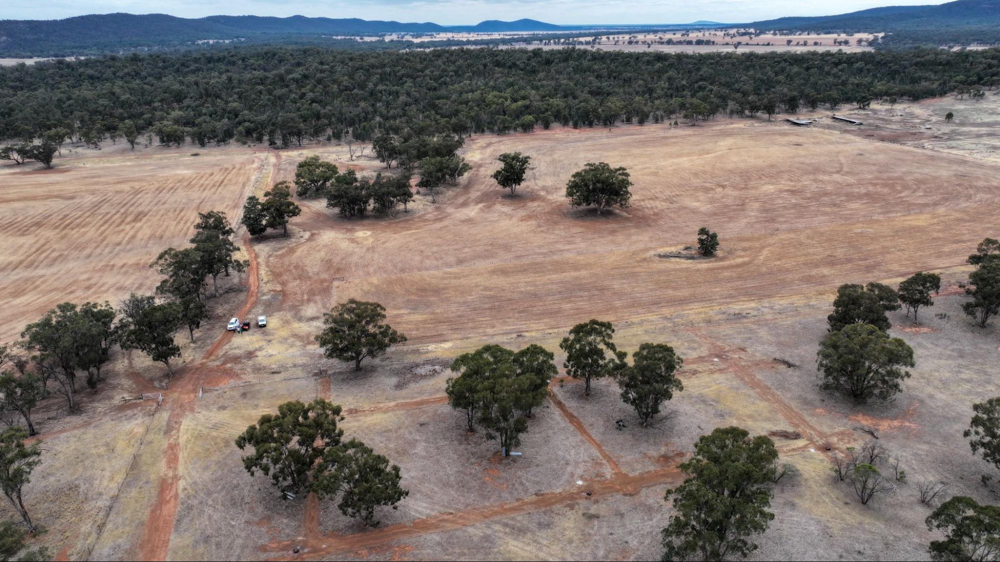
Image 19. Aerial image of Anderloose. Source: Grow Love Project.
Videos about this project
Watch the Wilkes-Bowes and other Riverina farmers talk about the Riverina project, soil monitoring and three drought resilient practices:
Coming Together for Resilient Soils and Landscapes
Native Shelterbelts in the Riverina
Stock Management Areas in the Riverina

Dam Enhancements in the Riverina
Downloads and links
See the links below to download documents relevant to this page.
Acknowledgements
This case study is part of the Riverina Drought Resilient Soils and Landscapes project, which aims to support producers in adopting drought resilient practices and enhance their landscape and soil monitoring capabilities. The Riverina Project is led by Riverina Local Land Services (LLS). It is supporting 15 producers to adopt one of three well-established management practices that enhance agricultural productivity and profitability during or after droughts while safeguarding natural resources. As part of the project, Soils for Life has prepared five case studies that follow producers as they implement their chosen practice/s, and their experiences with soil lab-testing and in-field observations. The producers are guided in their practice implementation with support from Riverina LLS, and have opportunities to learn through field days and webinars provided by the project partners, and an online discussion group. This project is led by Riverina Local Land Services, in conjunction with Sustainable Farms ANU, and Soils for Life. This project has received funding from the Future Drought Fund. We acknowledge that the contents of this page do not necessarily reflect the views of these contributors.

This project has received funding from the Australian Government’s Future Drought Fund.
For more information
Follow us for the latest
If you have any questions, get in touch at [email protected].

