

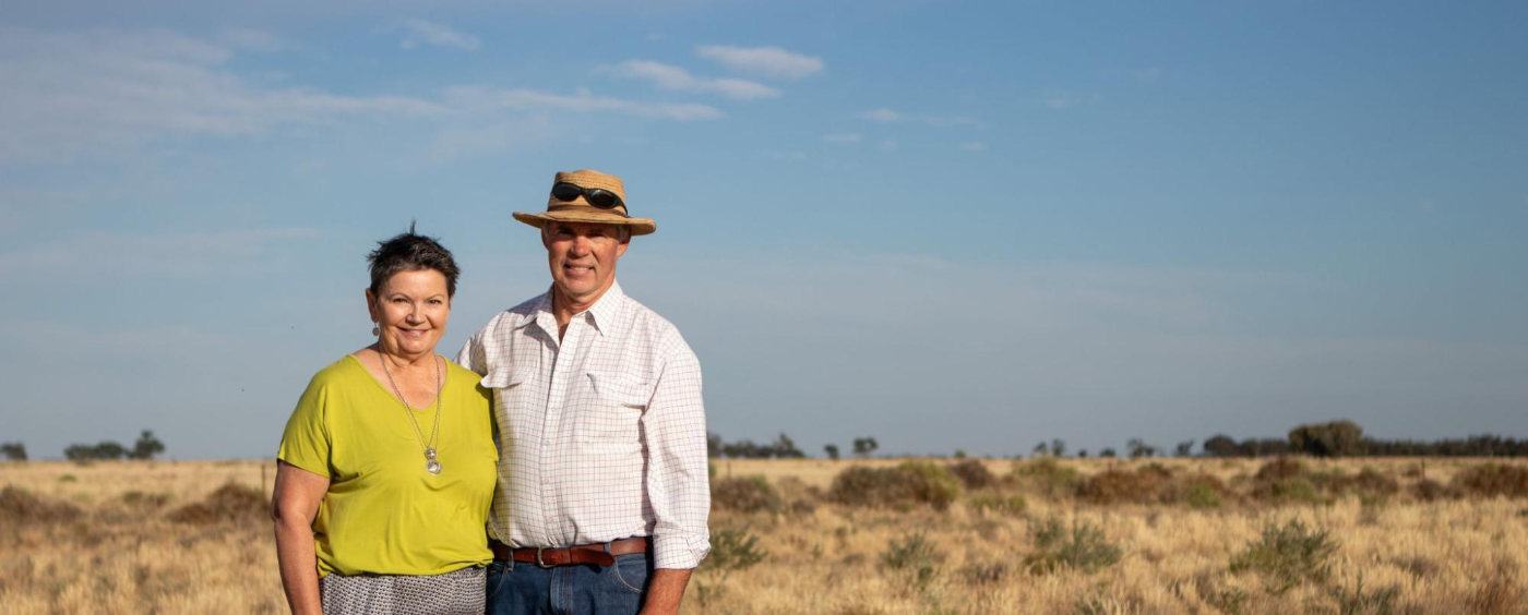
The Matthews at Bedarbidgal
Supporting biodiversity in the Hay Plains | Published January 2024
‘It was eye opening. We’d managed our way into just having annual grasses on the property. We became aware of how beneficial perennials were and that we needed to change our grazing management to improve the perennials.’ – Bert Matthews
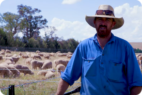
Bedarbidgal has a long agricultural history, beginning in 1861 with the establishment of the Robertson Land Acts. Originally spread across 40,000 ha, the size of the farm has decreased over the past four generations to meet the changing needs of the family. The property has been managed for over 40 years by Robert Matthews (known as Bert) with his wife, Elizabeth (known as Liz) and their four children.
There have been some significant turning points in Bert’s life as a farmer, including a major bushfire in 1990 that badly damaged 65% of the farm and the final years of the Millennium drought when Bert travelled the old stock route for four months to keep his flock alive. These experiences pushed Bert to deeply question what could be done to improve things on the land and prepare for an uncertain future.
Today, the Matthews holistically graze merino sheep and angus cattle on 7,000 ha. In 2018, they reduced their merino flock to focus on the restoration of native pasture areas across the property. With a wealth of knowledge and experience to draw on, Bert and Liz have dedicated a lot of time to improving the country, building biodiversity back into the landscape and supporting soil health. Bert also undertakes leadership roles in the local community, including as Captain of the local Bushfire Brigade, twice Chair of Hay Trees on Plains Landcare group and in 2017 participating in the Australian Rural Leadership Program. The Matthews hope their commitment to land and soil stewardship inspires others in the local region and beyond.
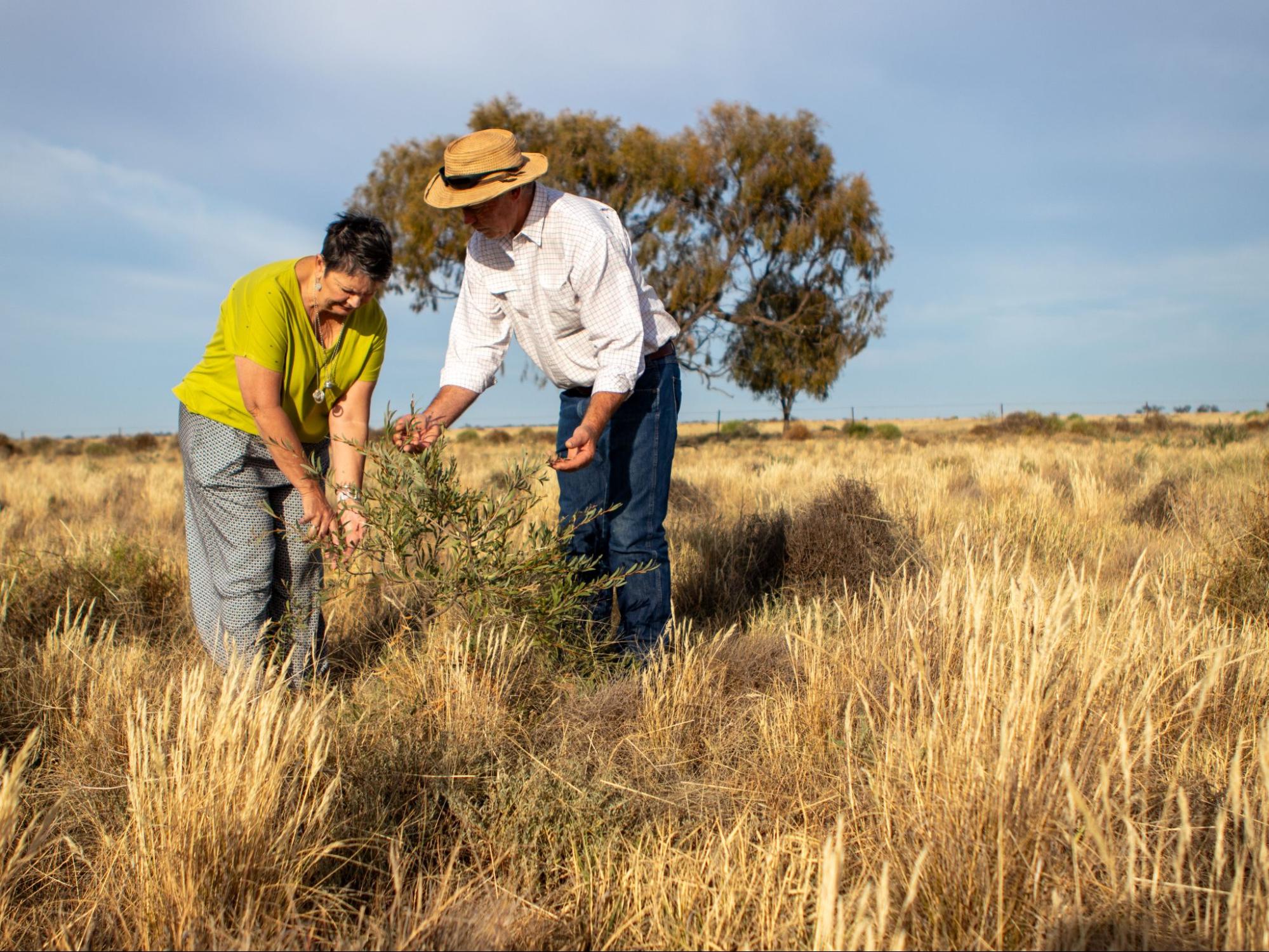
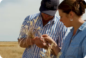
Image 1. Bert and Liz inspect a self-seeded boree (Acacia pendula) in ‘Kyeema’ paddock, which they are protecting from grazing stock through the Local Land Services Riverina project. Source: Grow Love Project.

Video 1. Native shelterbelt planting in the Riverina. Produced by the Grow Love Project
Farm Facts
Location
Wiradjuri Country |South Hay, Riverina, NSW
Climate
Hot dry summer, cold winter
Average Annual Rainfall
337 mm (recent, 1993-2022)
Agro-ecological Region
Mediterranean
Property Size
7,000 ha
Elevation
93 m
Social Structure
Family owned and operated
Enterprise Type
Dryland grazing merino sheep and angus cattle
Landscape
Flat alluvial plains dissected by distributary channels (ancient and contemporary creeks and streams) and abandoned lakes. Wind blown clays (parna) are a feature of the landscape.
Soils*
Grey and brown cracking clays (Vertosols) on the low plains; red sandy loams over clays (Chromosols) higher in the landscape; some deep sands (Rudosols) which are either windblown or alluvial (associated with past or present creek and stream lines).
*Learn more about soil classifications at www.soilscienceaustralia.org.au
The Highlights
Drought Resilience Strategies
Soil and Landscape Monitoring
Future Plans
- Building resilience at all times, irrespective of seasons, finances, productivity
- Providing rest to 90% of the landscape at any one time and building biodiversity
- Paying attention to groundcover and strict holistic grazing, removing stock if needed to maintain groundcover
- Using swales on some areas of the property to hold water higher in the landscape for longer
- Installing a stock management area (SMA) to protect groundcover and prepare for dry conditions
- Building on existing soil and landscape monitoring data and knowledge
- Paying close attention to how the soils and landscape are responding to different weather events
- Gaining insights through regularly assessing soil water infiltration at different times throughout the year
- Increasing understanding of some of the local soil conditions, including limiting factors (low cation exchange capacity in the topsoils, low calcium to magnesium and carbon to nitrogen ratios, and the increase in exchangeable sodium from about 50 cm depth in the soil)
- Opportunity to consider ways to build organic matter and the relationship between organic matter and soil cation exchange capacity (CEC)
- Increasing soil organic matter as the key for building drought resilience
- Continuing thoughtful management of weeds to build fungi in the soil, which builds and supports other biology
- Setting up a quarterly monitoring routine to coincide with the beginning of each season
Landscape and Soils
Bedarbidgal lies approximately 50 km south-east of Hay on the vast Hay Plains of the Riverina region. This landscape formed from the alluvial deposition of ancient streams interbedded with wind-blown clays, resulting in a range of soils.
The low-lying plains are characterised by non-self-mulching and self-mulching (finely aggregated surface soil) cracking clays, which typically have a high nutrient and water holding capacity. Although historically heavily grazed, these soils support a range of shrubland and grassland vegetation, including boree (Acacia pendula), saltbush (Atriplex spp.), windmill grass (Chloris truncata), wallaby grass (Rytidosperma caespitosa) and spear grass (Austrostipa spp.).
Scalding is evident elsewhere on the plains, which may be a reflection of older floodplains or terraces. These areas can include cracking clays, but also feature red and brown texture-contrast soils. Some of these soils may become hardsetting when dry, restricting water infiltration rates into the soil when it does rain. The scalded plains support similar vegetation to the low-lying plains, with the exception of boree (A. pendula), but including cotton bush (Maireana aphylla) and wallaby grass (R. caespitosa). Much of the plains feature the sandy ridges of prior streams, which support white cypress pine (Callitris columellaris), needlewood (Hakea leucoptera), pittosporum (Pittosporum sp.) and spear grass (Austrostipa spp.).
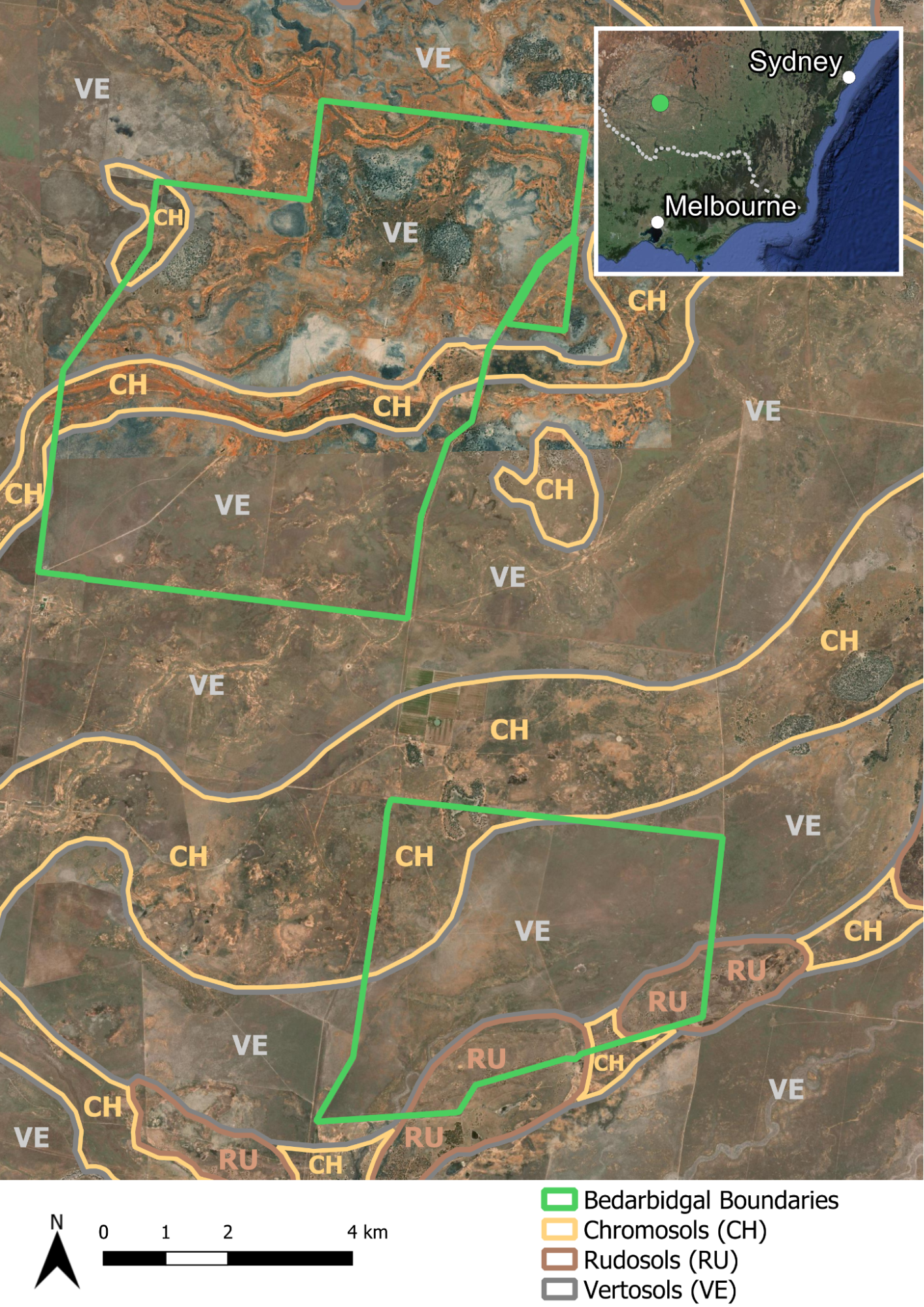
Figure 1. The broad soil orders at Bedarbidgal. Source: Soils for Life and DPIE (2021)1.
1These soil orders represent a regional overview and are not derived from detailed soil information. The soil boundaries are based on the Department of Planning, Industry and Environment (DPIE) (2021) Australian Soil Classification (ASC) Soil Type map of NSW, Version 4.5, Department of Planning, Industry and Environment, Parramatta.
More about the Matthews
Motivations for change in the early years
Bert took up management of Bedarbidgal in 1984 after a period working as a jackaroo on a merino stud. For several years he followed in his forefathers’ footsteps with a large flock of set-stocked sheep. A massive bushfire in the early 1990s prompted his interest in restoration and biodiversity. After witnessing widespread devastation, Bert began questioning what could be done to repair the landscape.
Following the bushfire, Bert started to see that the mode of dryland grazing practiced at Bedarbidgal for over 100 years was also a cause of ‘decline to our environment and landscape.’ His early realisations were based on observation, alongside his participation in a Holistic Management course and learning from the work of Allan Savory. He came to understand that altering grazing management on the farm would improve pastures and promote groundcover, and that providing rest to the landscape in paddocks to build biodiversity would encourage more species that are desirable, particularly perennial grasses and forbs.
‘It was eye opening. We’d managed our way into just having annual grasses on the property. We became aware of how beneficial perennials were and that we needed to change our grazing management to improve the perennials.’ – Bert Matthews
While Bert understood the value of holistic grazing during the early years as a young farmer, he also admits that he ‘always made excuses for the flock.’ This would often mean following the principles of holistic grazing for a few months each year and then falling back on previous habits, which would inevitably lead to over-grazing and land degradation. It wasn’t until the Millennium drought that Bert began to commit to sustained and deeper levels of change across all areas of management.
Responding to dry conditions
During the final years of the Millennium drought, which ‘lasted three years longer than expected,’ Bert saw the land without any groundcover, significant loss of topsoil and the impacts of massive dust storms. Prior to this, Bert believed they could retain all of their stock in very dry conditions. Forced onto the travelling stock route with his flock to keep them alive, Bert experienced a significant change of perspective, which led to his practice changes over the following decade.
In 2018, the Matthews turned their full attention to groundcover and strict holistic grazing, and they sold 95% of their self-replacing merino flock. At Bedarbidgal, they don’t grow grain or pasture unless it rains. Bert believes that stock must be removed to maintain groundcover and to prevent overgrazing. As part of their commitment to prevent overgrazing, protect groundcover and prepare for dry conditions at Bedarbidgal, they installed a stock management area (SMA) through previous support from Riverina LLS. Bert can now see that preferential grazing by sheep and cattle reduces diversity in a paddock and that allowing a paddock to rest is critical to improve diversity and maintain groundcover.
Like most properties in the region, the dry climate means Bedarbidgal is prone to drought, so swales have been designed and built on some areas of the property to hold water higher in the landscape for longer as part of an overall strategy to rehydrate the landscape.
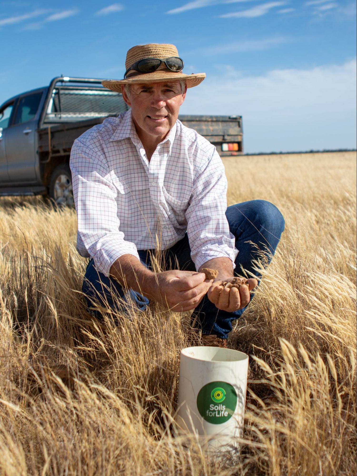
Monitoring soil health at Bedarbidgal
In recent years, the Matthews have come to understand more about what they can do to support below ground diversity. In 2018, Bert studied soil biology, participating in Elaine Ingham’s Soil FoodWeb course and he has since been more focused on practices that support biology and increase nutrient cycling. Bert has also been involved in a long-term soil testing program and has years of soil data that he works with to monitor his progress and inform his management decisions. The NSW Soil Conservation Service (SCS) began monitoring a site on Bedarbidgal in 1994. This was known as the Range Assessment Program and annual data was collected of vegetation species, rainfall, stocking rate and soil surface cover. More recently, Bert has engaged two soil consultants to help revegetate areas of the property that had been reduced to bare ground. Testing has been done by Environment Analysis Laboratory (EAL) and Microbe Wise.
Recently the Matthews joined 15 producers in the Riverina who are being supported to implement one of three practices (enhanced farm dams, native shelterbelts, or SMAs) to improve drought resilience as part of the Riverina Drought Resilient Soils and Landscapes project. The project also involves the farmers participating in soil monitoring activities, field days, an online farmer discussion group and a WhatsApp group.
Bert says that the soil health monitoring they are doing as part of the project is giving the ‘confidence that I know that we can improve the productivity of this land going forward.’ The Matthews are working to increase organic matter in the soil through revegetation across the landscape and they have been looking for opportunities to trade soil carbon through the carbon market. Early investigations with a carbon farming service provider have shown that rainfall in marginal areas will likely limit the ability to sequester tradeable volumes of carbon in this landscape. Bert is concerned that good land managers will not be rewarded for their diligent management of the land resource and those with degraded landscapes will benefit by having lower baseline measurements of soil carbon.
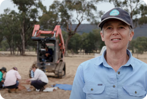
Images 2. Soil monitoring with Bert Matthews at Bedarbidgal. Source: Grow Love Project.
Images 3. Soil monitoring with Bert Matthews at Bedarbidgal. Source: Grow Love Project.
Reaping the rewards of rotational grazing, groundcover and biodiversity
Over the years, the Matthews have come to see the farm in a more integrated way, recognising how multiple factors influence the overall flourishing of the land. While there are still challenges on the property, such as feral animals (particularly rabbits) and weeds, the way the Matthews think about and address them has changed. For example, providing rest to 90% of the landscape at any one time and building biodiversity is encouraging the return of perennial grasses rather than weeds.
Supporting healthy grasslands and groundcover at Bedarbidgal has been rewarding on many levels. In March 2022, the Matthews celebrated the first ever release of captive bred plains-wanderers (Pedionomus torquatus) at Bedarbidgal as part of the Paddocks for Plains-wanderers project. NSW Environment Minister, James Griffin MP, travelled to Bedarbidgal to take part in this significant event. A tiny quail-like bird, plains-wanderers are one of Australia’s most critically endangered bird species. Overgrazing is the biggest deterrent to the bird’s survival because plains-wanderers need groundcover that’s sparse, but not too sparse or too congested. The Oolambeyan National Park adjacent to Bedarbidgal was established in 2002 because it is ideal plains-wanderer grassland habitat. Bert became involved in the Management Board of the National Park and has worked closely with the NSW Government in that capacity. In 2018, a breeding pair of plains-wanderers were captured on Bedarbidgal and transported to a breeding program in Dubbo. The recent return of six birds to the property was a proud moment for the many people involved. It demonstrated that well-managed grazing properties can coexist with and support biodiversity, and it is hoped the Paddocks for Plains-wanderers project will boost the bird’s population.
Bert’s role in local Landcare over the decades has had a profound impact on his appreciation of plant species and the role of native vegetation on the farm. Bert is also motivated by the value that Landcare provides in building and uniting agricultural communities.
The Matthews have fenced off several areas of remnant vegetation in collaboration with Landcare and plan to replicate this across other areas of their large property to ‘enhance the whole landscape.’ Bert believes this level of revegetation ‘improves the productivity of the stock and it’s good for your own wellbeing too.’ One of his daughters got married in their rosewood forest, which provided a scenic, shady place for this special occasion to occur, with many happy memories associated with it.
Protecting native vegetation with treeguards
The Riverina Drought Resilient Soils and Landscapes project has provided the Matthews with an opportunity to improve native vegetation management. Bert has a clear picture of how to support local regeneration and conservation of natural assets based on his experience with Landcare and the previous revegetation work on the farm.
‘After unloading the sheep and starting to view the landscape and reading what it was telling us, we noticed all the trees around the area were aged and there was no recruitment of young trees. Once the stock were removed and we had a couple of rainfall events, trees would come up on their own and we’d never noticed them in the landscape before.’ – Bert Matthews
The Matthews are installing approximately 150 tree guards that will carefully protect self-seeded trees across several paddocks at Bedarbidgal. Protecting these trees will allow them to mature and offer a range of benefits that will contribute to farm productivity over the long term. Whether as part of shelterbelts or standing individually in a paddock, trees serve as vital tools on the Hay Plains for livestock protection, erosion mitigation, and wind-speed reduction across the pastures. They also play a crucial role in supporting diverse wildlife populations and aiding natural pest control on the farm.
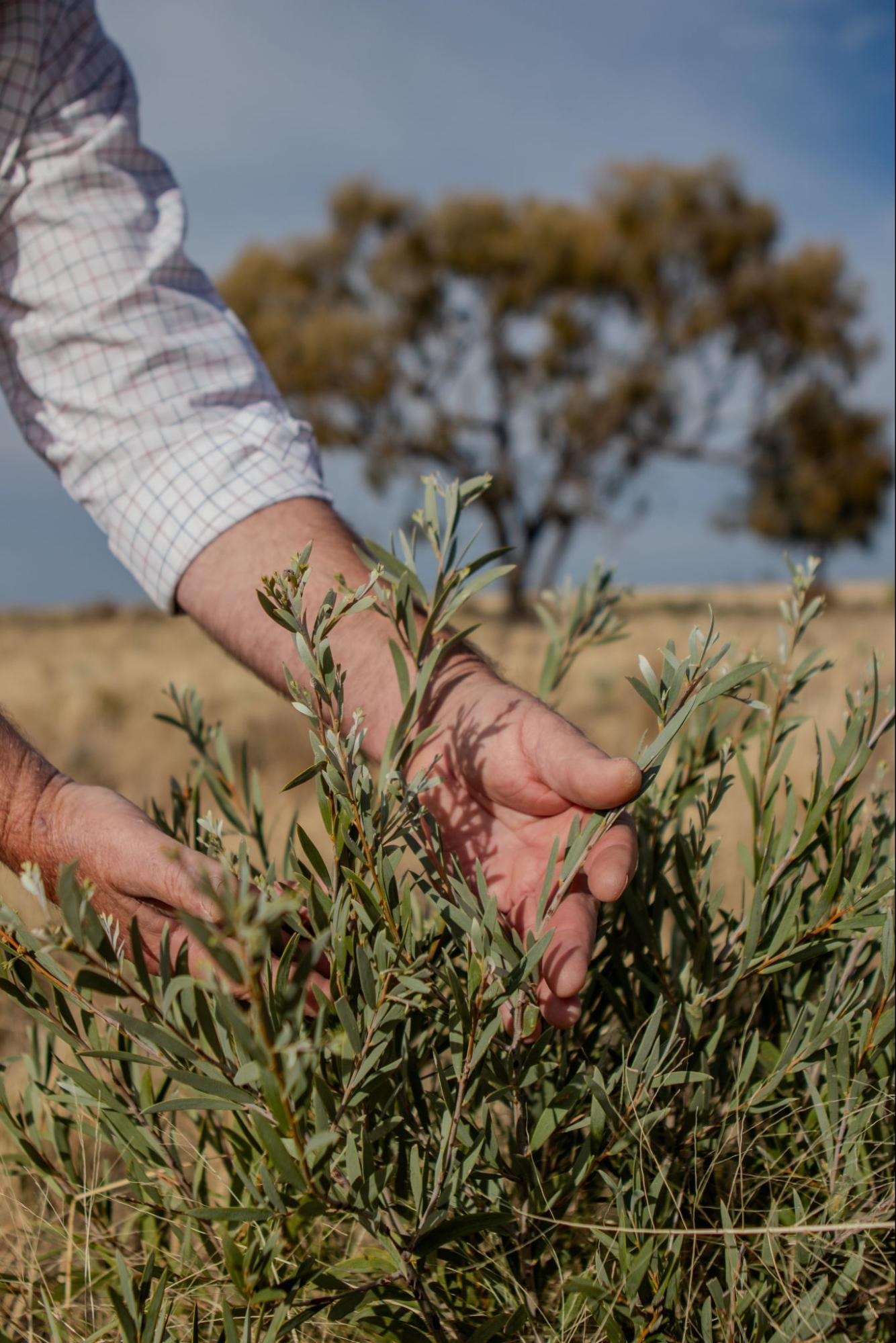
Image 4. A close up of boree (Acacia pendula.). Bert and Liz Matthews are working with Riverina LLS to maximise the benefits of native vegetation management at Bedarbidgal. Source: Grow Love Project.
Practice Implementation
Installing tree guards across Bedarbidgal
Bert and Liz have been steadily putting up the tree guards sincelate 2023. Overall, it has been ‘a very opportune time’ to be doing this work because abundant rainfall throughout the season has encouraged the germination of many self-seeded trees.
‘We shouldn’t waste the opportunity … if we hadn’t gone around and started to guard these trees then the stock would have taken them. In the next dry time we wouldn’t even know they were ever there.’ – Bert Matthews
The Matthews often identify new seedlings when they are busy with other things on the property, like mustering. Responding to what they see emerging naturally in the landscape is an exciting process because most of the trees at Bedarbidgal are aged trees. As Bert recalls, ‘we have had very little germination of young trees in my lifetime on the land.’ Bert believes the emergence of young seedlings ‘has got quite a bit to do with the fact that we don’t have stock in the paddock all the time. We don’t set stock any longer.’ Through the installation of tree guards, the Matthews are actively restoring and revegetating the landscape in new ways, giving these young trees a head start and the opportunity to ‘get up before being eaten off by stock.’
The Matthews still have some way to go with the installation. By April 2024 they had completed 20% of the approximately 150 tree guards, for mostly black box (Eucalyptus largiflorens) and boree (A. pendula) seedlings (see tree guards in Images 5, 6 and 7). The couple are using best-practice guidelines from Riverina LLS in order to protect their young paddock trees, with the following specifications for size and materials:
- A minimum of 4 steel posts per individual guard
- A minimum of 1.7 m in height per individual guard
- A minimum standard of sheep yard mesh to ensure full protection
- A minimum diameter of guards to be 0.75 m.

Image 5. A miljee (Acacia oswaldii) protected by a newly installed tree guard. Source: The Matthews.

Image 6. A grey box (Eucalyptus microcarpa) protected by a newly installed tree guard. Source: The Matthews.
The funding they received for the project has gone a good way toward covering materials and reducing the total project cost. Riverina LLS provided useful advice on where to source new materials to supplement the ‘old steel pegs from old fence lines’ they are recycling onsite, and the Matthews now have all materials and plan to finish the project at a steady pace. Making the guards is quite a lengthy process because, as Bert describes, the ‘mesh is quite heavy, and you have to bend it and secure it, and then put in the iron pegs. As the ground has gotten harder, that’s become more and more difficult.’
An unexpected issue they have faced during the installation has been the appearance of bag moths, which have been stripping the boree trees of leaves, ‘you look over thousands of acres and all the trees have been stripped. These moths obviously have a larvae form and the caterpillars go and chew all the leaves off.’ Bert notes that this has been a bit ‘disheartening’ while they undertake work to propagate new trees, but he also sees that ‘it’s part of nature’ and ‘that the strong survive.’
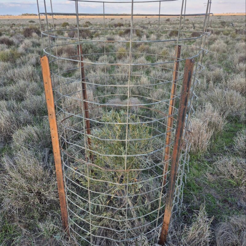
Image 7. A young boree (Acacia pendula) protected by a newly installed tree guard Source: The Matthews.
Soil Monitoring
For many years the Matthews have used their understanding of soil to guide aspects of their decision-making and management practices. Bert and Liz are now building on this pre-existing knowledge through the Riverina project. With support from Riverina LLS and Soils for Life, they are monitoring the health of their soils through their own observations and field assessments, complemented by soil sampling and lab testing.
Each farmer participating in the project received a report offering a general interpretation of their soil test results and had the opportunity to discuss their results with a Soils for Life soil scientist. They were also encouraged to share their photos and insights of their in-field observations and assessments with each other via the online farmer discussion group, Whatsapp group and field days.
Setting up monitoring at Bedarbidgal
Choosing a site at Bedarbidgal
The Matthews’ main monitoring site was in ‘Kyeema’ paddock where they have been collecting soil data for 20 years. The Soil Conservation Service (SCS) regularly visited the property as part of an assessment program, and ‘would come in autumn of every year, take a photopoint monitor, do 100 m transects and identify what was in a metre square in terms of species.’ Bert originally chose the monitoring site because it was adjacent to ‘a severe rabbit infestation’, and at one point cryptogam plants (e.g. spore plants, such as mosses, ferns and lichen) were the only groundcover and water would shed off the surface. Bert was curious about whether the presence of cryptogams was ‘a sign of first life or last life.’ Bert was also interested to see ‘what would happen if we put vegetation on there.’ The Matthews have been taking steps to improve soil health in that general area of the farm for a number of years. They have incorporated swales to hold the water, which has made a big difference, with the area now covered in vegetation. With the SCS data on hand, Bert has been able to go back and see periods of ‘boom and bust’ with groundcover, which he attributes to previous set stocking practices.
Making monitoring simple
Establishing new monitoring routines meant overcoming a few challenges. ‘Putting aside the time to do it’ was one of the major hurdles ‘because we’re all very busy.’ Bert and Liz got better at this with time, recognising the benefits of the process and finding ways to make it work within existing practices. For example, the simple step of keeping the monitoring equipment easily accessible made it efficient to get out into the paddock for monitoring.
‘I’ve now got a box where we’ve got the ring and the infiltration gear … I have a single spot and I know where everything is and I just pick up the tub and it is all together ready to go.’ – Bert Matthews
In-field assessments
The Matthews did their field assessments in August 2023, November 2023, February 2024 and May 2024. Each time, they applied the following monitoring techniques: photopoints, groundcover, soil infiltration, aggregate stability, soil organisms and soil pH assessment using guides provided by Soils for Life.
The in-field assessments are described below and have been developed into a ‘Soil Health Challenge’, see the Soil Health Assessment Guide at the bottom of this page (with the exception of the pH assessment). Insights from the monitoring are summarised in the next section.
Photopoints: This assessment involves setting up permanent locations where photos are taken repeatedly to capture changes over time.
Taking photopoints was the first activity Bert did each time he visited the ‘Kyeema’ site before putting a shovel into the soil. He considers photopoints very advantageous because ‘as much as we think we know how it looked three months ago, it changes so slowly and you just adapt to the change because you see it every day.’
Groundcover: A simple way to measure groundcover is by visually estimating the percent of the soil surface within a confined area that is covered and not bare.
Groundcover assessments are a central part of monitoring at Bedarbidgal. Bert regularly uses a hula hoop to estimate the percentage of cover, taking photos as a visual record each time. He pays close attention to what is growing month-to-month and how different species are responding to rain events.
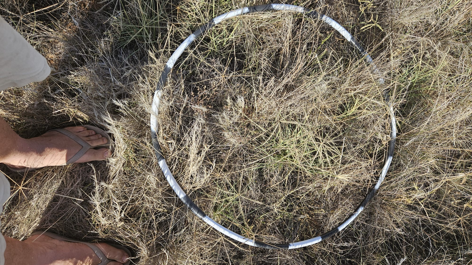
Image 8. Assessing groundcover at Bedarbidgal in February 2024. Source: The Matthews.
Soil infiltration: Soil infiltration is the downward entry of water into the soil. The rate at which water can infiltrate can be estimated in the field by recording the time it takes for a volume of water to enter and move through the soil.
Bert is interested in the water holding capacity of his soils, and while this is different to infiltration capacity, the two are related. By maximising soil water infiltration, any rain that falls can be held in the soil and not lost to surface run-off or evaporation. For Bert, regularly assessing soil water infiltration at different times throughout the year was a big ‘eye opener’. Watching how slowly or quickly water infiltrated his soils helped him understand how wet his soils could get under different management. He believes that assessing ‘infiltration rates at different times of the year is key, and observing how hard our soils get when they dry’.
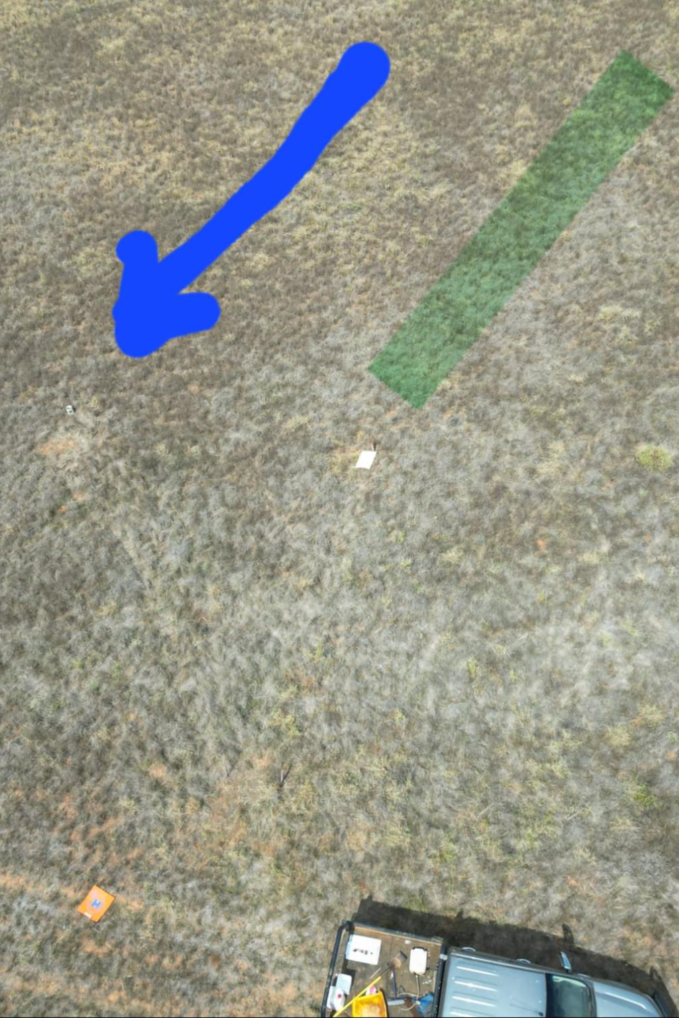
Image 9. Photopoint (green line) and infiltration assessment (blue arrow) locations at the ‘Kyeema’ site. Source: The Matthews.

Image 10. Bert showing soils above a PVC infiltrometer. Source: The Matthews.
Aggregate stability: Soil structure regulates the movement and storage of air, water and organisms, and therefore nutrients, in the soil. Soils with stable aggregates are more likely to retain their structure and are better able to withstand the forces imposed by wetting and drying, raindrop impact, stock trampling, cultivation and other disturbance.
Soil organisms: Soil organisms are responsible for many soil processes, including contributing to the development of soil structure, the breakdown of organic matter and the cycling of nutrients. One of the simplest methods for assessing the soil organisms that are visible with the naked eye (e.g. worms, beetles, spiders, ants, etc.), is to record the number that can be seen in a sample of soil within a defined period of time.
For Bert, just ‘being out digging your soil’ and observing the diversity of the living soil is valuable, and he notes ‘how exciting it actually is when we identify the critters in the soil over a period of time.’
Soil pH assessment: Soil pH is the acidity or alkalinity of the soil. Soils may be naturally acidic or alkaline, depending on the parent material on which they formed. Agricultural practices also influence soil pH, often removing alkalinity from the farming system, which results in an increase in soil acidity over time. A number of methods for estimating soil pH in the field are available. The Matthews used the soil pH kit provided as part of the project, which is readily available from hardware stores2.
2The kit is called a Manutec Soil pH Test Kit and comes with easy to follow instructions. The kit is based on Raupach and Tucker’s field method for assessing soil pH. See Raupach, M and Tucker, B (1959) The field determination of soil reaction. Journal of the Australian Institute of Agriculture Science 25:129−133. To see a soil pH demonstration, visit: https://www.youtube.com/watch?v=HZz3-cv_GGc&t=123s.
Sampling for lab tests
To supplement the in-field assessments, the Matthews collected soil samples from one location at ‘Kyeema’ for laboratory analysis. The samples were collected from four different depths in the soil (see Image 12) and submitted to the laboratory for a range of soil physical, chemical, and biological tests. The purpose of sampling at a single location was to provide the Matthews with a more in-depth account of the soil at their monitoring site so they can track changes in these soil over time. With additional investment, soil monitoring and sampling at multiple locations across Bedarbidgal would provide the Matthews with a broader understanding of their soils.

Image 11. Collecting soils at the ‘Kyeema’ soil monitoring site at Bedarbidgal. Source: Riverina LLS.
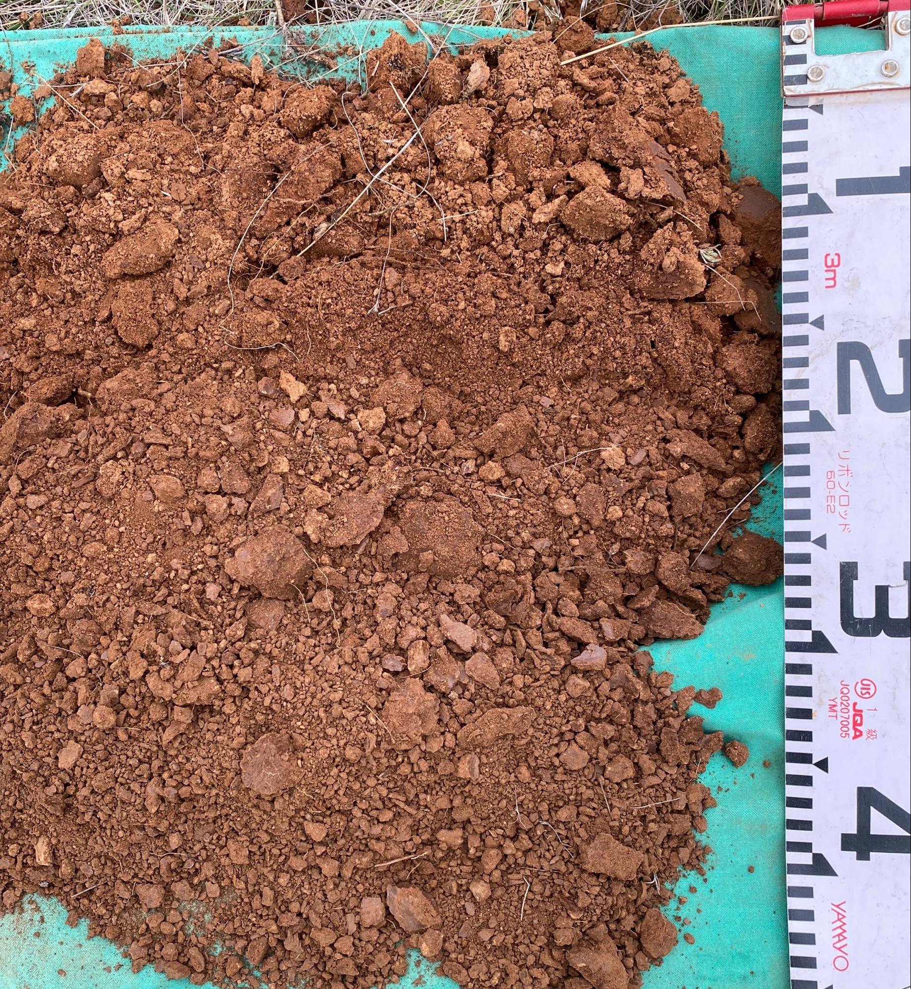
Image 12. Soil at different depths at the ‘Kyeema’ site. Source: Riverina LLS.
Soil and landscape insights
The soil at the ‘Kyeema’ site is moderately well-drained, with a gradual increase in texture from a sandy clay loam to a medium clay and a neutral to alkaline pH trend. The most notable properties are the low cation exchange capacity (CEC, one indicator of the potential fertility of a soil) in the topsoils where many of the plant roots will be seeking nutrients, the low calcium to magnesium and carbon to nitrogen ratios, and the increase in exchangeable sodium from about 50 cm depth in the soil.
Groundcover, organic matter and fertility
Maintaining groundcover has been central to the Matthews’ stock management and grazing regimes since 2018. They understand the value of groundcover in relation to building above and below-ground biomass and increasing soil organic matter, and will remove stock if that is what is required to maintain groundcover.
In February 2024, Bert observed ‘virtually 100% groundcover with some bare ground through the canopy but mostly litter covering the surface.’ Paying attention to how groundcover responds to weather events, Bert noted that they received 160 mm of rain between December 2023 and January 2024, which led to a ‘huge flush of summer grasses and forbs,’ including curly windmill grass (Enteropogon acicularis), saltbush (Atriplex spp.), sida (Sida sp.), turnip copperburr (Sclerolaena napiformis), and woolly button (Leiocarpa panaetioides). They had a good germination of medics in the January rain, but they ‘burnt off’ in the February heat, with temperatures reaching 41°C.
Groundcover is necessary for building above and below-ground biomass and increasing soil organic matter. And organic matter plays an important role in the development and maintenance of soil structure, increasing the soil’s water holding capacity and storing nutrients in organic forms. The lab test results suggest that the soil organic matter at the ‘Kyeema’ site is low to moderate for the soil type and region, and these results are comparable to previous soil testing of a similar soil at Bedarbidgal3. The Matthews’ commitment to maintaining groundcover will help to build organic matter in their soils.
Soil CEC is a measure of the soil’s capacity to exchange and retain cations (and therefore nutrient availability for plants). It is also an indicator of soil fertility and is influenced by the soil clay content, organic matter levels and soil pH, with organic matter having the potential to substantially increase soil CEC. The ‘Kyeema’ site subsoil showed a four-fold increase in CEC at 30+ cm depth, reflecting the increase in soil texture from the clay loam topsoil to the medium clay subsoil. After discussing these relationships with the Soils for Life soil scientist, Bert reaffirmed that building organic matter will be an effective way to increase the CEC of the soils at Bedarbidgal.
In addition to the CEC, a number of cation ratios offer insights into the processes happening in the soil. One such ratio is calcium to magnesium, which influences the exchange of oxygen in soils, effectively allowing soil to breathe. Clay soils with a low calcium to magnesium ratio, such as the soil at the ‘Kyeema’ site, can become ‘tight’ and low in oxygen, which is essential to the survival of the soil organisms and the plants. In these soils, and in soils high in sodium, increasing calcium can improve the soil structure.
3It is important to note that for all soil tests, results may vary depending on the method of test used and the laboratory at which the tests were conducted.
Soil organisms
By monitoring the soil organisms, Bert could see how they respond to the conditions, sharing that ‘when it’s dried off you can understand that they’ve either gone deeper or they’re dormant somewhere in their life cycle.’ In February 2024 Bert observed that cicada nymphs were the only critters in his sample (see Image 13). He also observed a lot of cavities in the top 10 cm (see Image 14) of the soil, which is evidence of soil organism activity.

Image 13. Assessing soil organisms at Bedarbidgal in February 2024. Source: The Matthews.

Image 14. Showing the cavities excavated by soil organisms in the top 10 cm of the soil. Source: The Matthews.
In relation to soil microorganisms, the lab results identified that bacteria is more dominant than fungi in the monitoring site topsoil, and this is common in many Australian agricultural soils. Bacteria abundance and activity were within the expected range, indicating that they are performing their role of decomposing organic matter and mineralising nutrients. Similarly, the protozoa which feed on bacteria are actively cycling the nutrients and making them available to plants. However, the lack of fungi means that the mycorrhizal (fungus to roots) relationships responsible for microbe-root-plant interactions, such as water and nutrient uptake and exchange, are limited.
Soil structure and infiltration
Soil structure is the natural arrangement of soil particles into aggregates or ‘peds’ (the structural building blocks of the soil), separated by voids. It governs soil permeability, infiltration, aeration, drainage and stability. While also providing organisms with a safe habitat, soil structure can be created and improved by the activities of soil organisms. The results are a more stable soil where the soil aggregates are held together either by organic matter (including soil organism secretions and root exudates4) or clay.
At the ‘Kyeema’ site, the soil organic matter levels are low, but the sandy clay loam texture suggests that there is enough clay present to contribute to soil aggregation. However, the low aggregate stability reported by the lab results is a reasonable indication that another factor is contributing to the lack of stability in this soil, which in this case could be a result of excess sodium (see below).
Soil sodicity and stability
One of the many benefits of soil testing is that the results can reveal what the in-field observations cannot. At the ‘Kyeema’ site, the soil tests revealed that the low aggregate stability is magnified by the presence of sodium, which is often a result of the natural weathering of the parent materials from which the soil has formed.
Soils with excess sodium (sodic soils) are highly susceptible to soil instability and soil structure decline, particularly if exposed to any form of disturbance. This loss of soil structure limits key soil processes such as soil water infiltration and aeration, resulting in a less than ideal habitat for soil organisms and plant roots. Minimal disturbance of these soils and a focus on maintaining groundcover can help increase soil stability and reduce the loss of soil structure.
4Root exudates are organic carbon compounds (e.g. simple sugars, organic acids and amino acids) secreted from living plant roots into the soil.
Future monitoring at Bedarbidgal
Bert wishes he had known about the simple in-field methods for monitoring soil earlier in his farming career. The Matthews appreciate the simplicity of these methods and they are clear about how they will integrate them into their monitoring in the future. The project emphasised to farmers the importance of taking a long-term view on soil monitoring and the Matthews are in it for the long game. Their intention is to have a quarterly monitoring routine, which will be marked in the calendar to remind them to undertake the process at the beginning of each new season at Bedarbidgal.
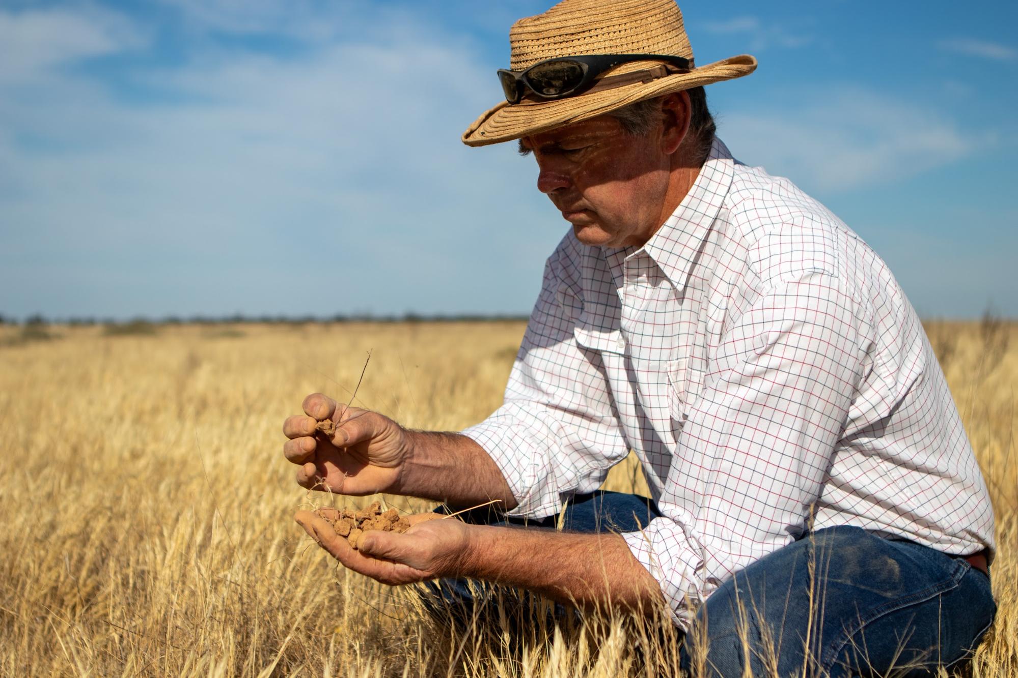
Image 15. Bert looking at soils at Bedarbidgal. Source: Grow Love Project.
Looking to the Future
The Matthews believe that taking care to actively build resilience at all times, irrespective of seasons, finances and productivity is key to good management. This has been reinforced through the knowledge the Matthews have gained as participants of the project.
The Matthews have identified that increasing soil organic matter is the key for building drought resilience at Bedarbidgal and that they need to maximize opportunities to incorporate organic matter whenever moisture is available. They also recognise the positive role that all plants, including ‘weeds’ can play in their holistic farming system. The Matthews will continue their thoughtful management of weeds, having reframed them as useful for the larger process of building fungi in their soil, which builds and supports biology.
Bert and Liz believe the greatest indicator of progress at Bedarbidgal will be how the landscape and soils fair during the inevitable next drought. They will track indicators of resilience during dry spells using measures such as having adequate groundcover biomass during stress periods and regeneration when rains return.
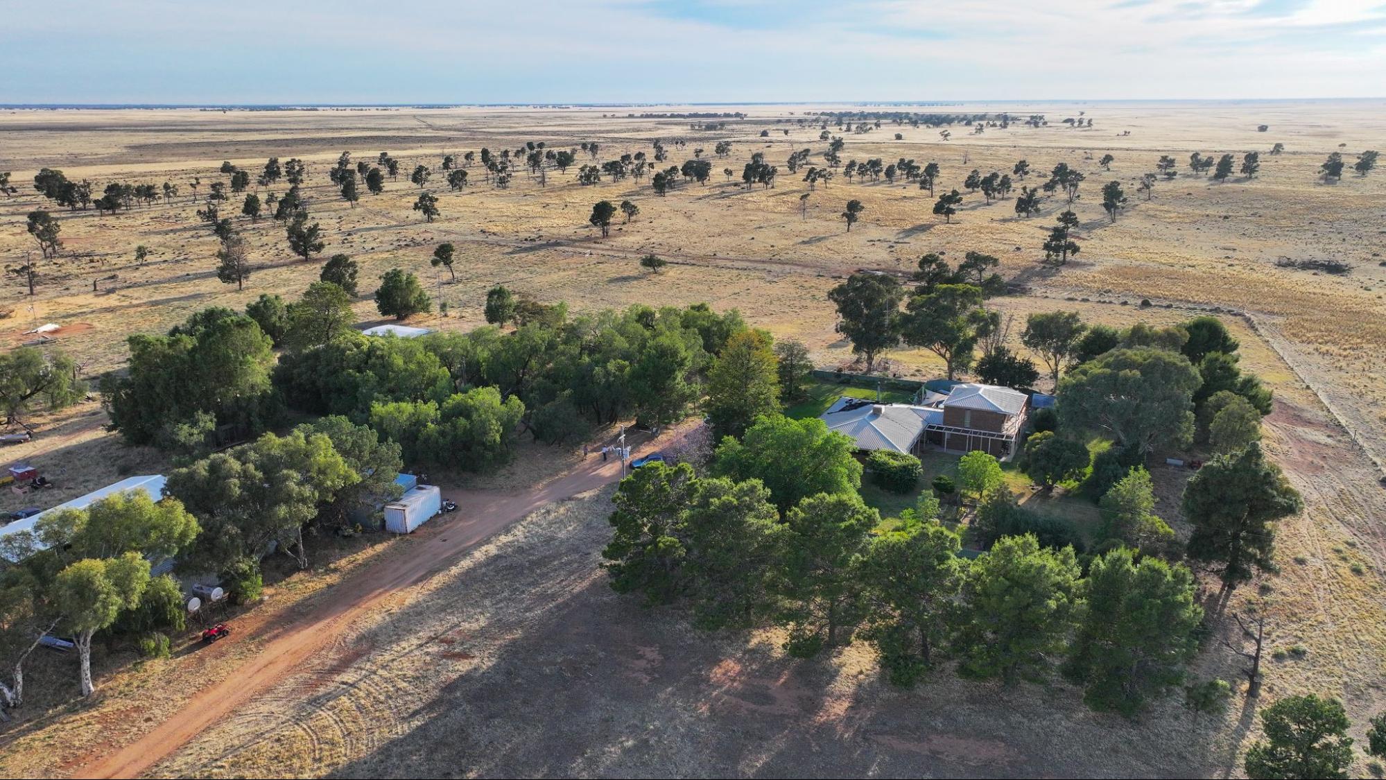
Image 16. Aerial image of Bedarbidgal. Source: Grow Love Project.
Videos about this project
Watch the Matthews and other Riverina farmers talk about the Riverina project, soil monitoring and three drought resilient practices:
Coming Together for Resilient Soils and Landscapes
Soil Monitoring in the Riverina
Stock Management Areas in the Riverina

Dam Enhancements in the Riverina
Downloads and links
See the links below to download documents relevant to this page.
Acknowledgements
This case study is part of the Riverina Drought Resilient Soils and Landscapes project, which aims to support producers in adopting drought resilient practices and enhance their landscape and soil monitoring capabilities. The Riverina Project is led by Riverina Local Land Services (LLS). It is supporting 15 producers to adopt one of three well-established management practices that enhance agricultural productivity and profitability during or after droughts while safeguarding natural resources. As part of the project, Soils for Life has prepared five case studies that follow producers as they implement their chosen practice/s, and their experiences with soil lab-testing and in-field observations. The producers are guided in their practice implementation with support from Riverina LLS, and have opportunities to learn through field days and webinars provided by the project partners, and an online discussion group. This project is led by Riverina Local Land Services, in conjunction with Sustainable Farms ANU, and Soils for Life. This project has received funding from the Future Drought Fund. We acknowledge that the contents of this page do not necessarily reflect the views of these contributors.

This project has received funding from the Australian Government’s Future Drought Fund.
For more information
Follow us for the latest
If you have any questions, get in touch at [email protected].

