

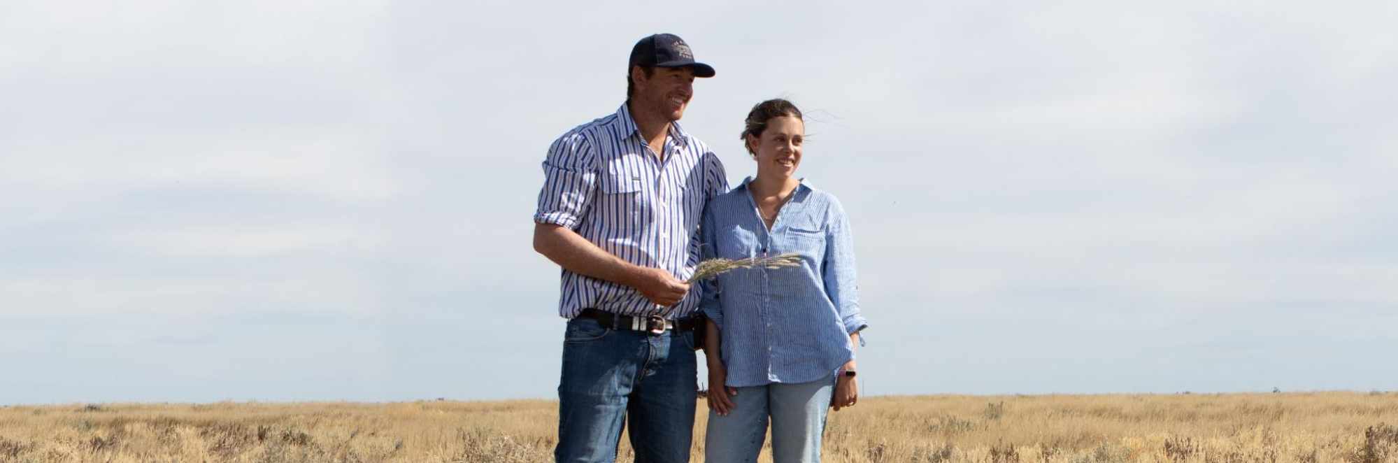
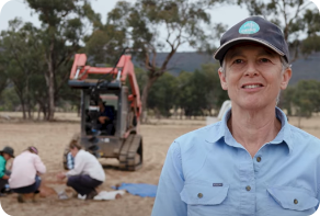
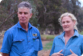
Jack and Annabel Hanna at Erin
Building drought and flood resilience on the semi-arid Hay Plains | Published January 2024
‘I talk about floods now, because that’s a recent experience for us. But in the long term, we’re going to be dealing with drought a lot more than we’re going to be dealing with floods … ’ – Annabel Hanna
Jack and Annabel Hanna spent their childhoods farming in different parts of the Riverina, and the Millennium drought left a big impression on both of them growing up. Jack remembers his father driving hundreds of kilometres each day to feed livestock and how it took his dad many years to fully recover from the strain. Annabel remembers her family having to buy their water and carting it for livestock, and the 20-second showers that were a regular part of family life for many years.
Having recently taken over Jack’s family farm, Erin, in 2022, the Hannas’ days are busy as they adjust to life on the property and care for two young children. They anticipate future droughts and floods in their region, and they want to prepare in as many ways as they can. They are starting by developing ways to monitor their pastures, cattle, sheep, and soils for health and profitability.
Before moving to Erin, the couple worked for three years on Annabel’s family farm, Spring Valley, in Holbrook. The experience on Spring Valley helped them to transition from their off-farm careers – Annabel is a qualified nurse and has done postgraduate studies in agricultural science and Jack is an electrician. But Erin has been a big change from the ‘high intensity’ farming they were used to at Spring Valley. According to the Hannas, Erin has had low-maintenance management for over 40 years and is, ‘pastoral with very few inputs.’
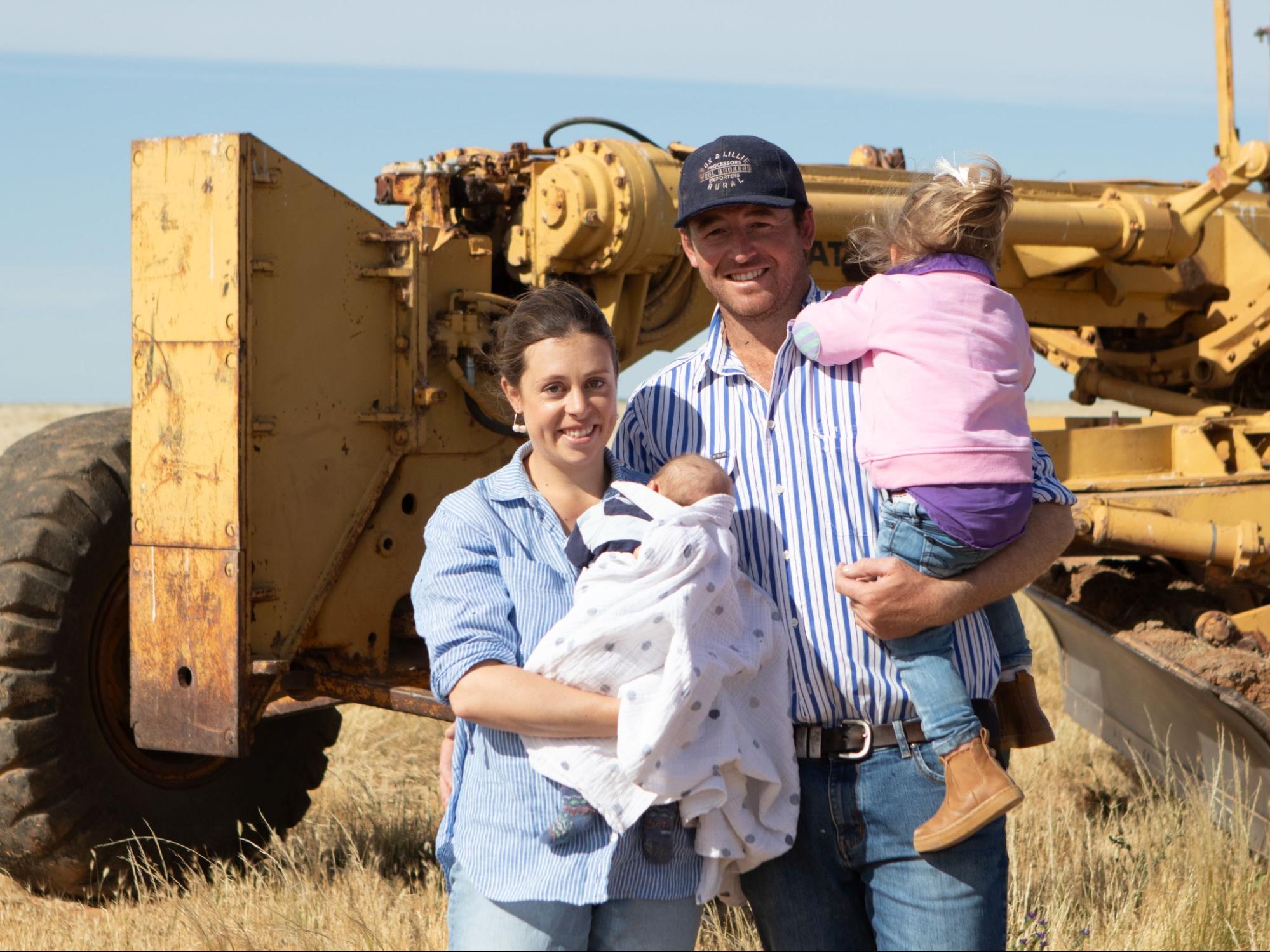
Image 1. The Hanna family at Erin. Source: Grow Love Project.
Video 1. An overview of the Riverina Drought Resilient Soils and Landscapes Project. Produced by the Grow Love Project
Farm Facts
Location
Wiradjuri, Nari Nari and Yitha Yitha Country |One Tree, Riverina, NSW
Climate
Hot dry summer, mild winter
Average Annual Rainfall
325 mm (recent, 1993-2022)
Agro-ecological Region
Dry
Property Size
8,500 ha
Elevation
93 m
Social Structure
Family owned and operated
Enterprise Type
Dryland merino sheep grazing, with seasonal cattle production and agistment, typically during and after a flood from the Lachlan River.
Landscape
Flat plains adjacent to the Lachlan River, characterised by numerous distributary channels, abandoned lakes and lunettes. Prone to extreme flooding and drought.
Soils*
Black and grey cracking clays (Vertosols) on the flood plains with isolated pockets of sandy dune soils (Rudosols). Red texture-contrast soils (possibly Sodosols, Kurosols, or Chromosols) on the open plains.
*Learn more about soil classifications at www.soilscienceaustralia.org.au
The Highlights
Drought Resilience Strategies
Soil and Landscape Monitoring
Future Plans
- Resilience planning, including plans to ‘manage drought in a way that is efficient’ and gives options for both dry and wet times
- Upgrading fencing to limit wildlife influx during drought, installing water troughs, pipe efficiency and accessing a second water source
- Building a stock management area (SMA) for use during drought and to protect animal and pasture health
- Introducing soil and landscape monitoring through in-field assessments and soil sampling lab tests
- Increased understanding of some of the local soil conditions, including limiting factors (low organic matter, the alkaline pH and very high salinity and sodicity throughout the profile)
- Increased awareness of the value of groundcover to help build above and below-ground biomass and increase soil organic matter
- Opportunity to consider soil stability and the many factors that contribute, including past practices such as set-stocking
- Monitoring and benchmarking pastures
- Managing groundcover for water retention and drought resilience
- Extending landscape monitoring to other sites across their property to better understand how their range of soils respond to changes in management
- Further improve water infrastructure with more troughs so they can more effectively graze 100% of the property
- Monitoring plant groundcover and changes in soil over the long-term to help guide decisions around rotational grazing
Landscape and Soils
Jack and Annabel Hanna’s property, Erin, lies approximately halfway between Booligal and Hay in the Murrumbidgee region of the Riverina. The farm is situated in the vast semi-arid to arid chenopod shrubland area of south-west NSW. The landscape is dominated by distributary channels of the Lachlan River – described as “creek country” – and the expansive Hay Plains, renowned for being the flattest place in the southern hemisphere.
The black and grey cracking clays are typical of the creek country, having formed from the finer sediments which were deposited after the flooding of the back plains. The lighter topsoils of the open plains are prone to degradation, including hardsetting or erosion. Due to the dry climate, proximity to the Lachlan River and the lack of slope across the Hay Plains, Erin is subject to both drought and flooding, with much of the farm remaining underwater months after floods.
The Hay Plains is considered a productive wool growing region, with the sheep meat and beef cattle industries growing in recent years in response to low wool prices. These industries are supported by the growing of pastures, including paspalum/white clover and rye grasses/subclover mixes.

Figure 1. The broad soil orders at Erin. Source: Soils for Life and DPIE (2021).1
1These soil orders represent a regional overview and are not derived from detailed soil information. The soil boundaries are based on the Department of Planning, Industry and Environment (DPIE) (2021) Australian Soil Classification (ASC) Soil Type map of NSW, Version 4.5, Department of Planning, Industry and Environment, Parramatta.
More about the Hannas
Building the ‘toolbox’ in a new landscape
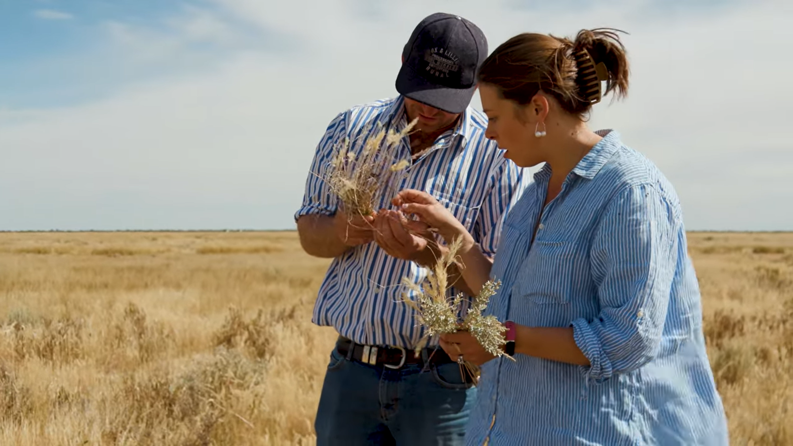
Since moving to Erin, Jack and Annabel have enrolled in several programs to upskill and learn ‘as much as possible as quickly as possible’ so that they can be ‘more proactive and efficient’ in their management. In 2023, they began a Meat and Livestock Australia (MLA) Profitable Grazing Systems course, which involves regular monitoring of their pastures and a benchmarking process to assist in monitoring the impact of changes they are making over time. They also engaged a consultant to help them with their financial and production goals.
Until recently, no soil testing has been done at Erin, so Annabel and Jack haven’t known whether soil conditions have changed over the longer term. As Annabel reflects: ‘to be honest, we have no idea about what the soils are like here at all, because no testing or anything has ever been done.’ Jack and Annabel are interested in what they can do to improve soil functionality, and so are open to learning how to monitor their soils on the farm. They are hoping to, ‘get a bit of an understanding about what is actually there and how we can improve it, and what needs to happen to the soils.’ For example, the Hannas have observed that posts on their property are ‘completely rusted out’ within five years, and speculate that this may be because of acidic soils. They would like to know more about soil chemistry, and the relationship between soil functionality and plant growth.
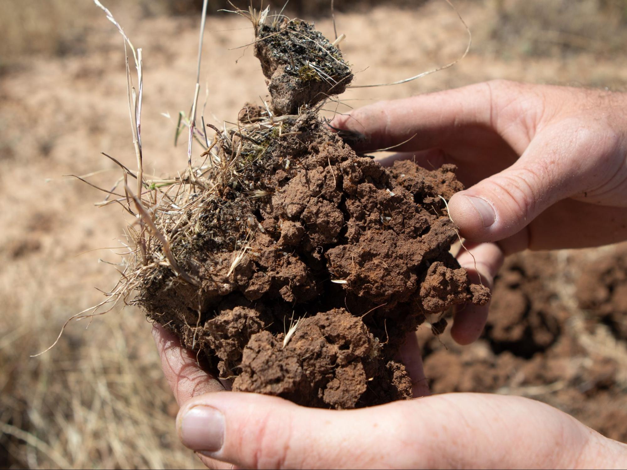
Image 2. Jack Hanna inspecting the soil at Erin. Source: Grow Love Project.
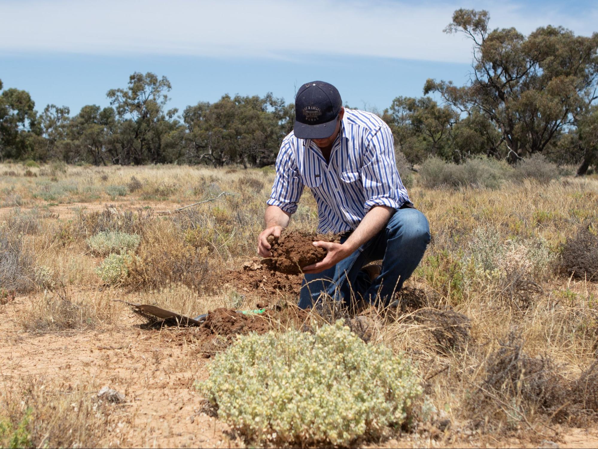
Image 3. Jack Hanna inspecting the soil at Erin. Source: Grow Love Project.
One of the challenges they face is having access to water, which is presently a barrier to implementing changes on the farm. Currently, the Lachlan River is their only source of water because underground water on the farm is not suitable for stock. The Hannas are in the early stages of installing a pipeline to improve water efficiency on the farm.
Another challenge to production in the region is that the landscape is severely impacted by feral animals, particularly wild pigs and goats. Feral animals prevent the Hannas being able to rotationally graze, and so they are planning to build an exclusion fence with watering points to address this issue.
‘At the moment we can’t even really rotationally graze, because when we bring stock off a paddock, everything from the national park moves in because they don’t have any water out there or anything. So, once we can get it fenced properly, we can change the way that we graze.’ – Annabel Hanna
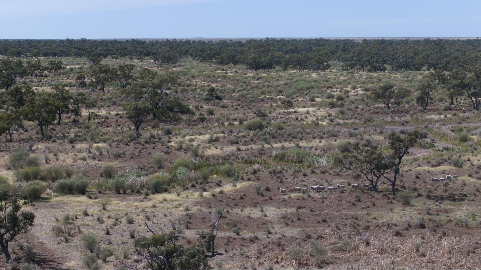
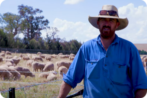
Image 4. Sheep grazing at Erin. Source: Grow Love Project.
Planning for drought and flood resilience
The property is in a fragile landscape with low rainfall and needs to be well managed to be productive. One of the ways the Hannas are preparing for the future is through resilience planning. They are one of 15 producers in the Riverina who are being supported to implement one of three practices (enhanced farm dams, native shelterbelts or stock management areas) to improve drought resilience as part of the Riverina Drought Resilient Soils and Landscapes project.
The project also involves the farmers participating in soil monitoring activities, field days, an online farmer discussion group and a WhatsApp group. The Hannas see their involvement in the project as part of a larger process to integrate new practices into the management of Erin, which will include a stock management area (SMA)2, exclusion fences and new water infrastructure.
The Hannas see a future benefit in having carefully selected parts of the property to build SMAs that are set up to hold, feed and water core farm-livestock during adverse weather periods, such as a recent major flooding event. In late 2022, the property flooded, and the Hannas were forced to drive their stock off-farm ‘because we didn’t have any land or options of anywhere to put them.’ During the flood there was a high point on the farm that could be accessed from the road that didn’t go under water, and presently the Hannas are building an SMA here.
2To read more about SMAs, explore our project partner resources Riverina LLS free training and a recent publication produced by MLA.
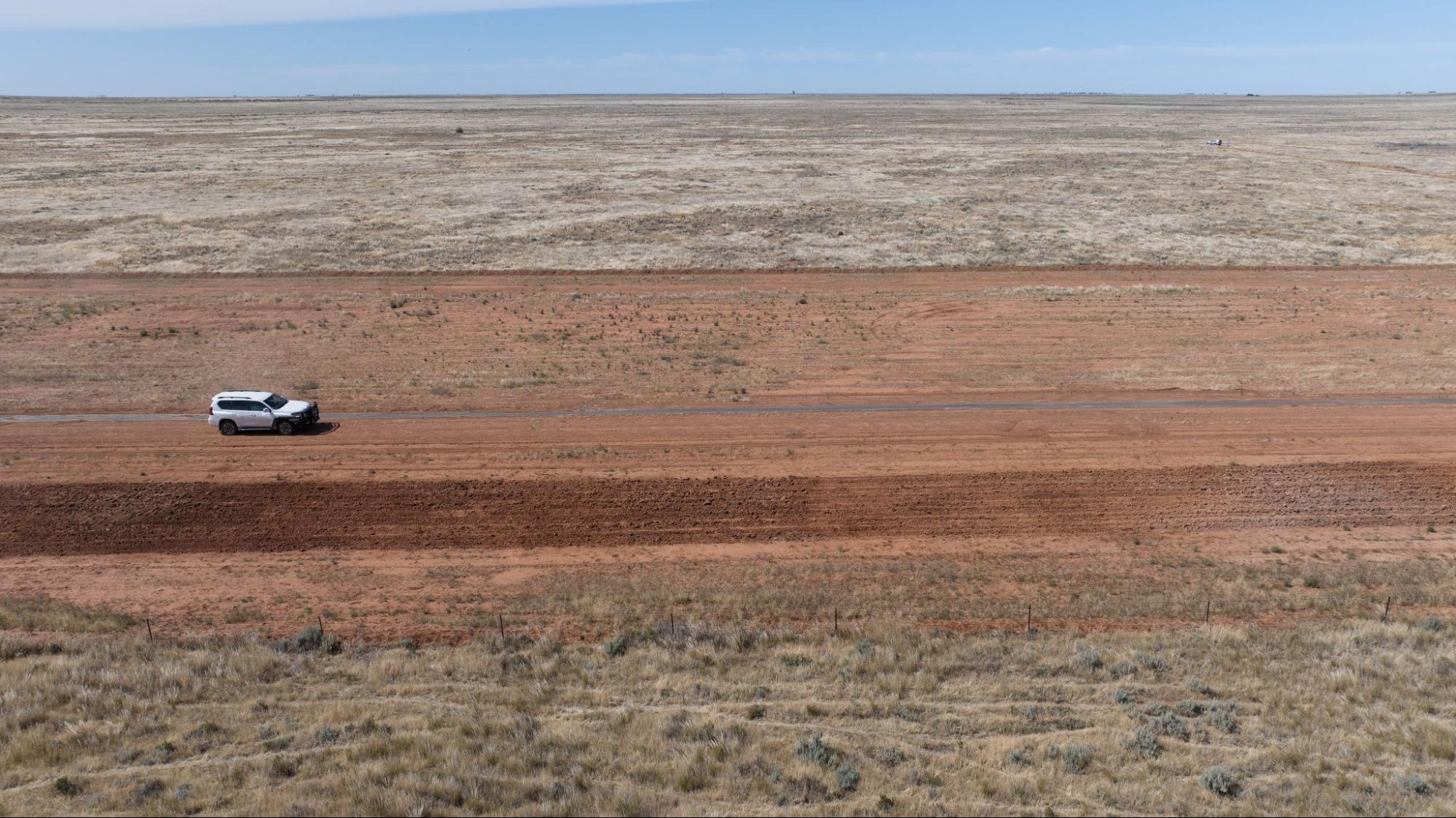
Image 5. Farming in the Hay Plains at Erin. Source: Grow Love Project.
Practice Implementation
Deciding to build a Stock Management Area (SMA)
As purpose-built pieces of infrastructure, SMAs can make feeding, watering and monitoring the health of stock during adverse weather conditions more efficient. Jack and Annabel see the value of building an SMA as giving ‘us an option’ in both wet and dry times to proactively manage the soil, landscape and their livestock, provide a fast way to get stock off pasture, and support the preservation and faster recovery of pastures and landscapes across the farm. Their focus has been on flooding because of recent events, however Annabel is certain that droughts will be the more persistent challenge they face:
‘I talk about floods now, because that’s a recent experience for us. But in the long term, we’re going to be dealing with drought a lot more than we’re going to be dealing with floods … One reason we’re doing stock management areas is for drought and managing the landscape because it’s very fragile soil, so that we can get stock off when we need to.’ – Annabel Hanna
As a young family in the early stage of their farming career and still ‘building a solid financial base’ for themselves, the Hannas feel the need to ‘manage drought in a way that is efficient’ on multiple levels. They want to ensure that the ‘bounce back period for the land’ will be shorter with the implementation of SMAs, which they believe will provide infrastructure to help limit widespread damage of soil by livestock. Their hope is that it will also streamline the process and time involved in caring for stock during a drought or flood, thereby enabling Jack and Annabel to devote more time to generating off-farm income should they need to.
Taking this step has been significant at Erin, particularly in contrast to the approach by past generations of farmers in the region who fed in ‘every paddock and damaged everywhere.’ Jack and Annabel need to introduce greater numbers of livestock onto the property without degrading the country in order to remain profitable, and they feel that SMAs will assist with this.
‘We need to run more stock as a business to survive and we need to find ways that we can do that sustainably because vegetation on the Hay Plains, such as our saltbush, if you overgraze it, you will have to wait 50 years for it to come back. So we need a way that we can economically survive, but without damaging our country.’ – Annabel Hanna
Building the SMA at Erin
The site for the Hannas’ SMA was selected based on access, scalability, soil and drainage. Funding and support from Riverina LLS through the Australian Government’s Future Drought Fund, helped to make the SMA a reality, allowing the Hannas to prioritise it as part of their pre-emptive drought strategy. Input from LLS staff helped the Hannas decide on their pen sizes and choose a site that was accessible and scalable. For Jack and Annabel, this was important because they, ‘need something that can take 4,000 head if we go into a real drought,’ and their current site has, ‘heaps of room to grow.’ The SMA is positioned close to a bitumen road, which also allows easy access to deliveries of grain, and will be useful for shipping and transporting stock in time. It’s also on ‘better soil with better drainage.’

Image 6: The site of the stock management area at Erin. Source: Riverina LLS.
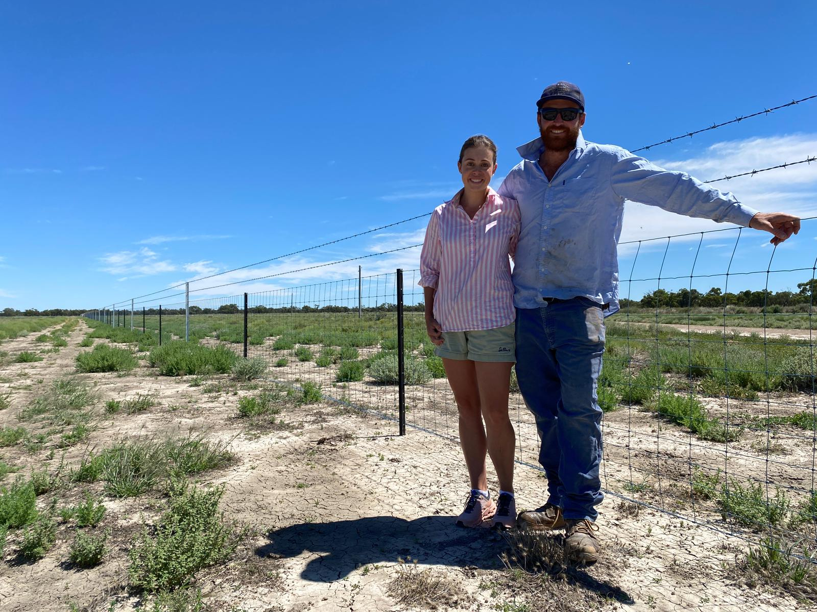
Image 7. The Hannas with the SMA construction underway. Source: The Hannas.
The majority of the SMA work was undertaken by Jack and Annabel starting in June 2023, with a fencing contractor brought on later in the year to put in strainers. The implementation of the Hannas’ SMA involved a few setbacks and delays in terms of sourcing materials, labor, timing and weather, which made completing the process slower than planned. Certain materials like specialty feed-lot troughs took several months to arrive, but with all materials now on farm, the build is close to complete. The overall material costs were higher than anticipated with an approximate total of $40,000. There were some unwelcome surprises, for example the conveyor belt was initially priced 20% lower than the actual sale price. Thankfully, there has been no pressure to use it straight away as pasture has been plentiful and the coinciding season has been ‘exceptional.’
‘This year we’ve had a pretty exceptional year with the flooding. Our main restrictions have been time and sourcing labour.’ – Jack Hanna
The Hannas’ containment area is nearly complete and very close to being stock-proof and ready for use. There are a few final tasks, including planting a row of oldman saltbush (Atriplex nummularia; as a drought resilient good forage plant, see Image 8), installing the water troughs (see Image 9) once the pipeline access to water supply is confirmed and folding the ‘conveyor belting’ to become a long feed trough (see Images 10 and 11).
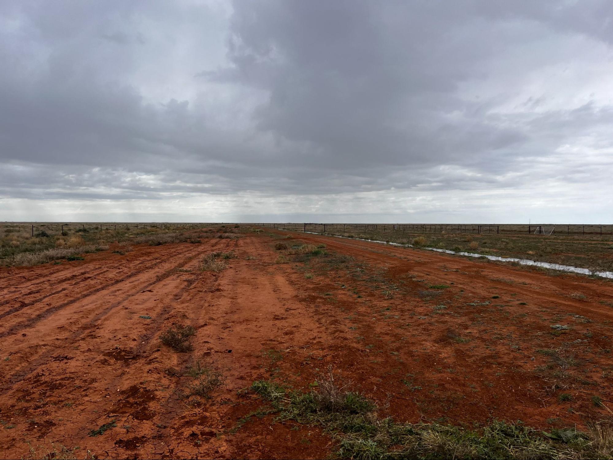
Image 8. The graded area on the left that is being prepared to plant an oldman saltbush corridor. Source: The Hannas.
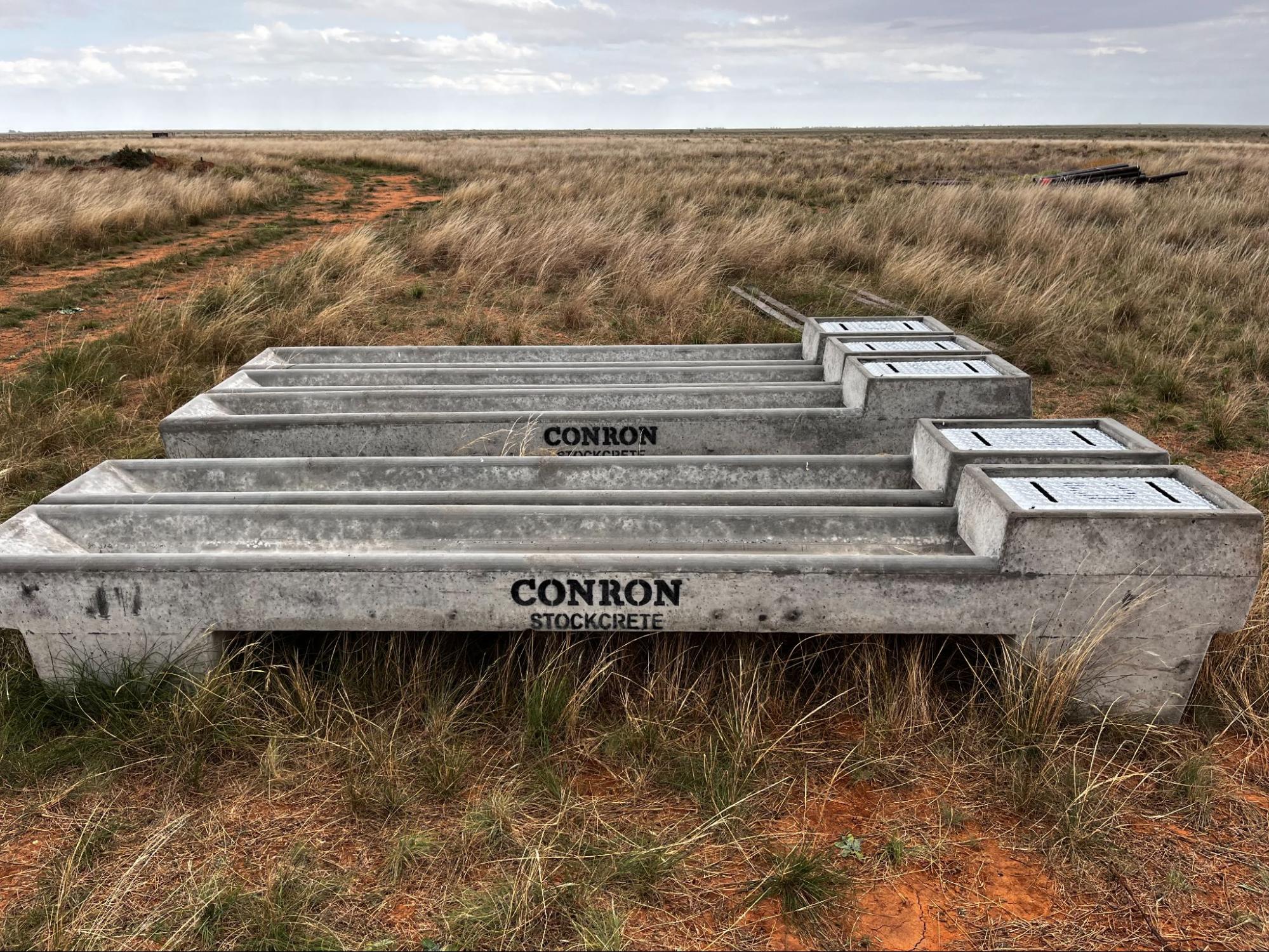
Image 9: Water troughs waiting to be set up. Source: the Hannas.
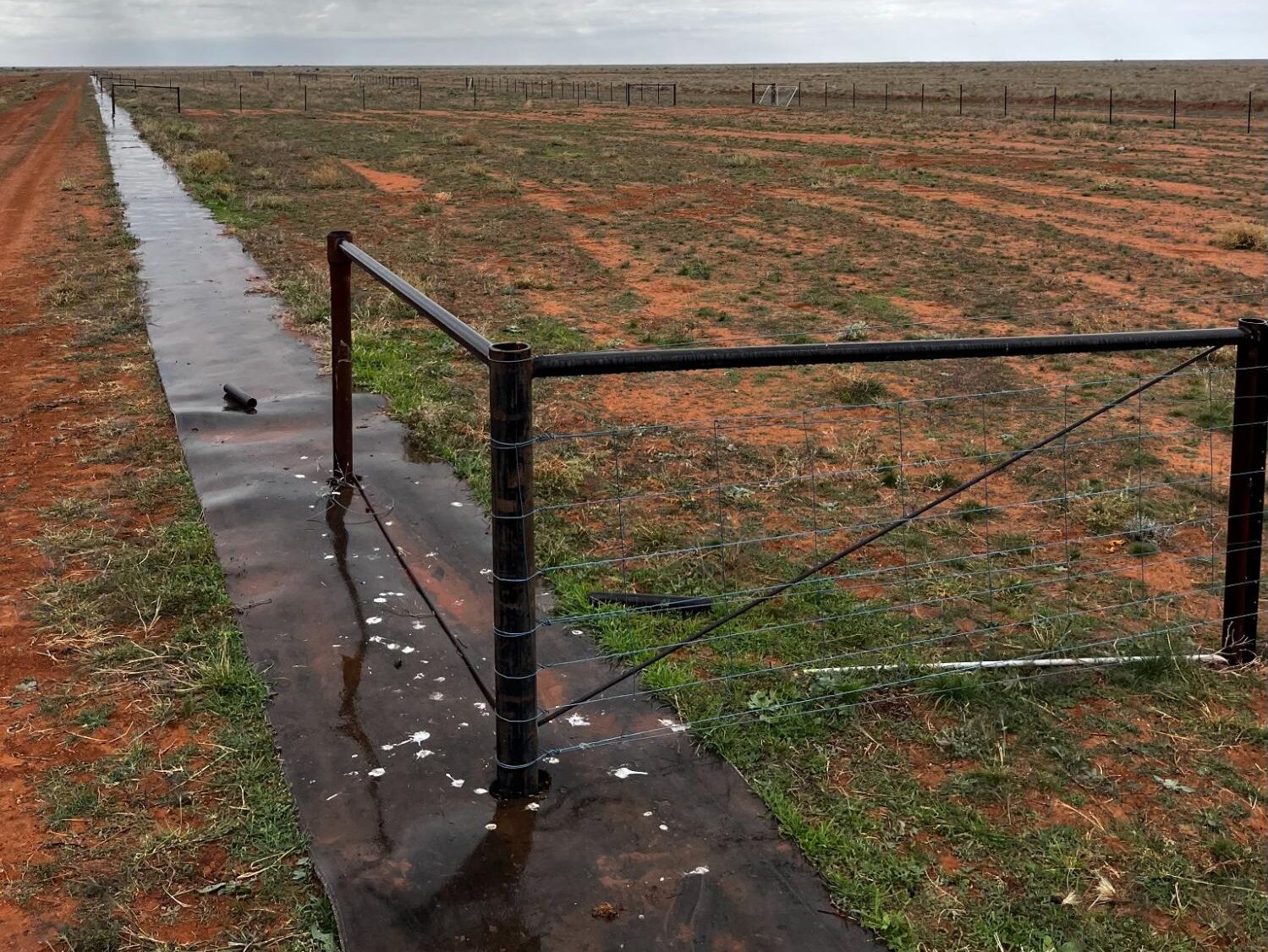
Image 10. The ‘conveyor belting’ in the ground which will be folded to become a long feed trough. Source: the Hannas.
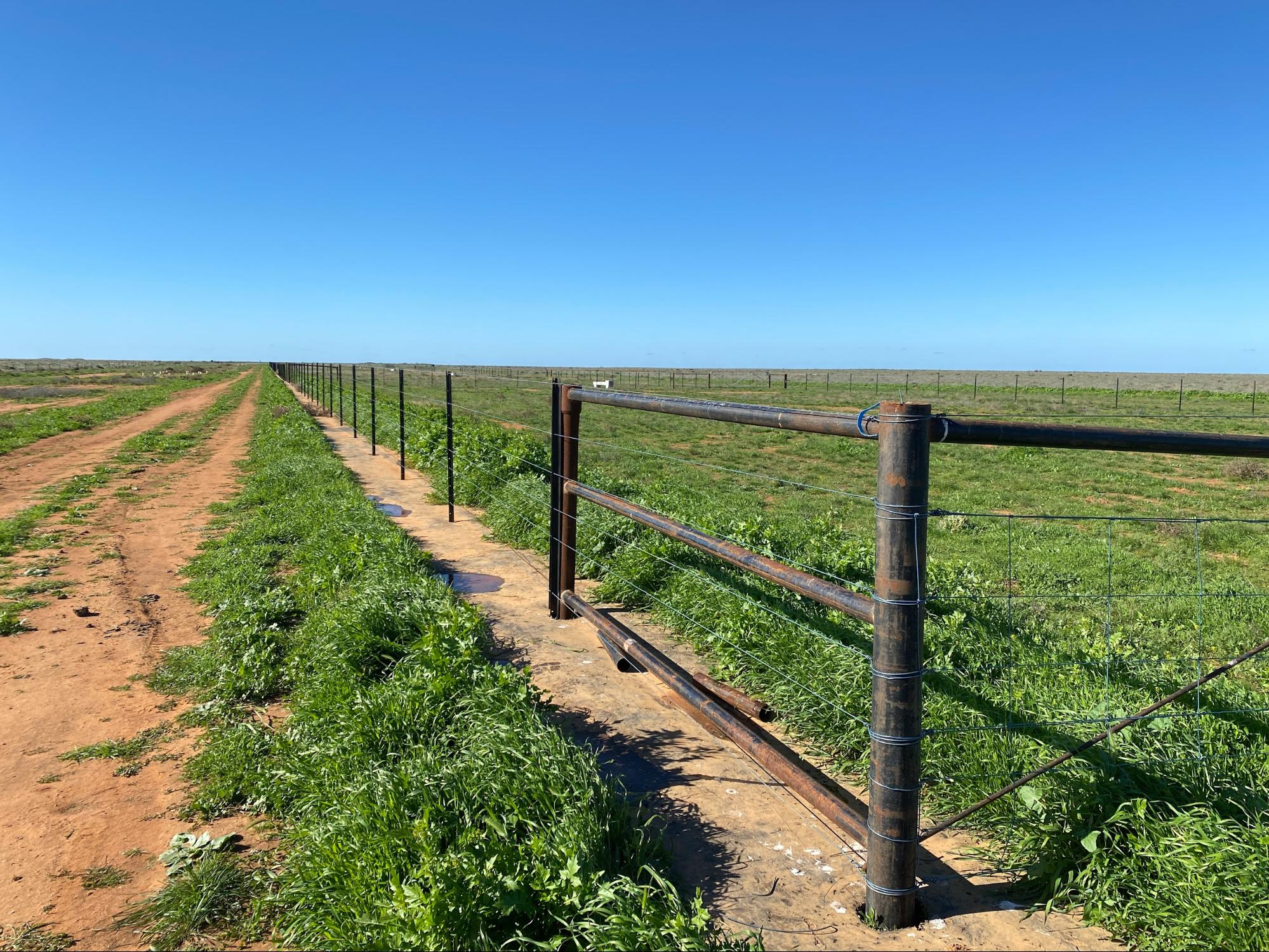
Image 11. The almost complete SMA in June 2024 showing the fence in. Sources: Riverina LLS
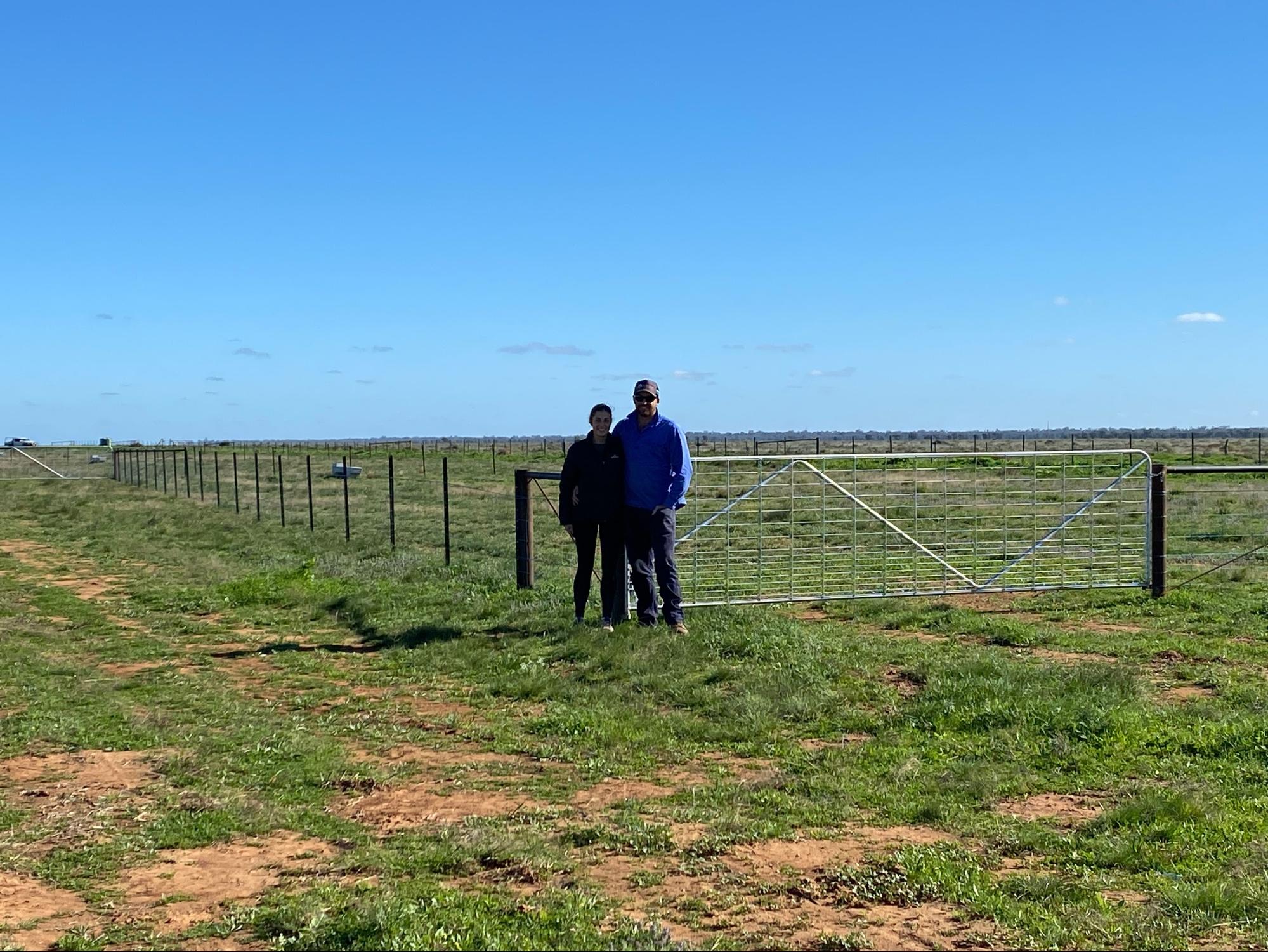
Image 12. Jack and Annabel Hanna in front of the mostly completed SMA at Erin in June 2024. Source: Riverina LLS
Soil Monitoring
The Hannas have embraced the opportunity to learn more about their soils and landscape. With support from Riverina LLS and Soils for Life, they are monitoring the health of their soils through their own observations and field assessments, complemented by soil sampling and lab testing.
Each farmer participating in the project received a report offering a general interpretation of their soil test results, and had the opportunity to discuss their results with a Soils for Life soil scientist. They were also encouraged to share their photos and insights of their in-field observations and assessments with each other via the online farmer discussion group, Whatsapp group and field days.
Setting up monitoring at Erin
Choosing a site
Soils for Life worked with the Hannas to identify a location on their farm where they could do their in-field soil assessments, and that was also suitable for any future monitoring of their soils, vegetation and biodiversity. Prior to the Hannas taking over management, the paddock in which their monitoring site is located had a history of set-stocking, but is now dominated by saltbush (Atriplex spp.), spear grass (Austrostipa spp.) and wallaby grass (Rytidosperma caespitosa).
The Hannas chose a site in ‘Wyanga East’ paddock near to their SMA partly for efficiency and time management, but also because they have been monitoring pasture at the site as part of a profitable grazing course. Jack and Annabel felt it would ‘make things easier – whenever we monitor the pasture site, we are doing the soil at the same time.’
In-field assessments
The Hannas did three independent rounds of in-field assessments at the ‘Wyanga East’ site in August 2023, February 2024 and May 2024. Each time, they applied the following monitoring techniques using guides provided by Soils for Life: photopoints, groundcover, soil infiltration, aggregate stability, soil organisms and soil pH assessment.
The in-field assessments are described below and have been developed into a ‘Soil Health Challenge’, see the Soil Health Assessment Guide at the bottom of this page (with the exception of the pH assessment). Insights from the monitoring are summarised in the next section.
Photopoints: This assessment involves setting up permanent locations where photos are taken repeatedly, to capture changes over time. For example, the Hannas’ photopoints resulted in a visual record of groundcover changes at the ‘Wyanga East’ site over a 12-month period, beginning in March 2023. Flooding occurred across the seasons and their photopoints captured dramatic changes of the groundcover. They then shared their images with the other farmers in the WhatsApp group (see Image 13).
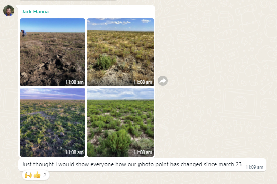
Image 13. Four photopoints from the ‘Wyanga East’ site over a 12-month period showing changes to groundcover in one location. Source: the Hannas.
Groundcover: A simple way to measure groundcover is by visually estimating the percent of the soil surface within a confined area that is covered and not bare.
Assessing groundcover became a regular part of the monitoring routine for the Hannas over 2023 and 2024.
Soil infiltration: Soil infiltration is the downward entry of water into the soil. The rate at which water can infiltrate can be estimated in the field by recording the time it takes for a volume of water to enter and move through the soil.
When the Hannas first attempted to measure soil infiltration in August 2023, they struggled to hammer the infiltration ring into the dry, hard soil to create an adequate seal. The resulting damage to the PVC infiltration ring can be seen in images 15 and 163.
3 To avoid this scenario, consider a DIY infiltration ring made of steel or brass.

Image 14. Assessing soil infiltration at Erin in August 2023. Source: the Hannas.

Image 15. Assessing soil infiltration at Erin in August 2023. Source: the Hannas.

Image 16. Assessing soil infiltration at Erin in August 2023. Source: the Hannas.
Aggregate stability: Soil structure regulates the movement and storage of air, water and organisms, and therefore nutrients, in the soil. Soils with stable aggregates are more likely to retain their structure and are better able to withstand the forces imposed by wetting and drying, raindrop impact, stock trampling, cultivation and other disturbance.
Assessing aggregate stability became a regular part of the monitoring routine for the Hannas (see Images 17, 18 and 19) for assessments in February 2024.
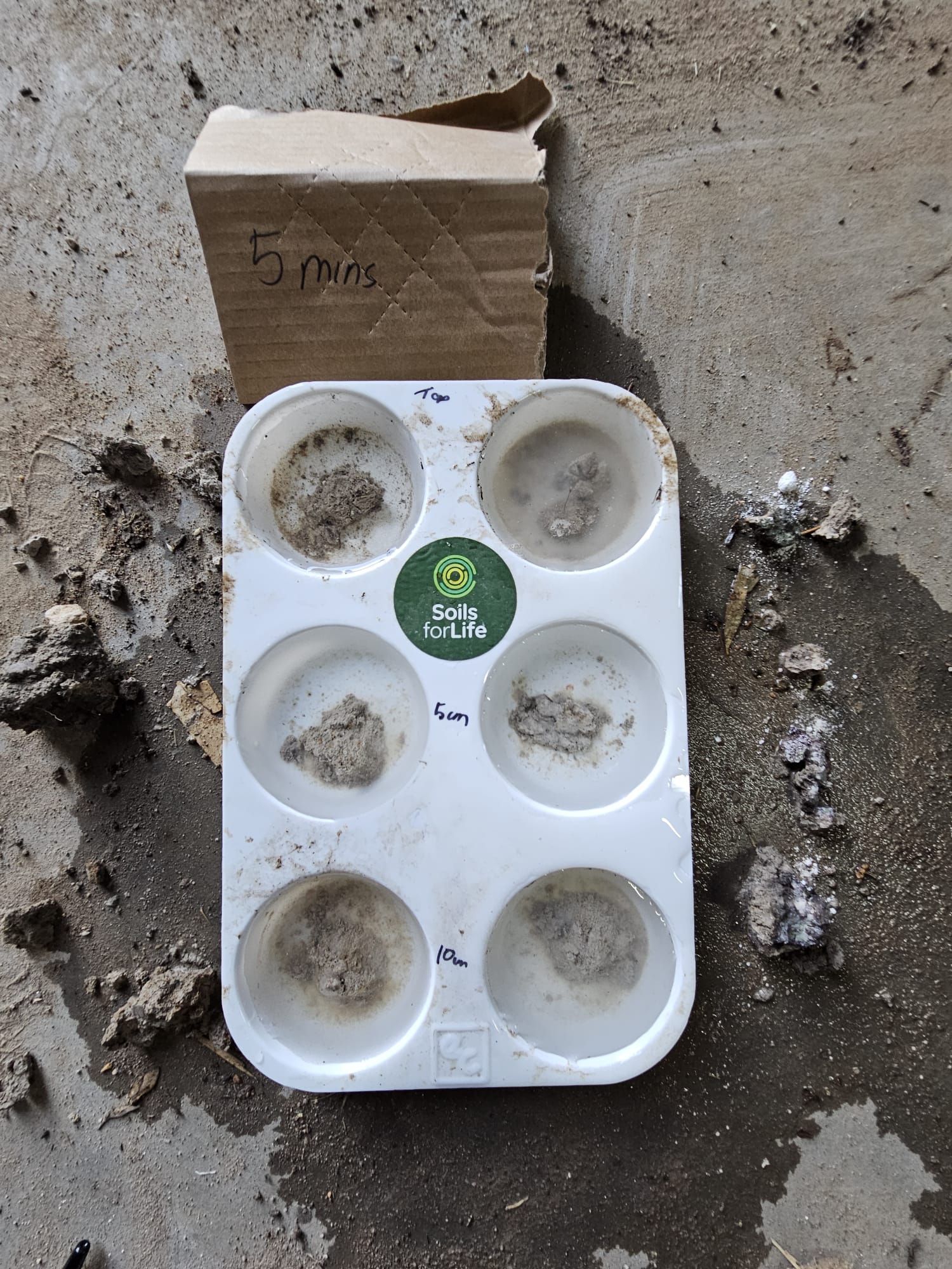
Image 17. Assessing soil aggregate stability at 5 minutes at Erin in February 2024. Source: The Hannas.
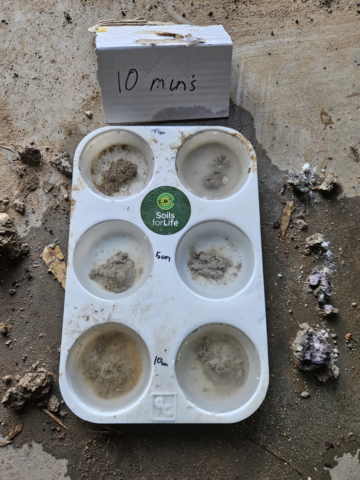
Image 18. Assessing soil aggregate stability at 10 minutes at Erin in February 2024. Source: The Hannas.

Image 19. Assessing soil aggregate stability at 20 minutes at Erin in February 2024. Source: The Hannas.
Soil organisms: Soil organisms are responsible for many soil processes, including contributing to the development of soil structure, the breakdown of organic matter and the cycling of nutrients. One of the simplest methods for assessing the soil organisms that are visible with the naked eye (e.g. worms, beetles, spiders, ants, etc.) is to record the number that can be seen in a sample of soil within a defined period of time.
Jack and Annabel found the soil organism assessment interesting as it forced them to, ‘actually dig down and have a look at the roots of the plants,’ and see what they could find. Annabel notes that the ‘first couple of times I didn’t really find anything – obviously because of the flood it was inundated – and then the last time there were a few spiders and a heap of ants. So it definitely changes.’
Soil pH assessment: Soil pH is the acidity or alkalinity of the soil. Soils may be naturally acidic or alkaline, depending on the parent material on which they formed. Agricultural practices also influence soil pH, often removing alkalinity from the farming system which results in an increase in soil acidity over time. A number of methods for estimating soil pH in the field are available. The Hannas used a soil pH kit provided as part of the project, which is readily available from hardware stores4.
Sampling for lab tests
To supplement in-field monitoring, the Hannas collected soil samples from one location at the ‘Wyanga East’ site for laboratory analysis. The samples were collected from four different depths in the soil (see Image 20) and submitted to the laboratory for a range of soil physical, chemical and biological tests. The purpose of sampling at a single location was to provide the Hannas with a more in-depth account of the soil at their monitoring site so they can track changes in these soil properties over time. With additional investment, soil monitoring and sampling at multiple locations across Erin would provide the Hannas with a broader understanding of their soils.
4 The kit is called a Manutec Soil pH Test Kit and comes with easy to follow instructions. The kit is based on Raupach and Tucker’s field method for assessing soil pH. See Raupach, M and Tucker, B (1959) The field determination of soil reaction. Journal of the Australian Institute of Agriculture Science 25:129−133. To see a soil pH demonstration, visit https://www.youtube.com/watch?v=HZz3-cv_GGc&t=123s.
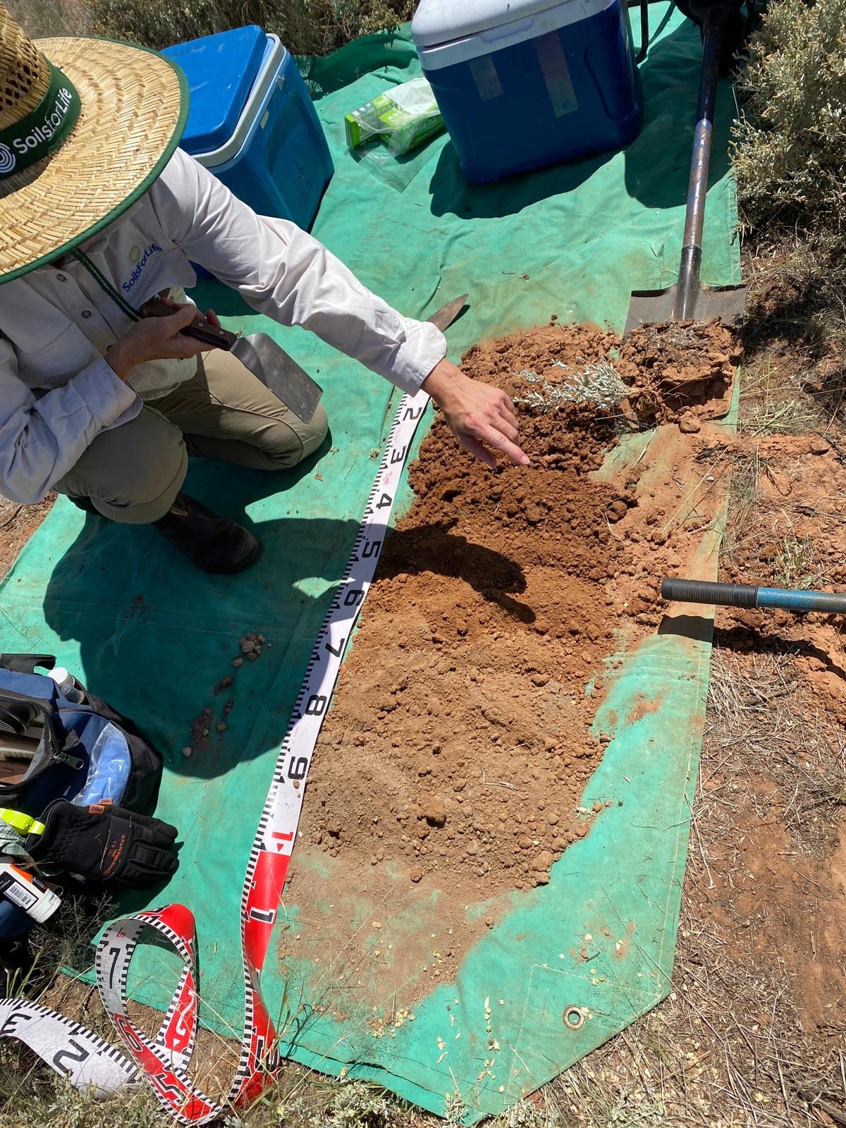
Image 20. Soils for Life soil scientist, Katharine Brown, points out changes in the soil at different depths while soil sampling at Erin in February 2024. Source: Soils for Life.
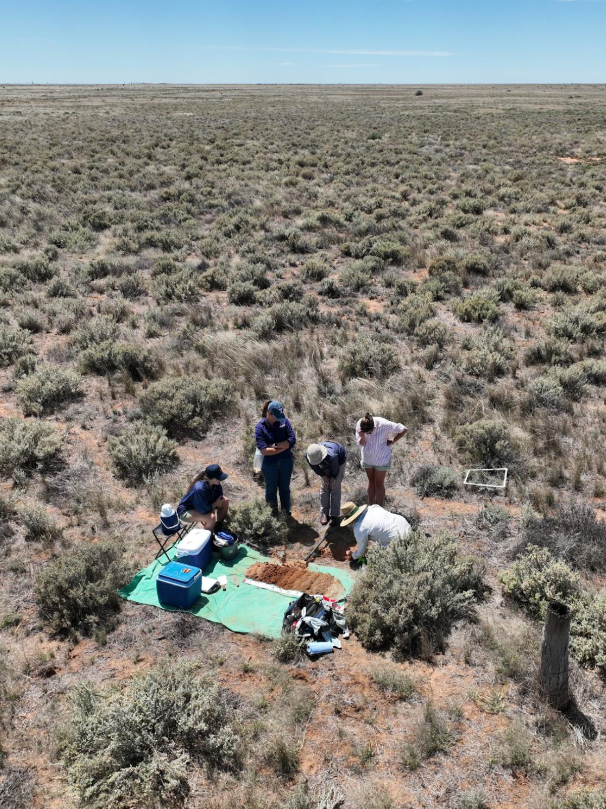
Image 21. Soils for Life and Riverina LLS collecting soil samples with the Hannas at Erin in February 2024. Source: Soils for Life.
Soil and landscape insights
The soil at the ‘Wyanga East’ site is moderately well-drained (when not impacted by flooding), with an abrupt increase in texture from sandy loam to light clay and an alkaline pH trend. The most notable properties that may be limiting to the soil function and productivity at the site are the low organic matter (and therefore low carbon and nitrogen levels), the alkaline pH, and the very high salinity and sodicity throughout the profile.
Organic matter and fertility
The contribution of groundcover in building drought resilience at Erin cannot be overstated given the marginal nature of the landscape. The Hannas have long understood the value of groundcover in reducing soil erosion, and their participation in the Riverina project broadened this understanding. They are now more aware of the value of groundcover in relation to building above and below-ground biomass and increasing soil organic matter. With the lab tests showing soil organic matter levels of less than 1% at the ‘Wyanga East’ site, the Hannas see an opportunity to draw on what they have learned to increase the soil organic matter at Erin.
‘Everyone says groundcover is important and I get it with wind erosion and losing your topsoil, but I didn’t realise how much it contributed to retaining water in the soil down the root systems and that sort of stuff, which is good to know.’ – Annabel Hanna
Image 22. Groundcover on the Hannas’ higher country not far from their SMA location in a very good season in August 2023. Source: The Hannas.
Image 23. Erin in late 2023 during a very good season with abundant groundcover. Source: The Hannas.
Soil cation exchange capacity (CEC) is also an indicator of soil fertility and the Hannas wanted to understand the relationship between CEC and soil carbon. The CEC is a measure of the soil’s capacity to exchange and retain cations (and therefore nutrient availability for plants), and is influenced by the soil clay content, organic matter and pH. At the ‘Wyanga East’ site, the CEC was low to moderate in the topsoil and high in the clay subsoils.
The low CEC of the topsoil reflects the low clay content of the sandy loam soil and the low levels of organic matter (less than 1%). Although the CEC increases at depth due to increased clay content, suggesting an increased capacity to exchange and retain nutrients, the lab tests show an excess of sodium and magnesium in relation to calcium. That is, in relation to soil fertility, the proportions of these cations are less than ideal.
CEC and soil carbon are influenced by the levels and types of organic matter in the soil. Organic matter typically contains about 58% carbon and has a much higher CEC than clays, therefore as soil organic matter levels increase, so will soil carbon and CEC.
Soil microorganisms
As is the case in many Australian agricultural landscapes, the soil at the ‘Wyanga East’ site is more dominant in bacteria than fungi. The lack of fungi means that the mycorrhizal (fungus to roots) relationships responsible for microbe-root-plant interactions, such as water and nutrient uptake and exchange, are limited, indicating that the nutrient cycling at the site is also limited.
One explanation for the low activity of the bacteria and fungi that are present is the dry conditions at the time of sampling. The low abundance and diversity of the soil microorganisms and the low levels of organic matter suggest a lack of nutrition available to the soil microorganisms. In addition, the high soil salinity, sodicity and alkalinity is a less than ideal environment for many of the organisms living in the soil.
Given the Hannas are interested in the role of groundcover at Erin, monitoring and managing it could be one way to build biology. Plant growth can stimulate soil biology, which in turn feeds the plants. During photosynthesis, plants produce exudates5 that stimulate biological activity and build soil humus, which in turn enables increased uptake of nutrients.
Soil sodicity and stability
Both the in-field assessments and the lab results for aggregate stability indicate that the soil at the monitoring site has low stability (see Images 17, 18 and 19), showing ‘slaking’ and ‘dispersion’ of soil aggregates after the in-field assessment of soil aggregate stability in February 20246.
Over time, the natural weathering of the soil’s parent materials can result in nutrients, clays and salts accumulating in the soil. If one of these salts is sodium, these soils are known as sodic soils and are highly susceptible to instability. Low levels of fungi can also negatively impact soil stability.
Soils with low stability are susceptible to soil structure decline, particularly if exposed to any form of disturbance. This loss of soil structure limits key soil processes such as soil water infiltration and aeration, resulting in a less than ideal habitat for soil organisms and plant roots.
While the loss of soil structure at the ‘Wyanga East’ site is a result of several factors, including high sodicity, Jack attributes the results of their in-field monitoring of soil aggregate stability and soil water infiltration to the many years of set-stocking and the resulting soil compaction (see Image 24). Jack also notes that the monitoring site is on what he describes as a ‘clay pan covered by grass’. He realised that if they had monitored other sites with different soil types and management histories at Erin, the results, ‘would have changed a lot more over the time.’
Good soil structure leads to high rates of water infiltration and soils that readily absorb water are more drought resilient. Plants play an important role in the process. When plant roots grow and die they create pore spaces allowing water to flow into the soil. Plants also create an ideal environment for small animals (e.g. worms) and beneficial biology, which further increases space for water to flow.
5Root exudates are organic carbon compounds (e.g. simple sugars, organic acids, and amino acids) secreted from living plant roots into the soil.
6Slaking refers to the collapse of the original aggregate into smaller aggregates or individual particles. Dispersion refers to separation of fine clays from aggregate and the suspension of these fine clays resulting in the water becoming ‘milky’. See Soil Health Assessment Guide.

Image 24. Soil compaction at Erin. Source: Soils for Life.
Salinity and pH
Soil pH influences the availability of essential nutrients and often dictates the plant and organism species that will thrive in a soil, depending on their sensitivities to soil acidity or alkalinity.
The Hannas were surprised to find the soil at the ‘Wyanga East’ site was alkaline because they had witnessed the corrosion of their fence posts and assumed this was due to high soil acidity. However, alkaline soils are not uncommon in regions of low rainfall and high evaporation rates, and when combined with high salinity in frequently waterlogged conditions, are also highly corrosive.
The accumulation of naturally occurring salts in the landscape also contributes to salinity. The historical extensive clearing of vegetation at Erin and resulting rise in the water table has moved these salts higher up in the soil profile. Combined with the windblown source and frequent flooding from the Lachlan River, the soil at the ‘Wyanga East’ site is highly saline.
Salt tolerant species
The Hannas have been interested in understanding more about the value of salt-tolerant plants, such as saltbush, and the role they play in their environment and how they might use this resource. Through working with LLS they have discovered the importance of protecting their native perennials, such as bladder saltbush (A. vesicaria), to maintain a sustainable farm into the future.
Erin has a diverse range of plant communities starting with the river red gums (Eucalyptus camaldulensis) on the fringe of the Lachlan River, which merge with the open woodland of black box (Eucalyptus largiflorens) that continues out into the swamp lands and creek systems that contain nitre goosefoot (Chenopodium nitrariaceum) and lignum (Duma florulenta). Further out on the alluvial plains, the chenopod shrublands contain a diverse range of species including bladder and eastern flat top saltbushes (Atriplex vesicaria and A. lindleyi, respectively), interspersed with smaller saltbushes, grasses and other native forbs. These species have all evolved to exist in this semi arid environment with low and erratic rainfall.
Future monitoring at Erin
Closely monitoring how their pastures and groundcover are tracking will be an ongoing part of the Hannas’ approach to soil health and drought resilience. Their experience of soil monitoring has increased their understanding of some of their local soil conditions and the importance of groundcover for water retention and drought resilience. The process helped them reflect on their site selection and the value of monitoring more than one site to capture the variability across the landscape. And so, the Hannas plan to extend their monitoring to other sites across their property to better understand how their range of soils respond to changes in land use and management.
The couple want to improve their ability to manage livestock grazing according to soil type and will continue to work on how best to integrate rotational grazing. With a more comprehensive understanding of some of the soils at Erin, they have greater confidence in fencing to soil type in the future. The Hannas plan to ‘utilise everything a lot more by being able to control where livestock are at a period of time based on the feed.’ This will happen after they finish implementing the exclusion fencing. The Hannas believe they need this to help control overgrazing and damage during droughts when wildlife – especially pigs, foxes, goats and kangaroos from the adjacent National Park – also rely on their land for food.
The Hannas currently track progress at Erin using different metrics, including their overall business sustainability, their capacity to maintain consistent stock numbers during drought and land recovery rates after drought. They have several drought resilience activities in progress, such as upgrading fencing to limit wildlife influx during drought, installing on-farm water piping for efficiency, and accessing a second water source. The couple plans to monitor the impact of running their stocking rates properly, knowing they have a drought feeding option and that their future rotational grazing decisions will be guided by monitoring of plant groundcover and changes in soil over the long-term.
Looking to the Future
Focusing on drought resilience has helped the Hannas become more decisive and proactive in their management and they are looking forward to using the SMA to protect their pastures and soil health. Installing the SMA has put drought preparedness in the front of their minds and Jack and Annabel agree that it’s better to take action ‘while we’ve got a bit of money to do it and cash flow is all right.’ Organising feed storage at Erin ahead of time is now a priority because the Hannas see the need to protect the health of their stock during dry times.
‘From what I’m learning, our issue isn’t so much our feed quantity; it is more the quality of our [pasture] feed out here that deteriorates. We are feeding stock as much as they can eat, but they’re still going backwards and not putting on weight.’ – Jack Hanna
They believe the SMA will help in the process of ensuring that the stock they keep when things dry out are healthy and will allow them to get their weaners up to critical weight before joining.
Planning water sources on the farm, the Hannas are looking at spreading the troughs out differently to where the ground tanks are now so they can more effectively graze 100% of the property. The Hannas would also like access to a pipe out of the Murrumbidgee River because when the Lachlan River ran dry in the Millennium drought, they had no water. As Jack says, ‘having secondary water access would be ideal,’ so they are in the process of figuring that out.
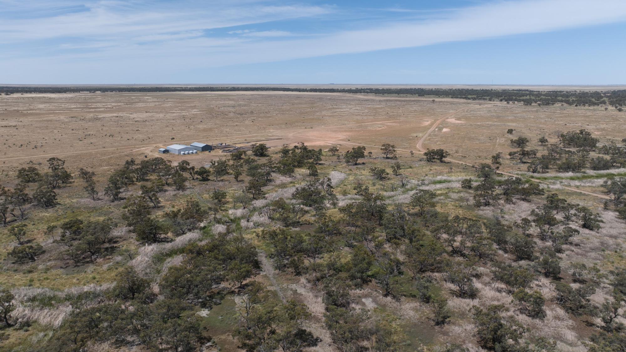
Image 25. Aerial view of Erin. Source: Grow Love Project.
Videos about this project
Watch the Hannas and other Riverina farmers talk about the Riverina project, soil monitoring and three drought resilient practices:
Soil Monitoring in the Riverina
Native Shelterbelts in the Riverina
Stock Management Areas in the Riverina

Dam Enhancements in the Riverina
Downloads and links
See the links below to download documents relevant to this page.
Acknowledgements
This case study is part of the Riverina Drought Resilient Soils and Landscapes project, which aims to support producers in adopting drought resilient practices and enhance their landscape and soil monitoring capabilities. The Riverina Project is led by Riverina Local Land Services (LLS). It is supporting 15 producers to adopt one of three well-established management practices that enhance agricultural productivity and profitability during or after droughts while safeguarding natural resources. As part of the project, Soils for Life has prepared five case studies that follow producers as they implement their chosen practice/s, and their experiences with soil lab-testing and in-field observations. The producers are guided in their practice implementation with support from Riverina LLS, and have opportunities to learn through field days and webinars provided by the project partners, and an online discussion group. This project is led by Riverina Local Land Services, in conjunction with Sustainable Farms ANU, and Soils for Life. This project has received funding from the Future Drought Fund. We acknowledge that the contents of this page do not necessarily reflect the views of these contributors.

This project has received funding from the Australian Government’s Future Drought Fund.
For more information
Follow us for the latest
If you have any questions, get in touch at [email protected].

