

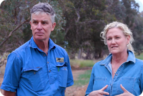
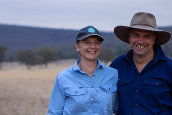
The Nicholls at Tumulla
Protecting pasture and preparing for dry times in the Upper Slopes region | Published January 2024
‘Managing our steep country, which is really susceptible to being washed [is a priority]. We’ve really got to maintain our ground cover. Ground cover is key. You can see with the recovery, how much quicker it comes back by maintaining that.’ – Anthony Nicholls
Anthony and Bec Nicholls have four blocks close to Gundagai in the Upper Slopes region of the Riverina where they run 1,000 crossbred ewes and around 180 angus cattle. The Nicholls took over three different sites from Anthony’s parents in 2013, and went on to purchase another block in 2018. Growing up on the farm, Anthony remembers living through dry times. He also recalls life as a jackaroo, with memories of having to ‘lock up stock in big mobs and feeding sheep through hotwires.’.
Before taking over the farm, Anthony worked in stockyard design and managed a large cattle herd near Holbrook, helping to implement an artificial insemination breeding program. Bec owns a homewares store in Gundagai and lends a hand on the farm during the busy periods, but most of her time is tied up running her business and raising their three young children. Since taking over management, Anthony and Bec have been on a ‘steep learning curve,’ particularly after the very dry years of 2018 and 2019 when they made certain decisions they later came to regret. This experience became a source of motivation. Anthony and Bec realised they needed to make some big changes in order to prepare for the future and to ensure they have as many options available to them when the next drought comes.
Over the last few years, they have gained new knowledge and participated in farmer-to-farmer learning opportunities. They have also tried several new practices, including supporting the re-introduction of native plants and pastures, promoting permanent ground cover, putting lime on paddocks to address soil acidity and enhancing their dams. Their land has been ‘rejuvenating’ with more water in the landscape over the past three years, and it has responded to the many changes that the Nichollses are making to their management.
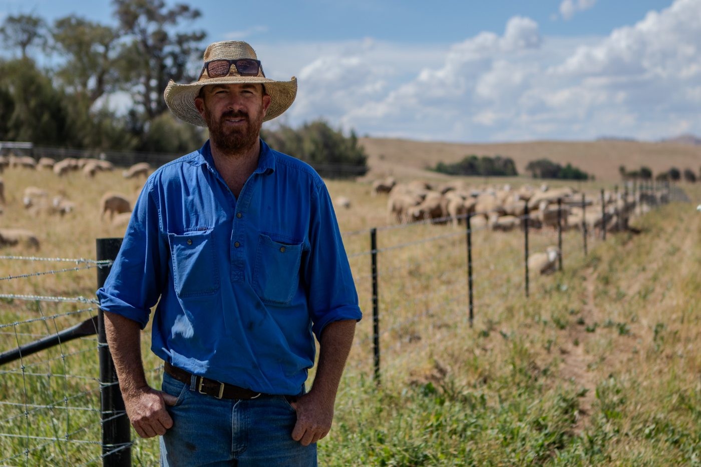
Image 1. Anthony Nicholls on the family property. Source: Grow Love Project.
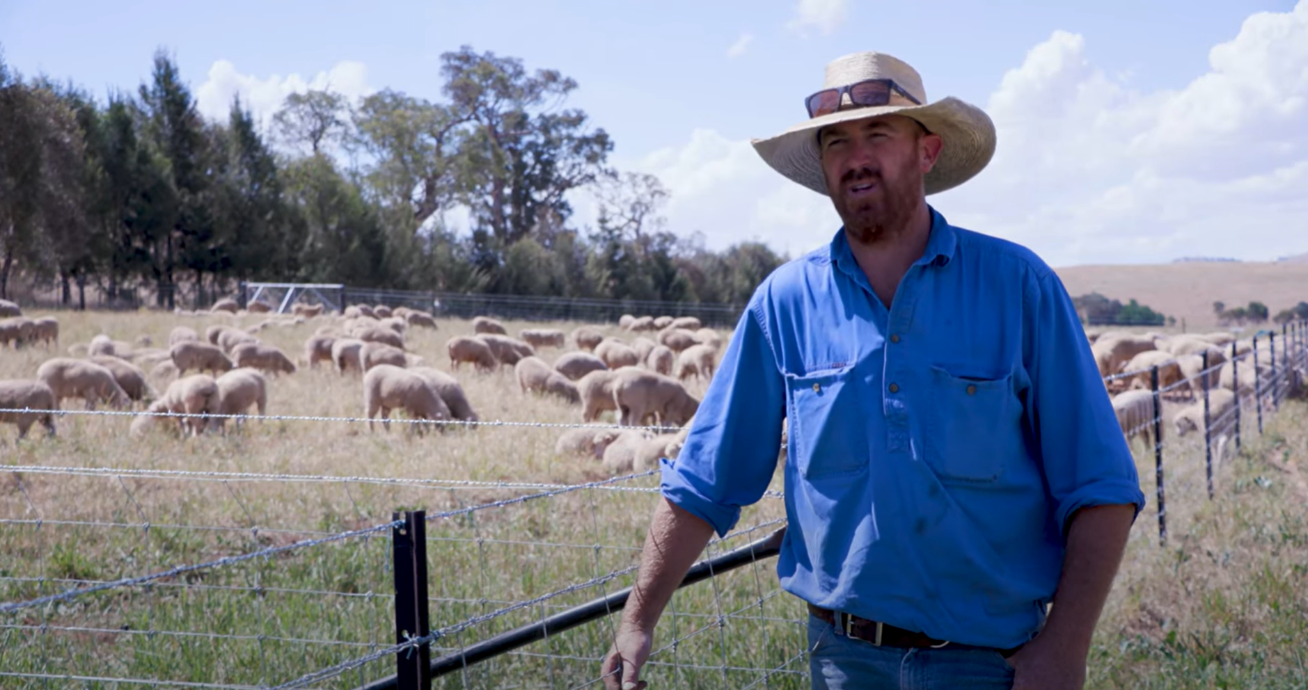
Video 1. Stock management areas in the Riverina. Produced by the Grow Love Project
Farm Facts
Location
Wiradjuri Country |Coolac, Riverina, NSW
Climate
Warm summer, cold winter
Average Annual Rainfall
647 mm (recent, 1993–2022)
Agro-ecological Region
Temperate cool-season wet
Property Size
830 ha
Elevation
308 m
Social Structure
Family owned and operated
Enterprise Type
Crossbred/composite ewes and commercial angus beef production.
Landscape
Hills and crests of volcanic origin (native hill country), mid to lower colluvial slopes (arable land) and alluvial plains and terraces (creek flats). Much of the native vegetation has been extensively cleared leaving an understorey of tussock grasses and forbs.
Soils*
Well-drained, structured red soils (Dermosols or Ferrosols) of varying depth on the mid and upper slopes; moderately well-drained, texture-contrast non-sodic soils (Chromosols) on the lower slopes; deep, well-drained alluvial soils (Rudosols) associated with Muttama Creek; sodic (Sodosols) soils in the poorly drained areas of the landscape.
*Learn more about soil classifications at www.soilscienceaustralia.org.au
The Highlights
Drought Resilience Strategies
Soil and Landscape Monitoring
Future Plans
- Revegetating the landscape with tree planting and shelterbelts
- Managing perennial pastures through drought, ‘so they come out the other end in good condition’
- Enhancing dams to slow down the flow of water and to improve water quality
- Building a Stock Management Area (SMA) for use during drought and to protect animal and pasture health
- Introducing soil and landscape monitoring through in-field assessments and soil sampling lab tests
- Increased understanding of some of the local soil conditions, including limiting factors (low calcium to magnesium ratio, low levels of some micronutrients, and low quantity and activity of soil organisms)
- Greater awareness of the value of groundcover to help build above and below-ground biomass and increase soil organic matter
- Extending landscape monitoring to other sites across their property to better understand how a range of soils responds to management changes
- Developing a rotational grazing system to allow the landscape periods of rest
- Planting more shelterbelts
- Exploring inputs to support the biology in the soil
- Experimenting with multispecies crops to increase diversity in the soil microbiology and encourage nutrient cycling
- Continuing to manage and monitor groundcover for soil health and drought resilience
Landscape and Soils
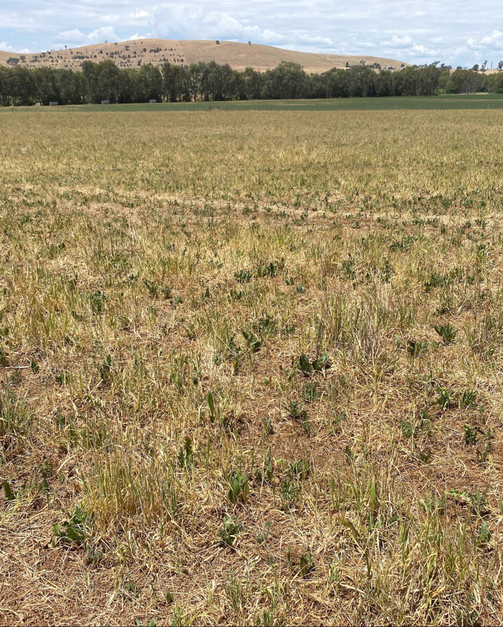
Tumulla is located in the Upper Slopes region of the Riverina, in south-west NSW. The property extends from the alluvial plains and terraces of Muttama Creek to the steeper (up to 20% gradient) slopes of the more elevated volcanic country to the west. The deep, well-drained alluvial soils associated with the creek plains and terraces reflect periods of deposition and minimal soil development. These soils are fertile, however the well-drained, structured red soils of the mid and upper slopes are also considered productive. Lower in the landscape, the texture-contrast soils feature, with minor occurrences of the sodic version of these soils where drainage is poor.
Most of the native vegetation has been extensively cleared for agriculture, with remnant pockets of red gum (Eucalyptus camaldulensis) and yellow box (Eucalyptus melliodora) occurring on the lower slopes, and white box (Eucalyptus albens) and the occasional white cypress pine (Callitris columellaris) found on the steeper slopes higher in the landscape. The understorey consists of tussock grasses and forbs, including common wheat grass (Elymus scaber), soft brome (Bromus hordeaceus), wallaby grass (Rytidosperma caespitosa), and red grass (Bothriochloa macra). Land use in the local region is mostly sheep and cattle grazing on improved pastures, fodder production or winter cropping of cereals and oilseeds on the more productive soils. Major limitations to production include soil erosion on the steeper country and minor rill and sheet erosion on the lower country, particularly on the cultivated areas, and soil salinity. Very high salinity levels have been recorded in associated tributaries of Muttama Creek.
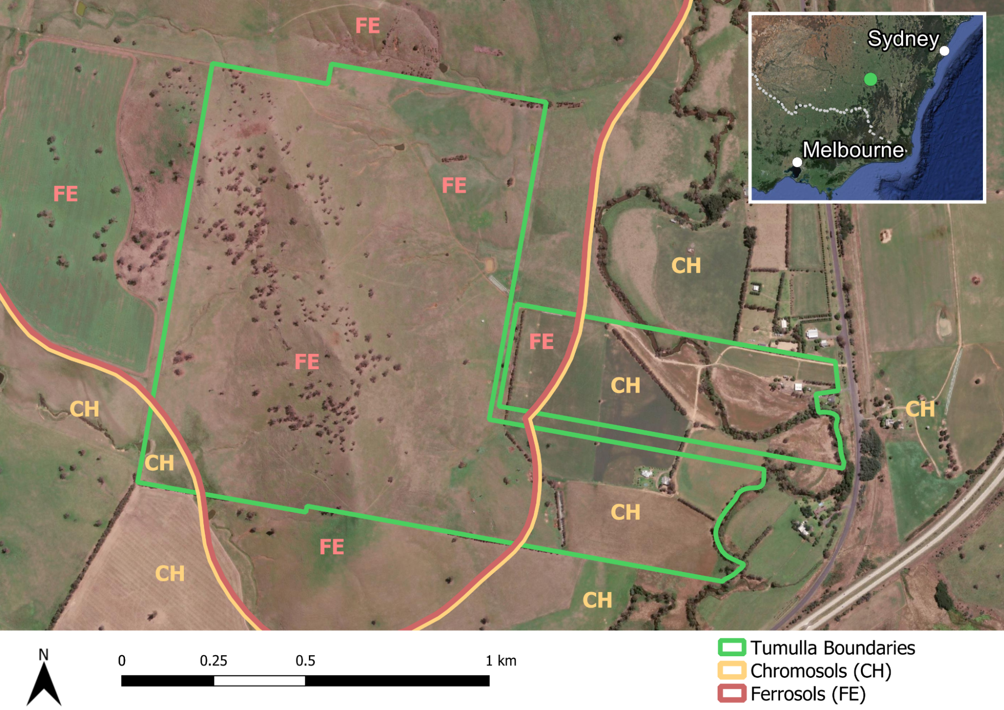
Figure 1. The broad soil groups (Land Types) at Tumulla. Source: Soils for Life and DPIE (2021).1
1These soil orders represent a regional overview and are not derived from detailed soil information. The soil boundaries are based on the Department of Planning, Industry and Environment (DPIE) (2021) Australian Soil Classification (ASC) Soil Type map of NSW, Version 4.5, Department of Planning, Industry and Environment, Parramatta.
More about the Nicholls
Learning from recent drought
During the 2018–2019 drought, the Nicholls significantly de-stocked, which took some pressure off the land.
‘We halved our cow numbers. We managed to maintain our sheep numbers pretty well. Getting out of all the lambs pretty early. Just sort of managing our numbers, managing our breeders more than anything’ – Anthony Nicholls
However, there were certain things they tried that ‘didn’t work very well’ over this period. For example, their attempts with drought-lotting were ‘not very well set up’, and though they tried to maintain ground cover, minimise soil and nutrient loss and maintain essential feed, there were many problems and lessons learnt. Their ‘native hill country’ was badly impacted. Looking ahead, the Nichollses want to be better prepared.
Anthony is wanting to change aspects of his grazing management, however certain challenges are still proving difficult. The Nicholls have four blocks that are spread out, which makes managing their farming system quite complicated. They are in the process of figuring out what they need in order to implement rotational grazing, noting multiple challenges given the terrain and access to water points for livestock in the landscape. One of the challenges that Anthony has identified is the topography including ‘serious hills’ and the need to move between a number of blocks. Rotational grazing also requires a careful approach to managing their ewes, particularly twinners. They are running composites and have ‘pretty high lambing rates’, and the Nicholls need to be ‘very careful about not disturbing them too much during lambing.’ With all this in mind, Anthony’s plans include subdividing more areas of the farm with either permanent or electric fencing, expanding existing water systems and putting in more dams where underground water isn’t available. He is also ‘looking to run our cattle in bigger mobs, and our ewes and lambs after lamb marking and weaning.’
Preparing for dryer times
Part of their plan to become better prepared for dry times has been to implement a stock management area (SMA). The Nicholls are one of 15 producers in the Riverina who are being supported to implement one of three practices (enhanced farm dams, native shelterbelts or stock management areas) to improve drought resilience as part of the Riverina Drought Resilient Soils and Landscapes project. The project also involves the farmers participating in soil monitoring activities, field days, an online farmer discussion group and a WhatsApp group.
Previously, they have worked with LLS to make enhancements to a dam and begin revegetating the landscape with tree planting and shelterbelts. Their aim with the SMA is to have an additional option in drought that can help to protect their pastures and soils if needed, especially when their stocking rates can’t be reduced to match carrying capacity and when their feed production is declining.
‘We want to be a lot better set up, in the hills particularly, which took a bit of a hammering through the drought. We’ve learned a lot of lessons since then.’ – Anthony Nicholls
Supporting soil and landscape health at Tumulla
There are delicate soils across many areas of the farm. Anthony has worked with an agronomist to conduct several soil tests and he is learning more about how he can monitor his soils through the Riverina Drought Resilient Soils and Landscapes project. He describes the property as having ‘varied soil types with some heavy, red country and some lighter pipeclay,’ with differences between soil types in terms of their water retention, acidity, salinity and erosion.
As Anthony notes, the heavier red country is ‘a lot more susceptible to cracking up, especially when it’s dry … but in the wetter years, it definitely holds a lot more water, and has got a lot better retention’. In other paddocks across Tumulla, ‘the water will just lay on that.’ During the last couple of years when there has been much more water in the landscape, Anthony has noticed how these soils ‘lose their structure pretty easily’. One of their blocks has quite a serious erosion issue, ‘washing away easily’.
The Nicholls’ recent goals for improving soil health have included increasing their own understanding of how their ‘soils are travelling’. The project has offered an opportunity to support them in this goal. They are also looking at how they can alter their management plan to reduce the amount of superphosphate they apply each year. With the rising cost of inputs and the potential damage synthetic fertiliisers can have on soil over the long term, the Nichollses are actively looking for alternatives.
Anthony is interested to learn what he can do to improve soil health by implementing new grazing management, growing different pastures and adjusting rest periods. In recent years, the Nicholls have been planting trees, gullies and ‘establishing pastures’ to help to hold up the soil and prevent erosion.
‘Managing our steep country, which is really susceptible to being washed [is a priority]. We’ve really got to maintain our groundcover. Groundcover is key. You can see with the recovery, how much quicker it comes back by maintaining that.’ – Anthony Nicholls
The Nicholls have put a lot of work into their perennial pastures and want to see them managed properly through drought ‘so they come out the other end in good condition’. Other management goals include experimenting with multispecies crops to increase diversity in the soil microbiology and encourage nutrient cycling.
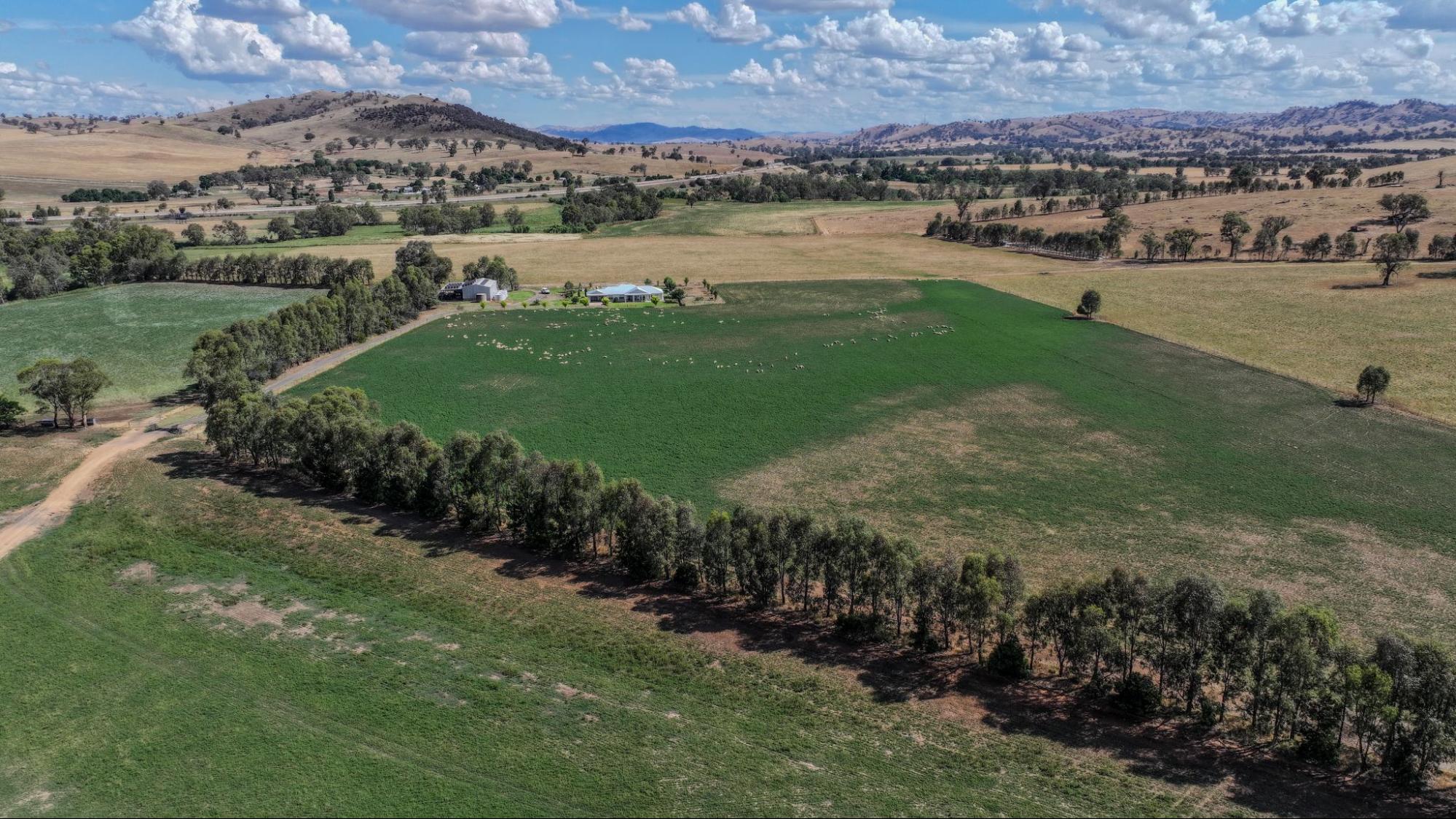
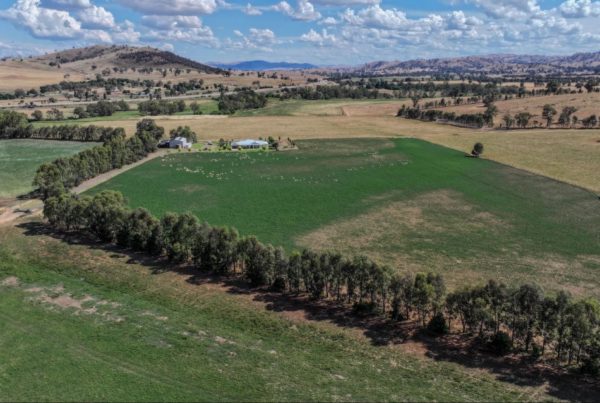
In collaboration with Riverina Local Land Services (LLS), the Nicholls also implemented dam enhancements at Tumulla, which they completed in Winter/Spring 2021. Anthony enjoyS observing the benefits of fencing off the dam area, as it has improved water quality for livestock. Additional benefits include ‘the slowing down of water flow through the dam which is helping to regenerate the grasses in the eroded parts of the creek below the dam’. Anthony also notes that ‘the water quality in the creek below the dam has improved’ and ‘hopefully has increased the amount of biodiversity in areas where the new trees have been planted and the stock have been excluded.’
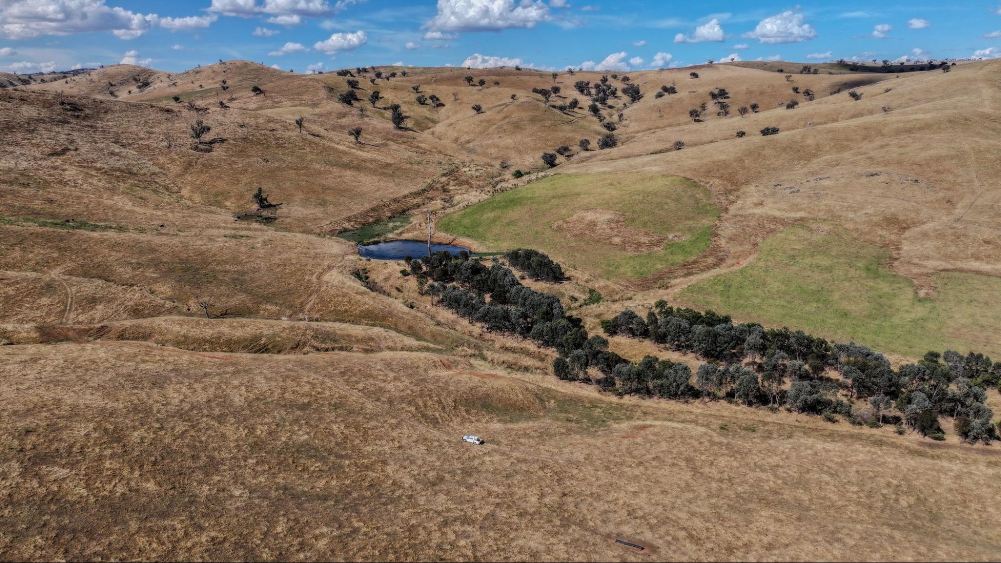
Image 2. An aerial view of the dam enhancement at Tumulla, installed in Winter/Spring 2021. Source: Grow Love Project.
Practice Implementation
Providing options in dry times with a Stock Management Area (SMA)
The Nicholls see a future benefit in having carefully selected parts of the property that are set up to hold, feed and water core farm-livestock during adverse weather periods of drought, which they experienced in 2018–2019. As a purpose built piece of infrastructure, SMAs make feeding, watering and monitoring stock health more efficient. By providing a fast way to get stock off pasture, they can support the preservation and faster recovery of pastures and landscapes across the farm. The Nicholls want to avoid long-term damage and the SMA will help to protect their pasture and better manage ground cover recovery. Anthony sees the value in acting early and having multiple options when going into dry periods. He intends to slowly reduce the pressure on his pastures by destocking where possible, getting weaners off early and gradually locking up stock. This will help to ensure a swift recovery after dry conditions pass.
Maximising the benefits of an SMA at Tumulla
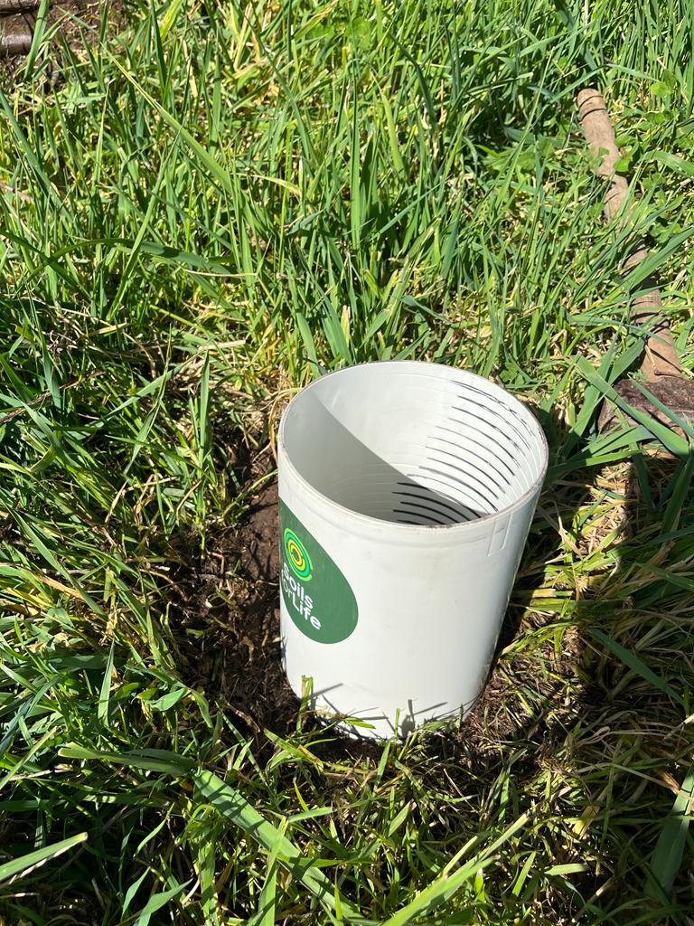
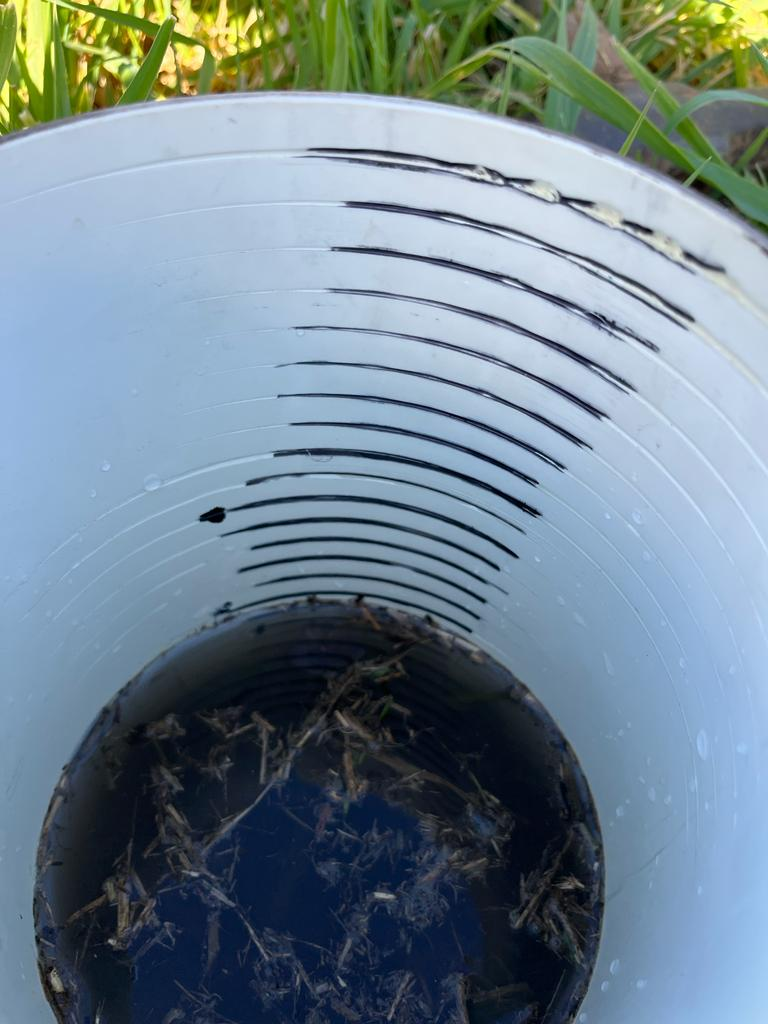
Anthony finished building the SMA in December 2023. With advice from Riverina LLS staff, he positioned it close to a 25-year-old shelterbelt on the lower slopes of a steep hill to maximise shade for livestock and drainage and to minimise flood risk. Anthony designed the SMA himself and worked through many versions to get the measurements correct based on stock numbers and other considerations like water flow and feed access. The SMA has five pens (35 x 65 m) and can hold 400 ewes, providing roughly 4–5 m2 per ewe.
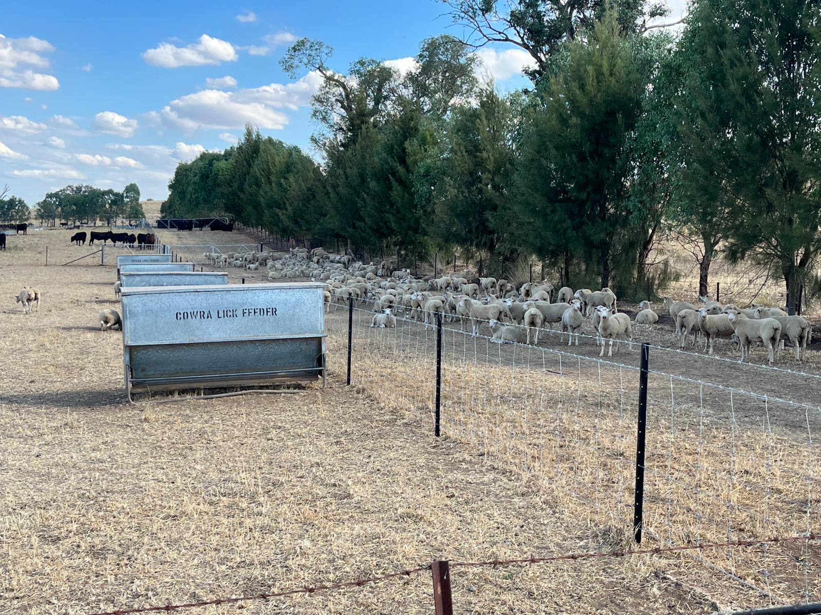
Images 3 & 4. The SMA at Tumulla was installed in Spring 2023 next to a mature shelterbelt, providing valuable shade and shelter for livestock. Source: Anthony Nicholls.
The build involved several weeks of work spread over a few months. Anthony built the fences himself and got some help to put in the water infrastructure.
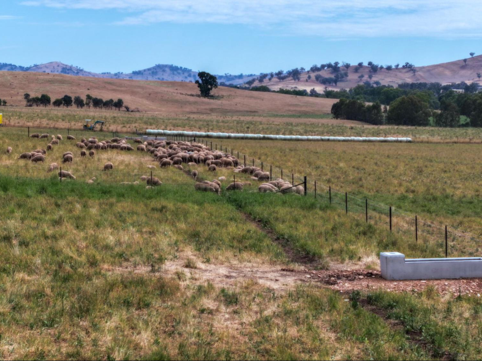
He completed most of the SMA just before a field day on his property and was able to show it to some of the other farmers involved in the project (see Image 5).
During a dry patch in Autumn 2024, the SMA was used for weaned calves and lambs, which were fed every other day. This has allowed the pastures at Tumulla to rest and recover and Anthony is noticing the difference in groundcover compared to previous years when his pastures would have been continuously grazed. Using the SMA, for the first time ever, Anthony has completely destocked the main production area of the farm to let all paddocks fully rest and recover ahead of next season. Anthony shared these updates on the WhatsApp thread noting,
‘G’day everyone. SMA into action. Weaner cattle that came in on Sunday after a week being yard weaned. Working well so far. Have been letting them come into the laneway for shade, they were chasing it this week.’ – Anthony Nicholls
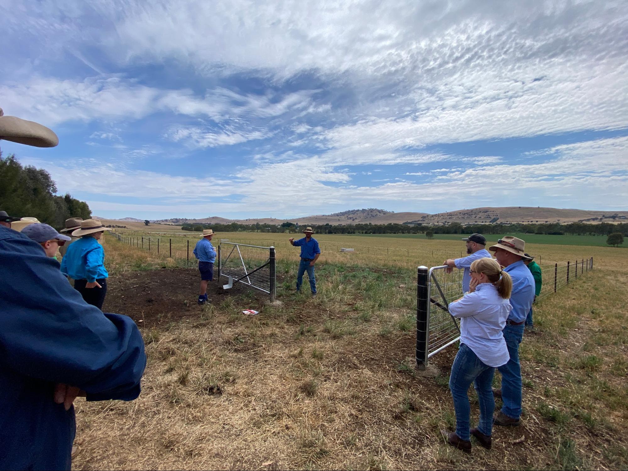
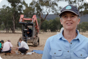
Image 5. Anthony talking about his SMA at a field day in November 2023. Source: Soils for Life.
Soil Monitoring
Anthony enjoyed the opportunity to learn more about the soils and landscape at Tumulla through soil monitoring. With support from Riverina LLS and Soils for Life, he has been monitoring soil health through his own observations and field assessments, complemented by soil sampling and lab testing. Each farmer participating in the project received a report offering a general interpretation of their soil test results and had the opportunity to discuss their results with a Soils for Life soil scientist. They were also encouraged to share their photos and insights of their in-field observations and assessments with each other via the online farmer discussion group, Whatsapp group and field days.
While Anthony was building the SMA and installing the water infrastructure, he became quite focused on his soils and made several observations alongside the formal soil monitoring. He noticed how the colour and texture of the soils changed and the differences in plant root systems and soil organisms. Anthony has also valued the opportunity to share his observations with others in the group and to bounce ideas around, saying ‘It’s been great … being part of such a diverse group across a fairly large part of the state … hearing about how everyone works. It’s been great to be a part of.’
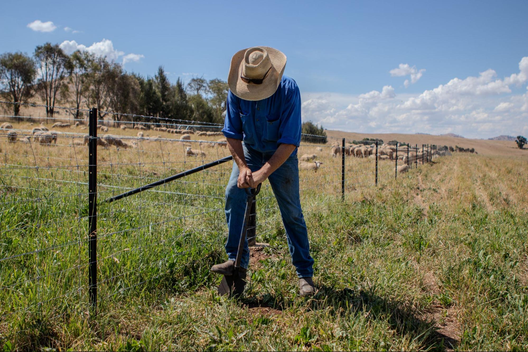
Image 6. Anthony takes a shovel to the soil next to the newly installed SMA, close to where the soil was sampled for lab testing at Tumulla. Source: Grow Love Project.
Setting up monitoring at Tumulla
Choosing a site at Tumulla
Soils for Life worked with the Anthony to identify a location on their farm where they could do their in-field soil assessments, and that was also suitable for any future monitoring of their soils, vegetation and biodiversity. Anthony chose to monitor at one site in the ‘Old Fescue’ paddock, located close to the recently built SMA (see Image 7). The paddock was historically cleared of vegetation and more recently sown to a pasture of chicory, lucerne, phalaris, prairie grass and subterranean clover.
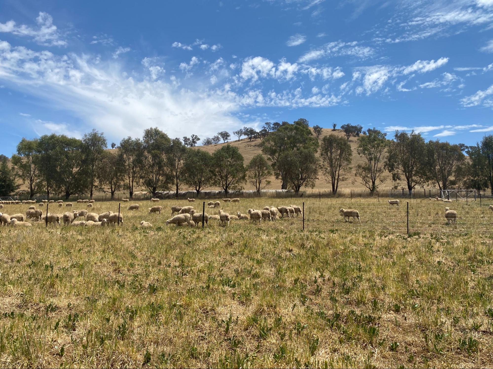
Image 7. The main soil monitoring site is adjacent to the new SMA. Source: Soils for Life.
In-field assessments
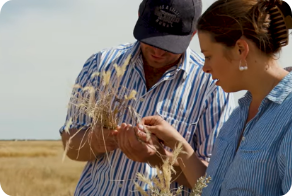
Anthony did two independent rounds of in-field assessments in August 2023 and April 2024. Each time, he applied the following monitoring techniques: photopoints, groundcover, soil infiltration, aggregate stability, soil organisms and soil pH assessment using guides provided by Soils for Life.
The in-field assessments are described below and have been developed into a ‘Soil Health Challenge’, see the Soil Health Assessment Guide at the bottom of the page (with the exception of the pH assessment). Insights from the monitoring are summarised in the next section.
Photopoints: This assessment involves setting up permanent locations where photos are taken repeatedly to capture changes over time.
Groundcover: A simple way to measure groundcover is by visually estimating the percent of the soil surface within a confined area that is covered and not bare. See Images 8 and 9 for Anthony’s groundcover assessment in August 2023.
Soil infiltration: Soil infiltration is the downward entry of water into the soil. The rate at which water can infiltrate can be estimated in the field by recording the time it takes for a volume of water to enter and move through the soil. See Images 10 and 11 for Anthony’s infiltration assessment in August 2023.
Aggregate stability: Soil structure regulates the movement and storage of air, water and organisms, and therefore nutrients, in the soil. Soils with stable aggregates are more likely to retain their structure and are better able to withstand the forces imposed by wetting and drying, raindrop impact, stock trampling, cultivation and other disturbance. See Image 12 for Anthony’s aggregate stability assessment in August 2023.
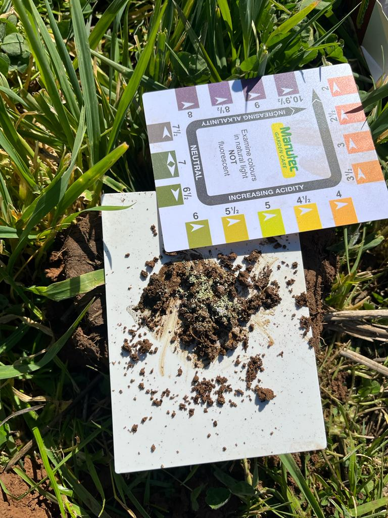
Soil pH assessment: Soil pH is the acidity or alkalinity of the soil. Soils may be naturally acidic or alkaline, depending on the parent material on which they formed. Agricultural practices also influence soil pH, often removing alkalinity from the farming system which results in an increase in soil acidity over time. A number of methods for estimating soil pH in the field are available. Anthony used a soil pH kit provided as part of the project, which is readily available from hardware stores2. See Image 13 for Anthony’s pH assessment in August 2023.
2The kit is called a Manutec Soil pH Test Kit and comes with easy to follow instructions. The kit is based on Raupach and Tucker’s field method for assessing soil pH. See Raupach, M and Tucker, B (1959) The field determination of soil reaction. Journal of the Australian Institute of Agriculture Science 25:129−133. To see a soil pH demonstration, visit: https://www.youtube.com/watch?v=HZz3-cv_GGc&t=123s
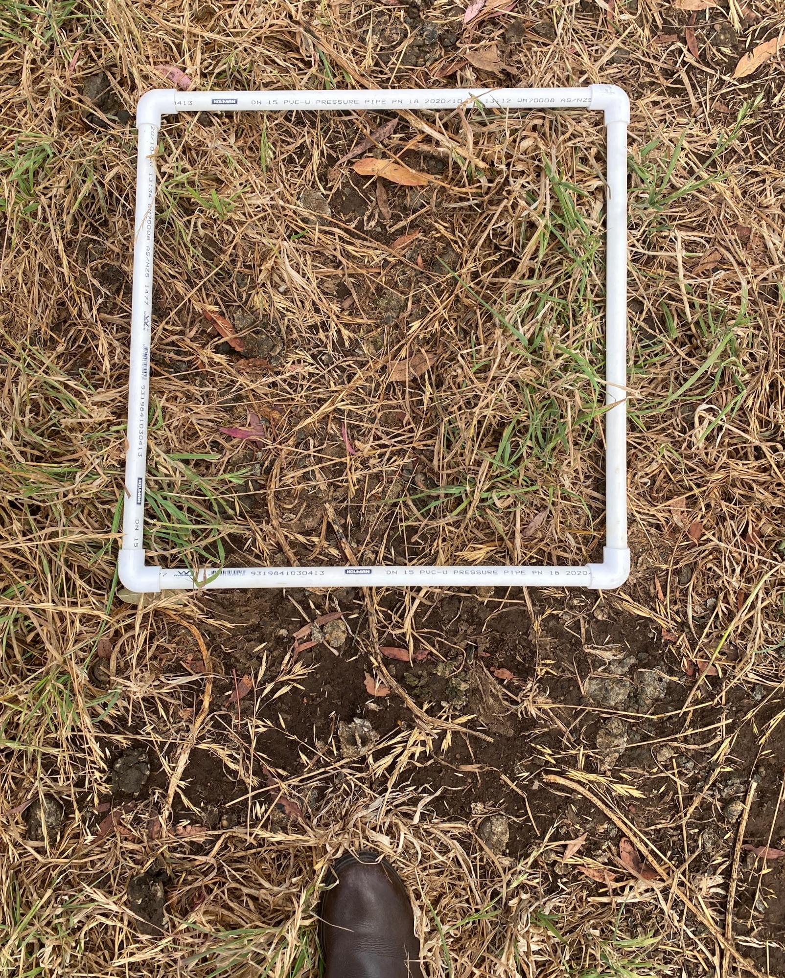
Images 8 & 9. Assessing groundcover at the ‘Old Fescue’ site on day of soil sampling in August 2023. Source: Soils for Life.
Images 10 & 11. Assessing water infiltration at the ‘Old Fescue’ site at Tumulla in August 2023 (left). Assessing water infiltration at the ‘Old Fescue’ site at Tumulla in August 2023 (right). Source: Anthony Nicholls.
Images 12 & 13. Assessing soil stability at the ‘Old Fescue’ site at Tumulla in August 2023 (left). Assessing soil pH at the ‘Old Fescue’ site at Tumulla in August 2023 (right). Source: Anthony Nicholls.
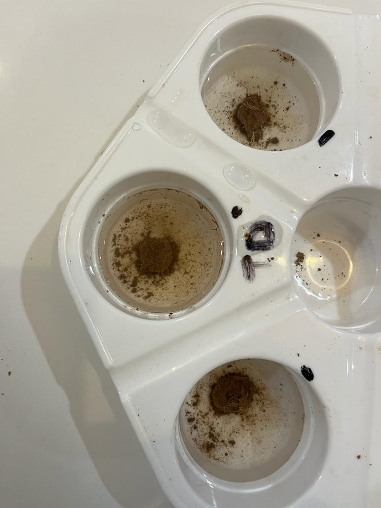
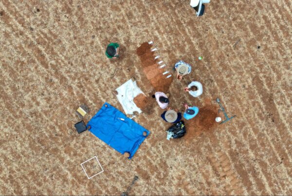
Sampling for lab tests
To supplement in-field monitoring, Anthony collected soil samples from one location at the ‘Old Fescue’ site for laboratory analysis. The samples were collected from four different depths in the soil (see Image 14) and submitted to the laboratory for a range of soil physical, chemical and biological tests. The purpose of sampling at a single location was to provide the Nicholls with a more in-depth account of the soil at their monitoring site so they can track changes in these soil properties over time. With additional investment, soil monitoring and sampling at multiple locations across Tumulla would provide the Nicholls with a broader understanding of their soils.
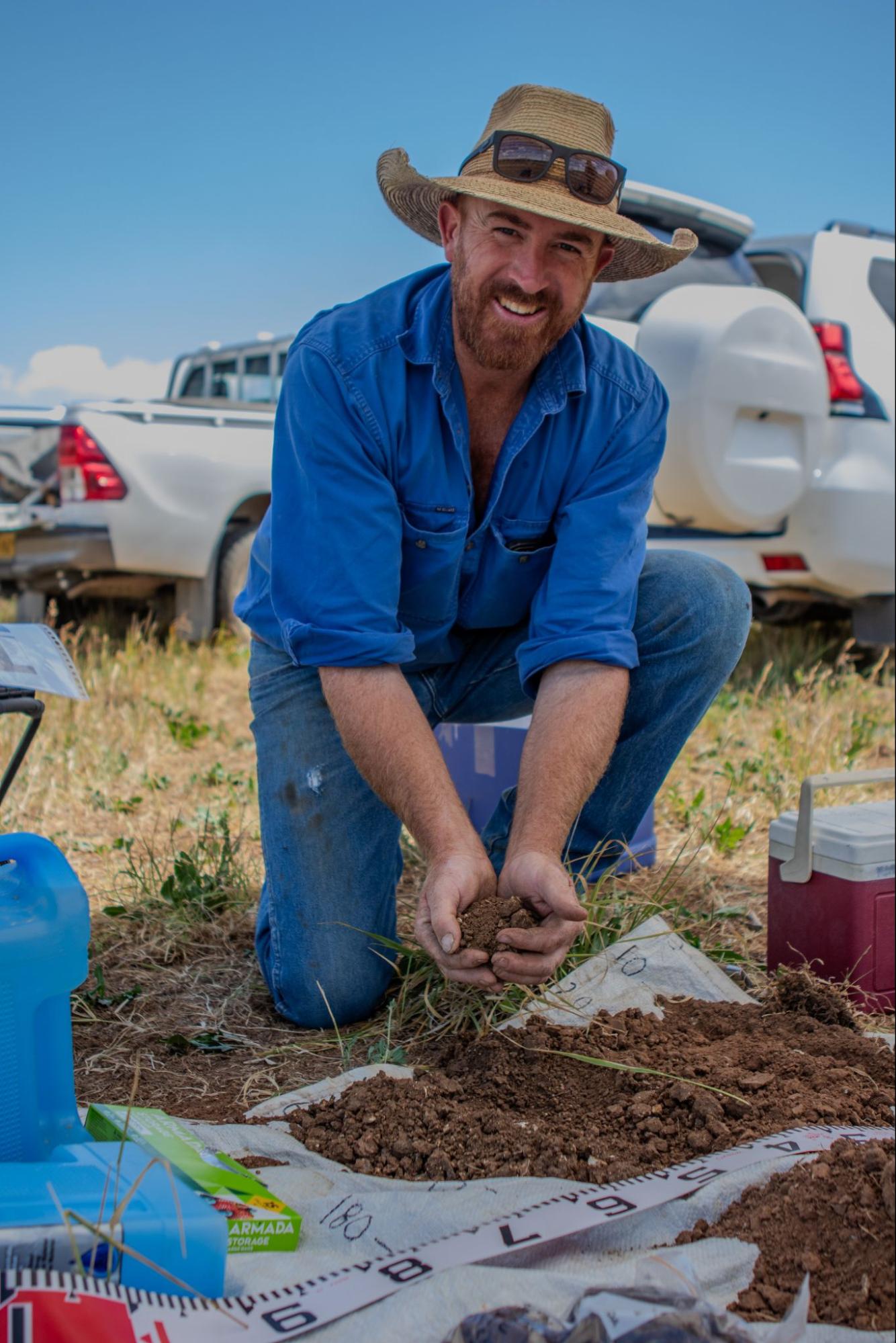
Image 14. Anthony Nicholls collecting soil samples at the ‘Old Fescue’ site at Tumulla. Source: Grow Love Project.
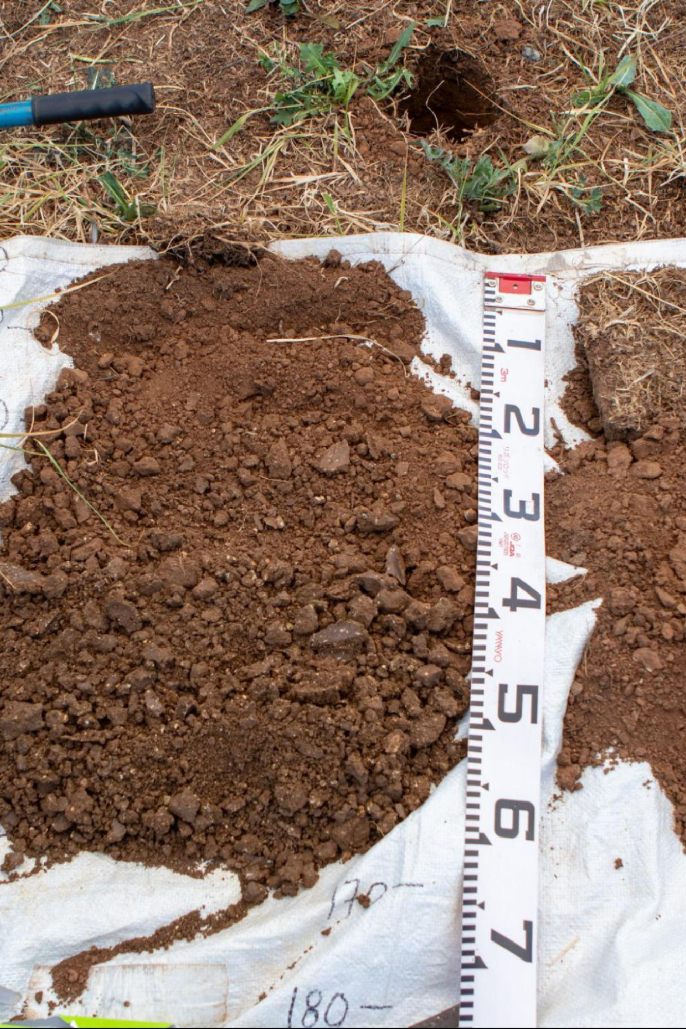
Image 14. Soil profile at the ‘Old Fescue’ site at Tumulla. Source: Soils for Life.
Soil and landscape insights
The soil at the monitoring site is moderately well-drained, with a texture ranging from a loam to a medium clay and a slightly alkaline pH trend. The cation exchange capacity (CEC) is moderate and the organic matter percent is also moderate. The most notable properties that may be limiting to productivity are the low calcium to magnesium ratio, the low levels of some of the micronutrients tested and the low quantity and activity of the soil organisms.
Organic matter and fertility
Due to its location in the landscape, the monitoring site receives surface and groundwater (and therefore minerals and nutrients) from upslope. The natural fertility of the soil type due to the influence of the volcanic geologies in the region, as well as Anthony’s management of groundcover, also contribute to the moderate to high soil organic matter value of 4.9% in the 0–8 cm sample.
Anthony has become more aware of the value of groundcover in relation to building both above and below-ground biomass and increasing soil organic matter. While the levels of soil organic matter are adequate at the ‘Old Fescue’ site, he has come to recognise the value in continuing to build soil organic matter at Tumulla. He would like to include more deep-rooting plant species and monitor whether this helps to build soil organic matter. Anthony’s current soil monitoring will give him an understanding of the baseline levels of organic matter in his soils, and this will allow him to track changes in soil organic matter in response to any management changes.
Soil cation exchange capacity is a measure of the soil’s capacity to exchange and retain basic cations (and therefore nutrient availability for plants). It is also an indicator of soil fertility and is influenced by the soil clay content, organic matter levels and soil pH. Anthony now knows that while the CEC at the monitoring site is considered moderate to high compared to other soil types in the region, increasing soil organic matter has the potential to substantially increase CEC, particularly in the top 50 cm of the soil.
Anthony was interested to learn to what extent aluminium levels reduce and/or inhibit the capacity of plants to receive nutrients. Typically, aluminium levels in the range of 2-5 mg/kg (2-5 ppm) will be toxic to plants that are sensitive to aluminium toxicity, and above 5 mg/kg (5 ppm) will be limiting to plants that are tolerant of aluminum toxicity. In relation to nutrient uptake, phosphorus, calcium, magnesium and sulfur are all affected by high levels of aluminium.
At the monitoring site, the exchangeable aluminium in the 0 – 8 cm sample was 5 mg/kg (5 ppm), but substantially decreased deeper in the soil. The low levels of aluminium below 8 cm in the soil, and the fact that the soil is not acidic, suggest that while aluminium is high in the 0-8 cm sample, it is unlikely to inhibit plant growth.
Soil microorganisms
Anthony was curious about the lab results for the 0–8 cm topsoil sample that was submitted for soil biological analyses. Like many Australian agricultural landscapes, the soil at the monitoring site was dominant in bacteria compared to fungi. The loss of fungi in farming soils has come about due to several factors, including the clearing of trees and shrubs, soil disturbance (tillage destroys fungal hyphae and mycelium) and the use of fungicides.
The lack of fungi in the monitoring site soil suggests that the mycorrhizal (fungus to roots) relationships responsible for microbe-root-plant interactions, such as water and nutrient uptake and exchange, are limited, indicating that the nutrient cycling at the site is also limited. One option Anthony is interested in exploring to improve nutrient cycling is increasing numbers of beneficial nematodes. Like protozoa, nematodes survive in the soil water and feed mostly on bacteria and fungi. In healthy soils these worm-like creatures are one of the smallest, but most abundant, multicellular animals. Another strategy that Anthony could consider is to focus on improving the ratio of bacteria to fungi in his soil as this is a primary indicator of soil health.
Soil structure and stability
Soil structure is the natural arrangement of soil particles into aggregates or ‘peds’ (the structural building blocks of the soil), separated by voids. It governs soil permeability, infiltration, aeration, drainage and stability. While also providing organisms with a safe habitat, soil structure can be created and improved by the activities of soil organisms. The results are a more stable soil where the soil aggregates are held together either by organic matter (including soil organism secretions and root exudates)3 or clay.
Anthony was pleased to learn from the lab results for aggregate stability that the soil at the ‘Old Fescue’ site was moderately-stable to stable. This confirmed his interpretation of his in-field assessments, which also suggested the soil was stable (see Image 12).
Soils with low stability, including sodic soils, are susceptible to soil structure decline. This loss of soil structure limits key soil processes such as soil water infiltration and aeration, resulting in a less than ideal habitat for soil organisms and plant roots. Although soil structure was not assessed as part of the project, observations of the soil profile at the monitoring site suggest that the soil had moderate to good structure. This supports the infiltration rates of about 40 mm/hr that Anthony observed while undertaking his in-field assessments at the site. Not only will a well-structured soil tend to be more stable, it will also allow water to infiltrate the soil at a reasonable rate leading to water-use efficiency and increased drought resilience.
Anthony’s attention to maintaining groundcover and building organic matter will also benefit soil water infiltration and retention. A diversity of plants with different growing habits and rooting depths will intercept and distribute rainfall across the soil surface, and when the plant roots die, will provide a food source for the soil organisms and leave cavities in the soil which become pathways for water to flow through the soil.
3Root exudates are organic carbon compounds (e.g. simple sugars, organic acids and amino acids) secreted from living plant roots into the soil.
Future monitoring at Tumulla
Reflecting on the insights of the recent soil monitoring, Anthony is looking to build on what he has learned from participating in the project and is considering a series of monitoring sites across the farm that would represent his different soil types.
Anthony is particularly interested in how soil type is influenced by the position in the landscape and underlying geology. A better understanding of these relationships will help him recognise soil-landscape patterns and monitor his soils more efficiently. This approach will also reveal whether the soil properties he chooses to monitor are features of the natural soil or a result of management practices, and how this information might inform his future management decisions.
Looking to the Future
The Nicholls plan to continue supporting soil health and building drought resilience by protecting and building groundcover across their property. Anthony has also been thinking about using biological inputs to support the biology in the soil. He has put worm castings across a few paddocks but found that his machinery didn’t respond well. While he’s never done paddock trials, he is considering whether a small scale ( and therefore low risk and low cost) trial might be a good starting point.
Grazing management is central to building groundcover and drought resilience. The Nicholls’ plan to develop a rotational grazing system and allow the landscape to have periods of rest. They are also planning more shelterbelts across the property and ongoing development of water infrastructure, including further dam enhancements.
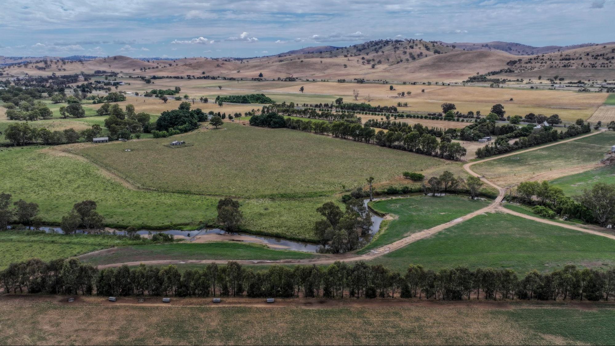
Image 15. A view of the Upper Slopes region of the Riverina, including parts of Tumulla. Source: Grow Love Project.
Videos about this project
Watch Anthony Nicholls and other Riverina farmers talk about the Riverina project, soil monitoring and three drought resilient practices:
Soil Monitoring in the Riverina
Native Shelterbelts in the Riverina
Coming Together for Resilient Soils and Landscapes

Dam Enhancements in the Riverina
Case studies in this series
Explore the other farmer stories in this series of Riverina cases studies
Coming Together for Resilient Soils and Landscapes
The Nicholls at Tumulla
The Wilkes-Bowes at Anderloose
The Matthews at Bedarbidgal
The Scotts at Glen Elgin
The Hannas at Erin
Downloads and links
See the links below to download documents relevant to this page.
Acknowledgements
This case study is part of the Riverina Drought Resilient Soils and Landscapes project, which aims to support producers in adopting drought resilient practices and enhance their landscape and soil monitoring capabilities. The Riverina Project is led by Riverina Local Land Services (LLS). It is supporting 15 producers to adopt one of three well-established management practices that enhance agricultural productivity and profitability during or after droughts while safeguarding natural resources. As part of the project, Soils for Life has prepared five case studies that follow producers as they implement their chosen practice/s, and their experiences with soil lab-testing and in-field observations. The producers are guided in their practice implementation with support from Riverina LLS, and have opportunities to learn through field days and webinars provided by the project partners, and an online discussion group. This project is led by Riverina Local Land Services, in conjunction with Sustainable Farms ANU, and Soils for Life. This project has received funding from the Future Drought Fund. We acknowledge that the contents of this page do not necessarily reflect the views of these contributors.

This project has received funding from the Australian Government’s Future Drought Fund.
For more information
Follow us for the latest
If you have any questions, get in touch at [email protected].
